Flying Safari to Namibia, May 2016
By Henry Doenlen
Our first visit to Africa was during our honeymoon. We did a safari in Kenya, riding in a van with 6 other tourists from one game part to another, seeing and photographing the animals and learning a little about the culture. When Hanks Aero Adventures proposed an Escorted Self-fly Safari experience, we were interested in going back to Africa. Having an escort was desired, to provide knowledge of the area and help with the administrative complexities so we could focus on the joy of flying in southern Africa. Much of our time was spent in the wonderful lodges and camps that were arranged by Nick and Christina Hanks for our trip, but this post will focus on the flying.
This web page is a combination safari blog and photo album. Almost all of the photos are clickable and hyperlink to a larger image. Clicking on the videos takes you to YouTube. Click here for the blog with flying info only.
A pilot needs to get their license "validated" before being permitted to fly a South African registered aircraft. The validation process started months before the safari in South Africa. I had fill out a 1 page validation application and send notarized copies of my American pilot's license, medical, recent logbook pages and passport photos to Hanks Aero Adventures. They took care of all of the details. Validation is for a specific model of airplane. Hanks Aero Adventures uses Cessna 182s. During the months before the safari, I found a Cessna 182 at Ferguson Airport (82J) for checkout and rent. I was able to do several soft field landings on the turf runways there.
 5/6/16: Departing the States…
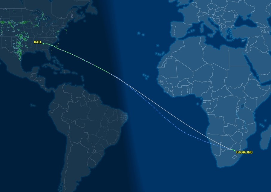
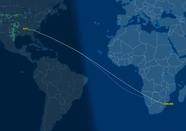
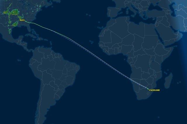
After a regional jet flight from Pensacola, we were ready at the gate in Atlanta for the 14 1/2 hour Delta 200 flight to Johannesburg. Our carryon luggage had our headsets and all of the other flying gear we would need. We had materials to study for the validation flight, including South African air law and the reporting points in the Johannesburg region. The flight was to depart by 8:30 PM, so the plan was to sleep 6 hours, then stay awake for the rest of the short day. Fortunately the international Delta flights were stocked with many new movies to watch while sitting snugly in the coach seats.
5/7/16 … and arriving in South Africa
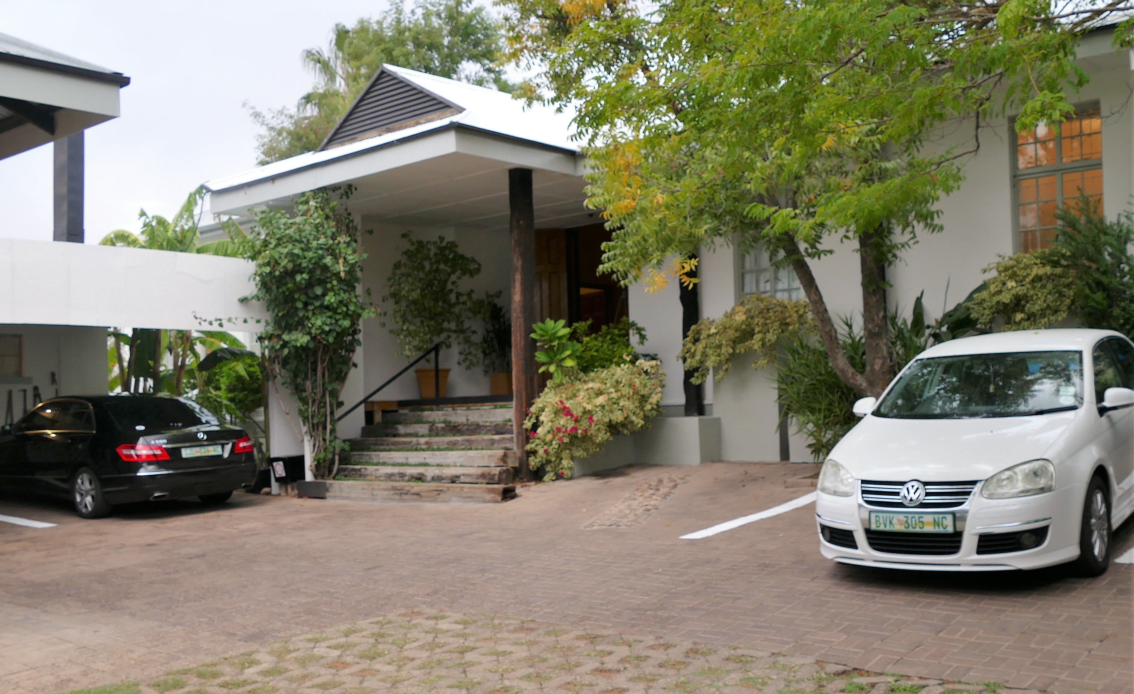
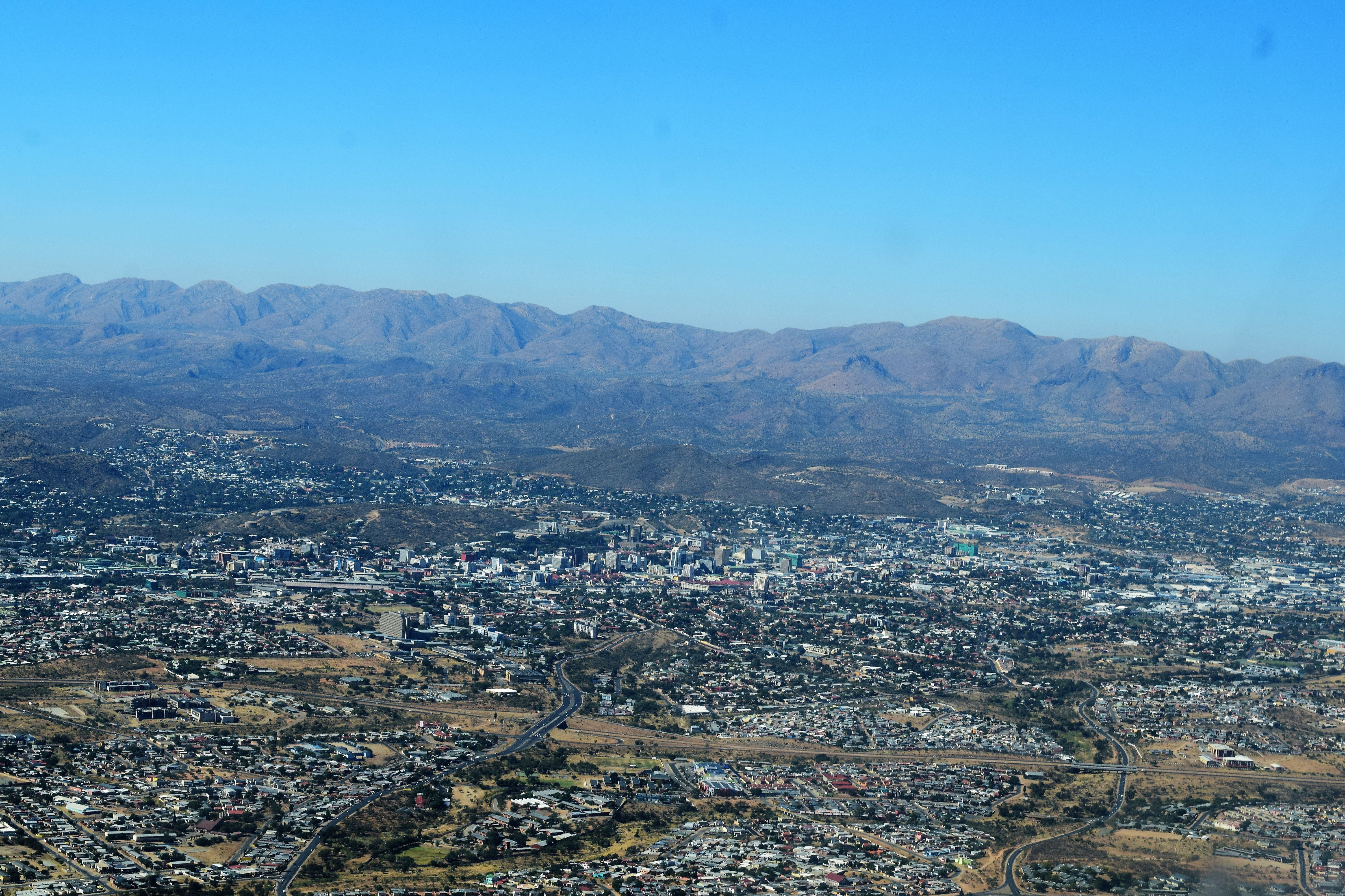
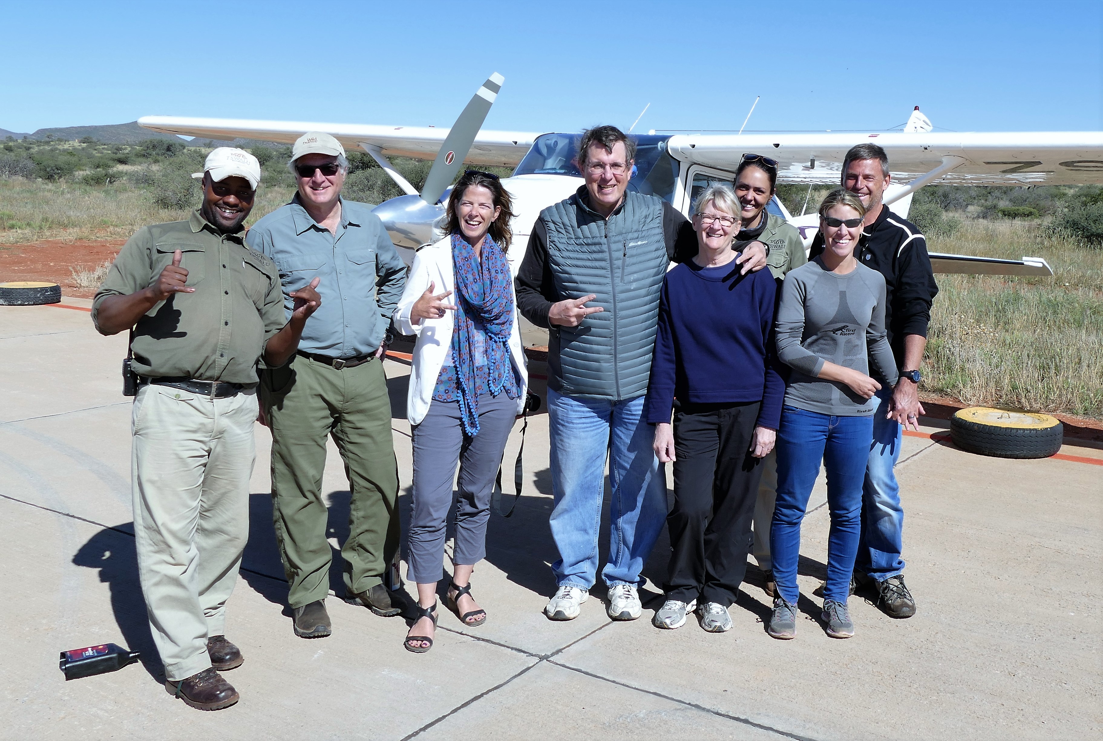
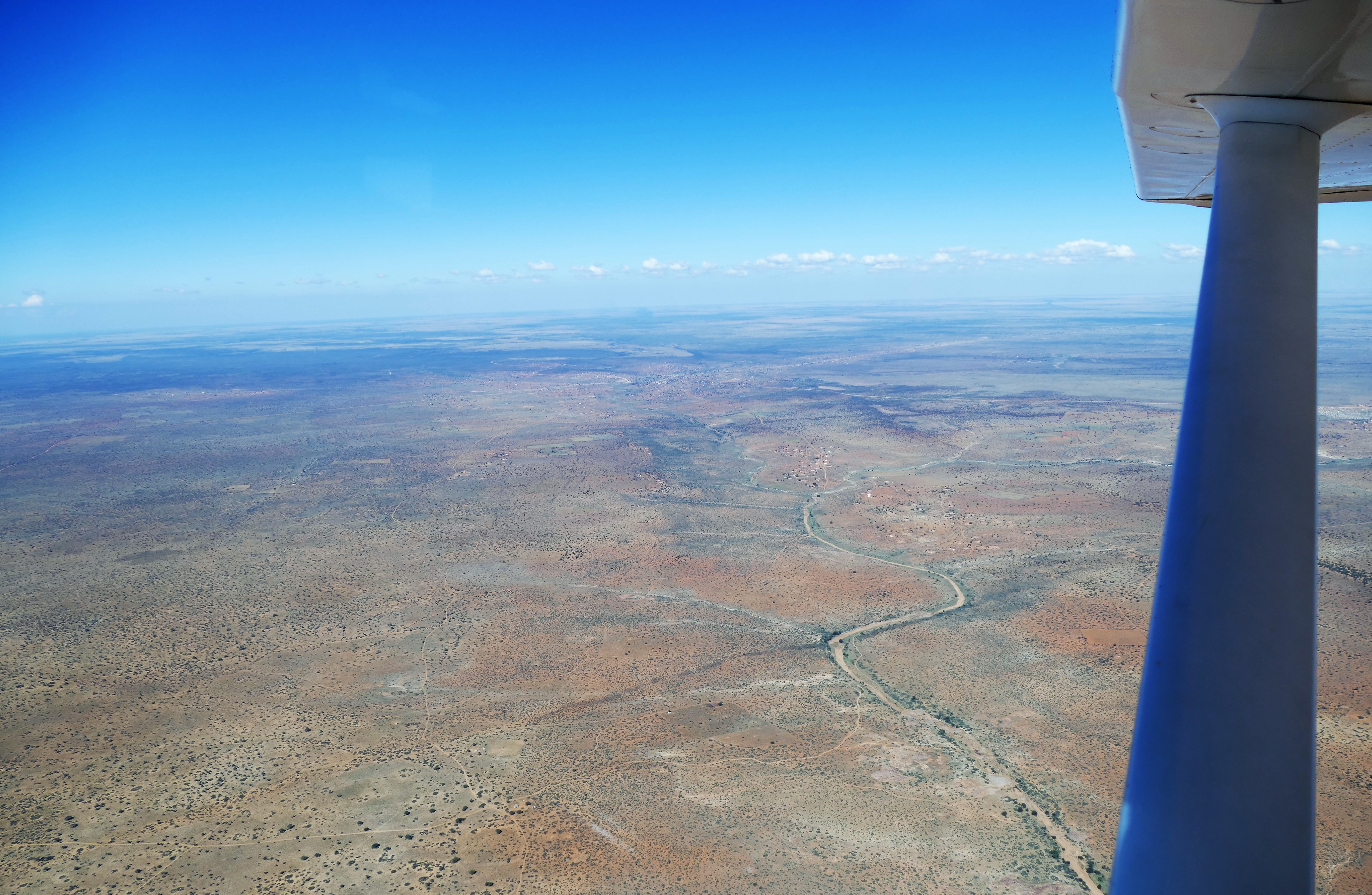
After sunrise, our flight took us over Namibia so we could see the terrain where we’ll be flying. From high up, we could see the sands along the coast, the mountains, and the desert bush lands. It was becoming dark by the time we landed in Johannesburg’s O. R. Tambo Airport around 5:50 PM. South African customs stamped our passport with a tourist visa. At the Johannesburg airport, I tried to get a Vodafone sim card for my cell phone, but the salesman could not make it work. The Hanks had arranged for the 45 minute drive north to the Hartford Hotel in Lanseria. At the hotel, we had are first meeting with Nick and Christina Hanks and with the crew of the other Cessna 182, Andy and Karie Davidson.
5/8/16 morning: Church & Lanseria Tower Briefing
After having breakfast at the Hartford hotel, we arranged for an Uber driver to get us to church It turned out that the latest services started at10 am, and our driver found a church, saying, “it's only 10 minutes away.” As he drove, we chatted on the way about life in his home country Zimbabwe and why he left for South Africa. His family still lives in Zimbabwe and they struggle with the economics and the corruption of the leadership. He reasoned that South Africa’s president is corrupt but at least he will pay for his corrupt dealings. The 10 minute drive actually became 30 minutes, and we got to the Church of the Resurrection in Bryanston about 30 minutes late. The church was standing room only, and an old priest was still giving an enthusiastic rambling sermon about church history and works of mercy that went on for another 20 minutes. After that, the service was same as in America, except for the South African accents.Outside of the church was an oddly configured shopping center. We started to notice that there was a lot of security around the buildings and that everything was gated and guarded. Even the church was gated. We shopped at 3 markets and purchased some Kalahari salt and tea for gifts. We also bought a small bag of beef biltong to try, which was like jerky with a somewhat milder different taste.
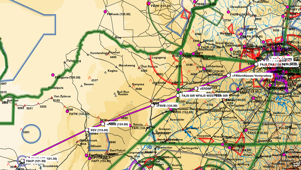
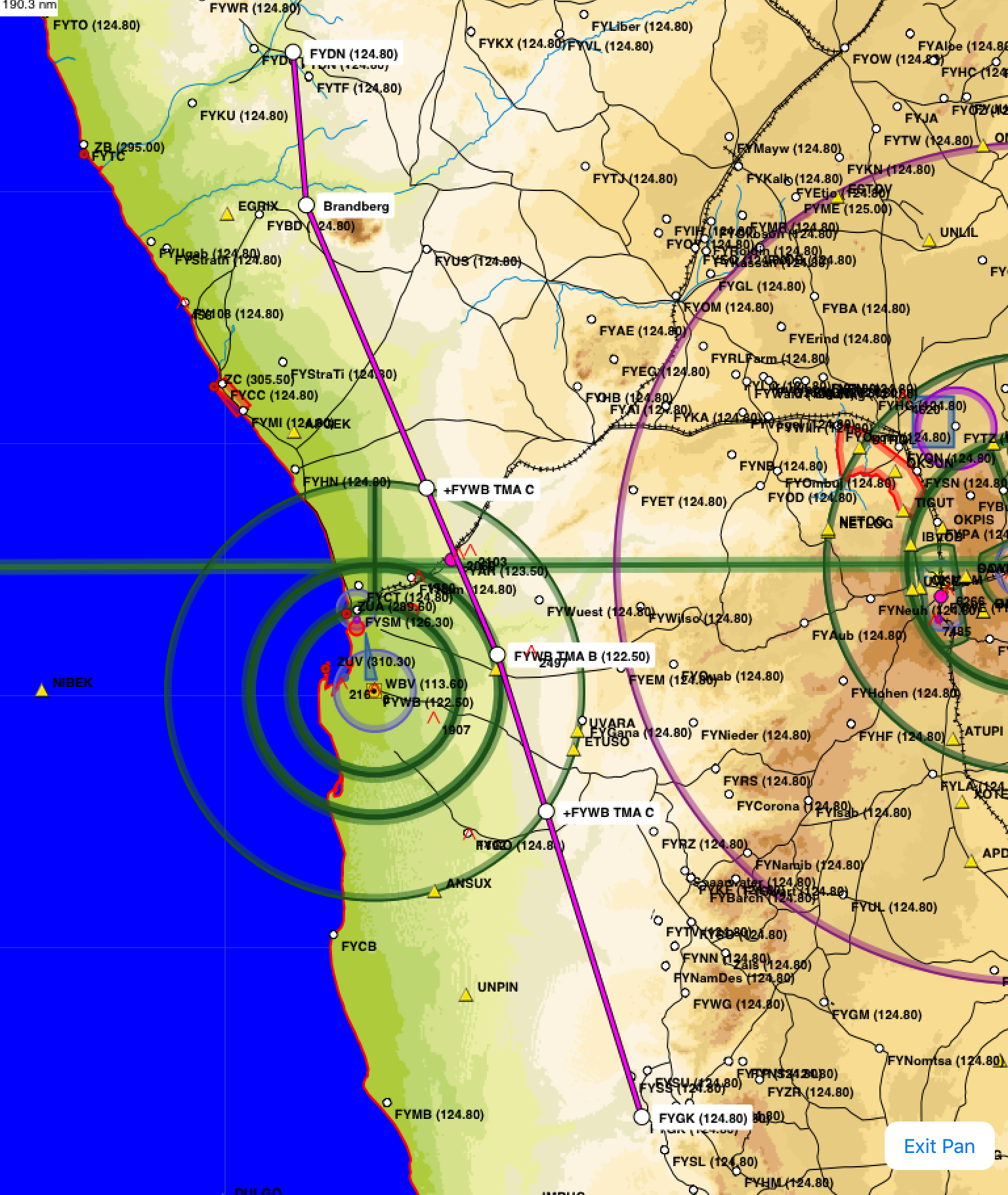
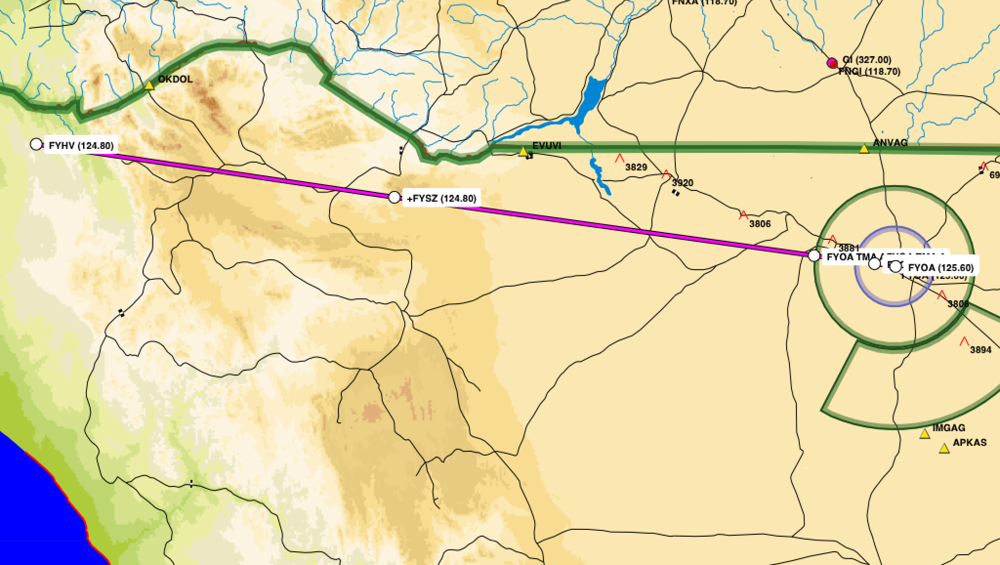
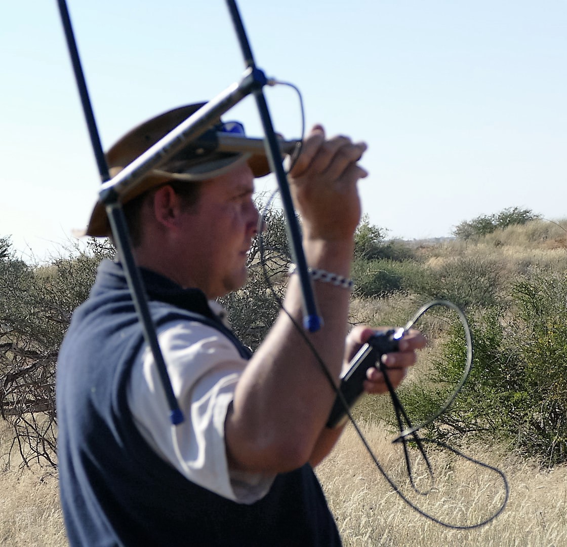
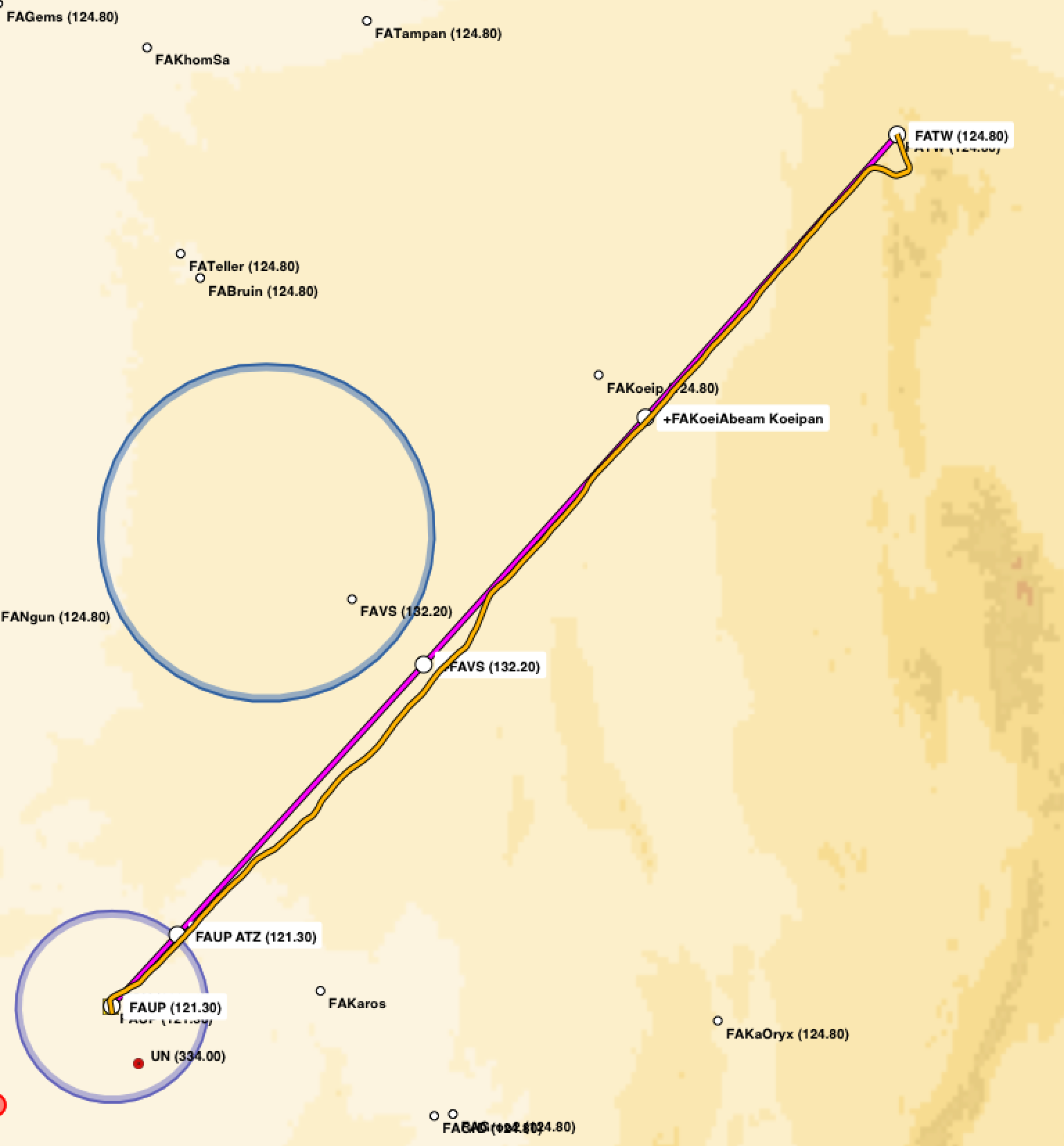
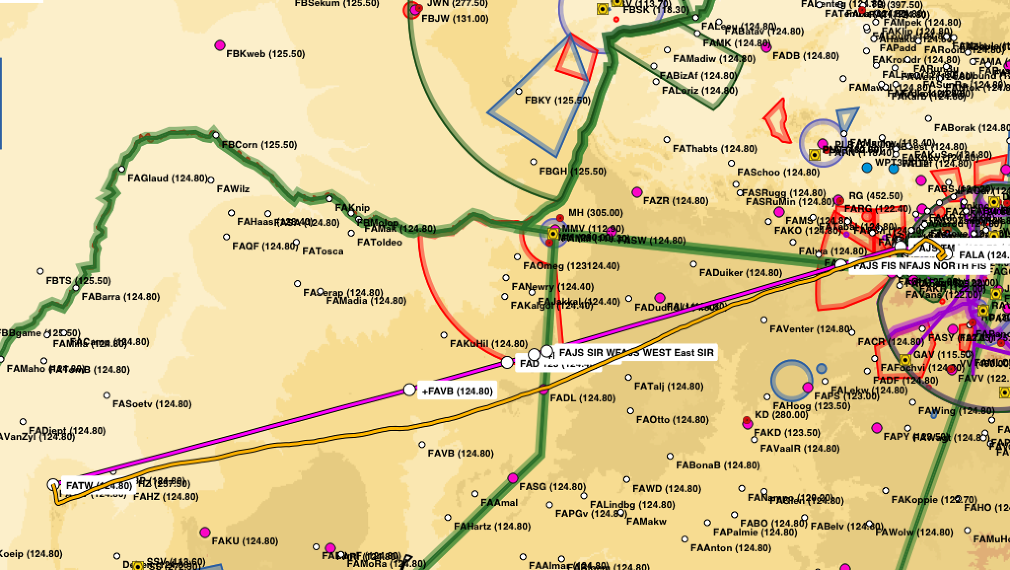
Back at the hotel at 300 PM, Andre from the Lanseria Airport (FALA) control tower gave us a briefing on the airport procedures and surrounding Johannesburg African airspace. There were a lot of airspace considerations for getting in and out of Lanseria Airport and some different terminology to become familiar with. Special rules, circuits, zone or boundary out were just a few in addition to the South African accent of the controllers. Airspace around Lansera is cramped. Lanseria Airport is 4521 elevation with a circuit pattern of 5500 feet. Johannesburg approach control does not allow VFR flights into the Johannesburg TMA which is 7600 feet to FL 110. There is also Lanseria CTR from ground to 6500 feet and a larger Lanseria TMA from 6500 to 7600 feet extending to the west and south of the airport. Fortunately, the tripkits from Hanks Aero had information about the altitudes to use getting in and out of Lanseria airspace. Louis Ashpole gave us a portable GPS with all of the safari flight plans to use in the Cessna 182 we would fly. After the briefing, I had to do a new flight plan for the validation flight, to take into account what I had just learned about the reporting points for the north departure from Lanseria Airport.. I slept poorly that night waking up a 2 am to program a flight plan into a portable GPS.
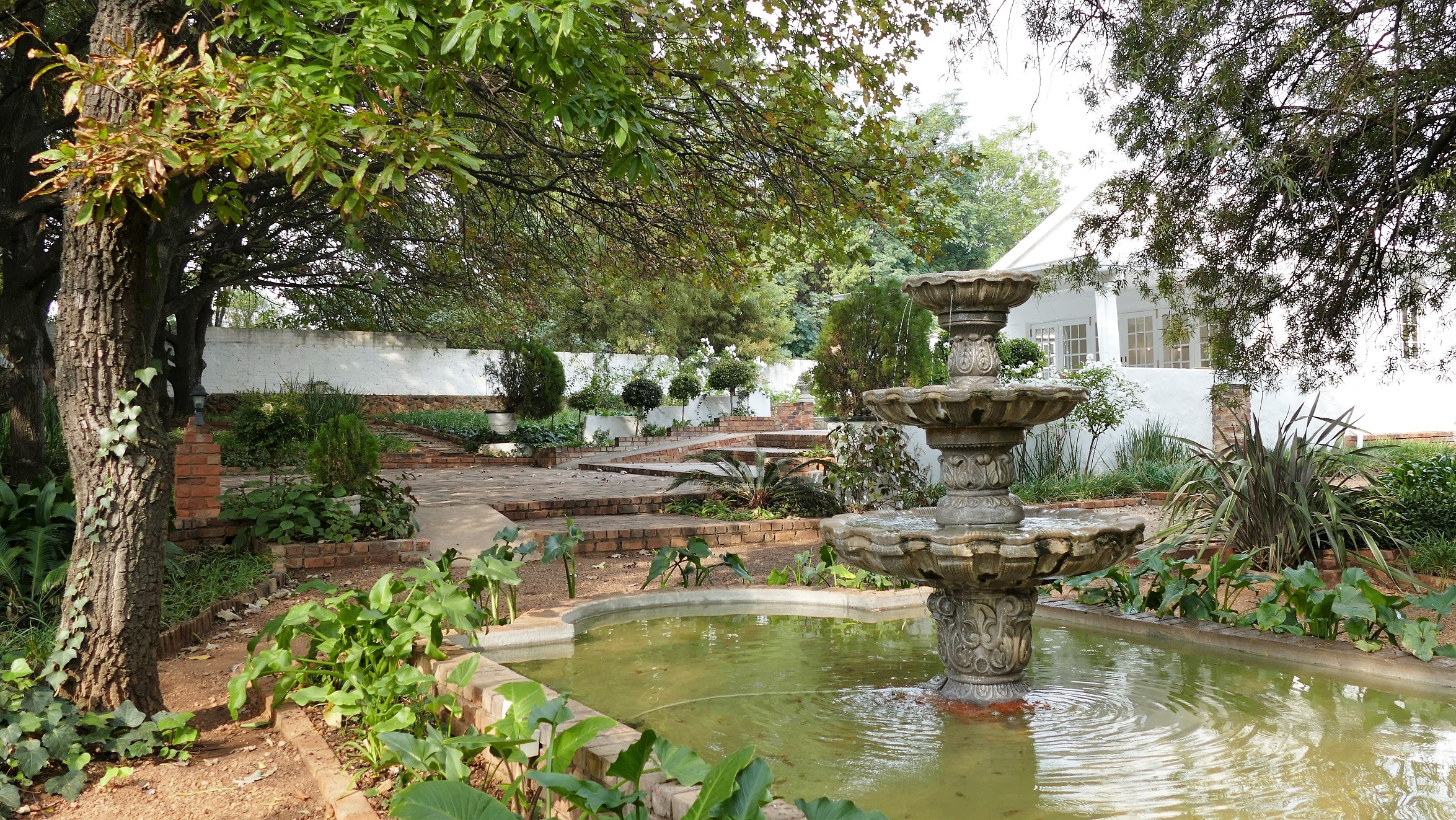
Fountain at the Hartford Hotel
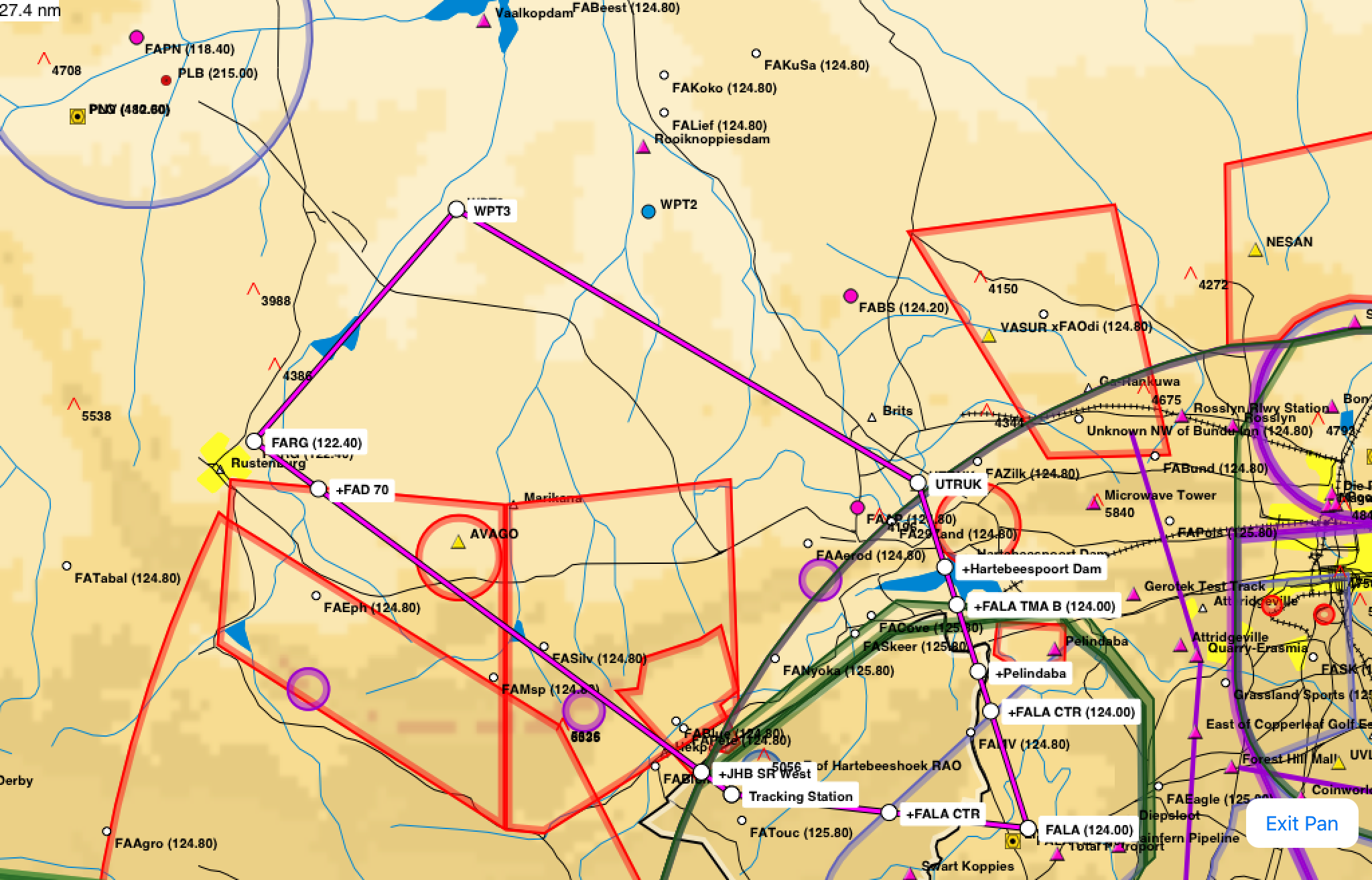
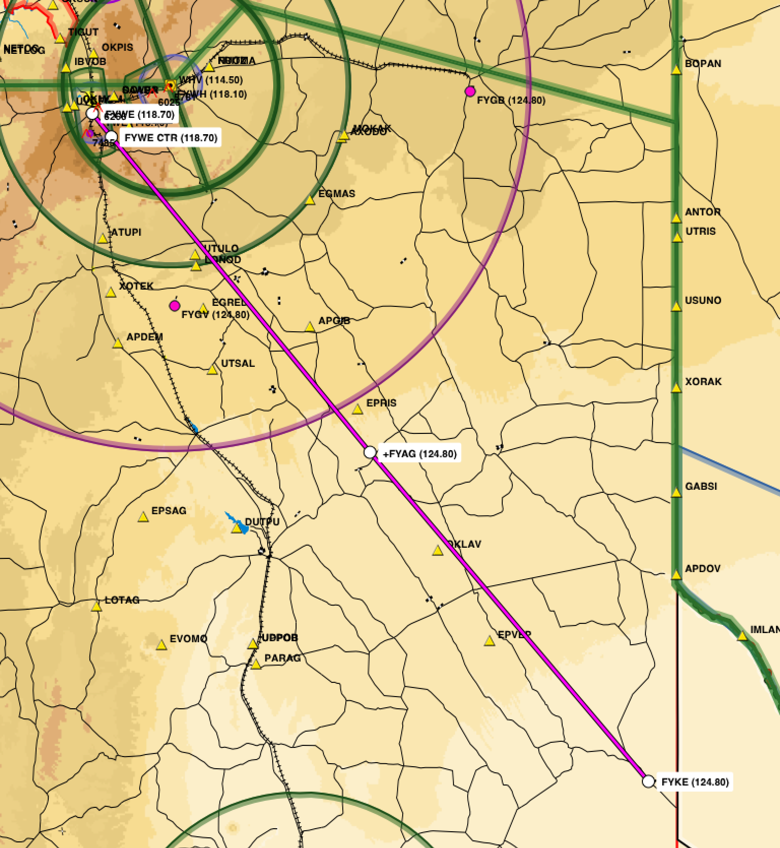
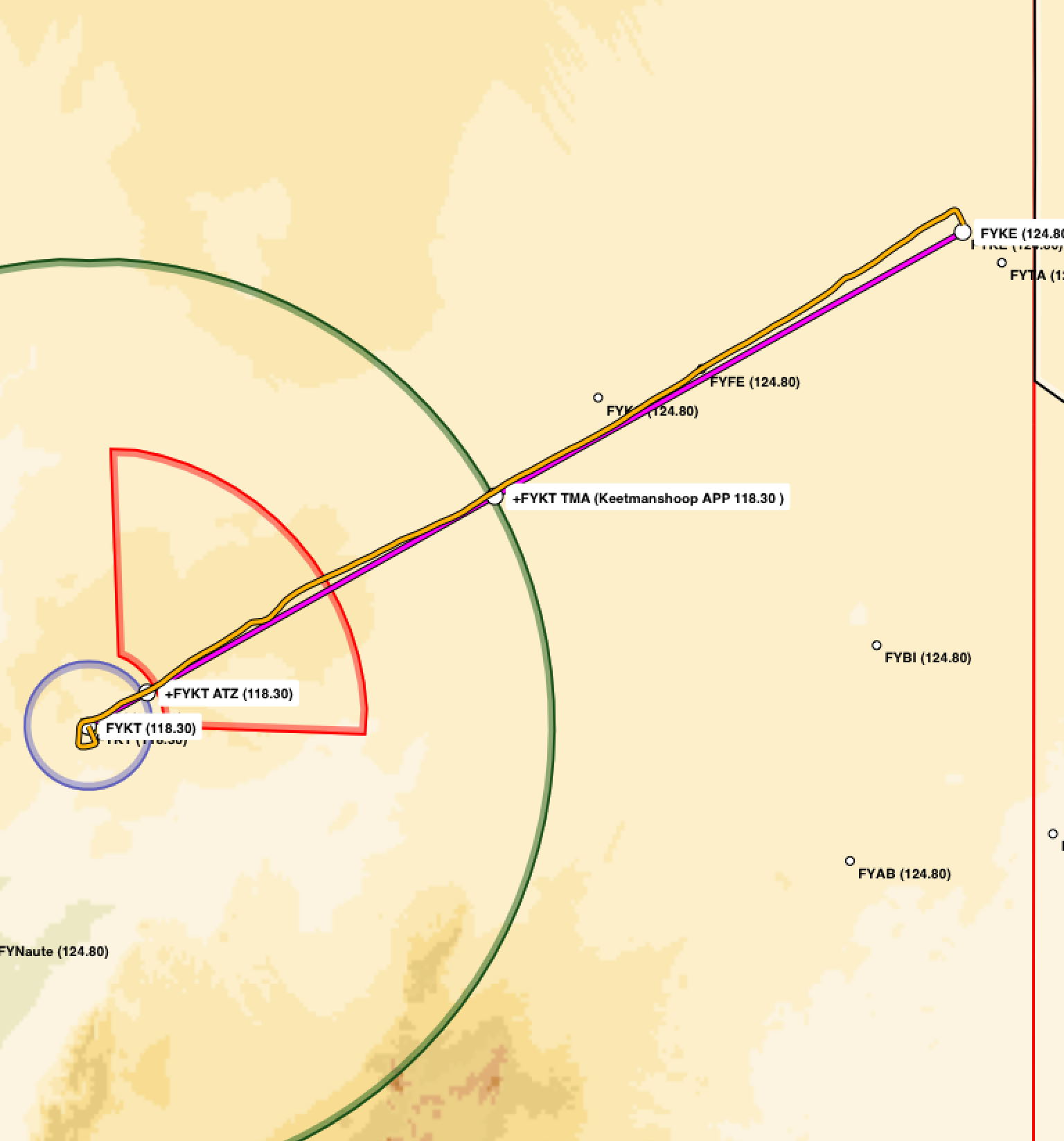
Actual routing for the validation flight
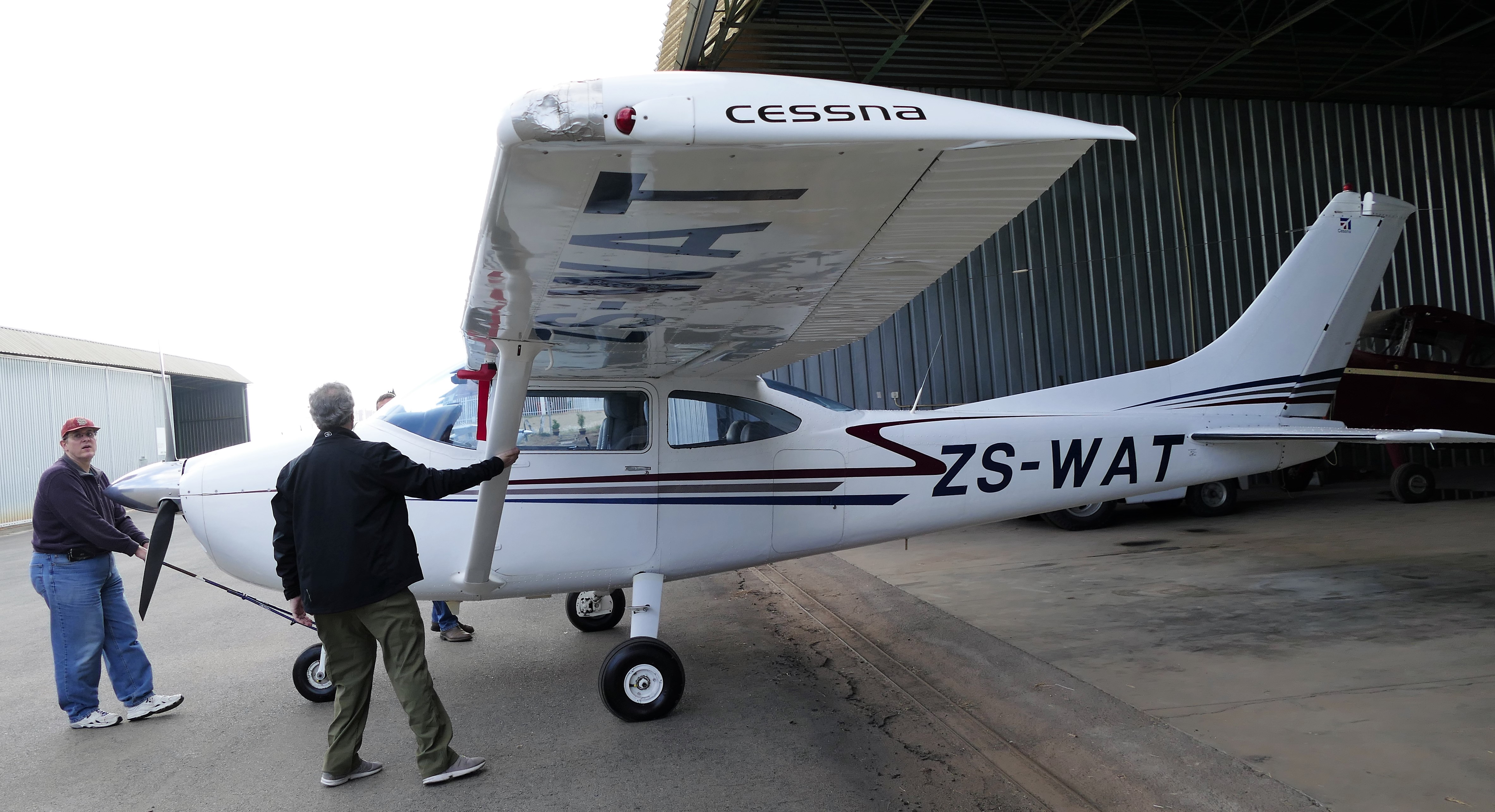
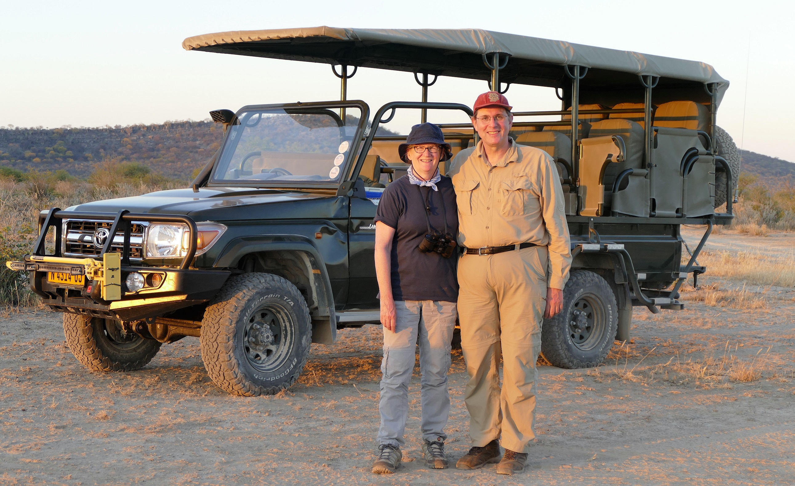
First meeting of our Cessna-182
5/9/16: Validation Flight & Botanical Gardens
At Lanseria
Airport, Silke gave Liz and I a briefing on flying the South Africa bush. Silke
was an instructor and a recently certified air transport pilot. She gave use
many interesting and scary tips. One tip was to watch out for bush pigs and
other animals who may choose to scamper onto the landing strip when the airplane
is on final approach at an unsecured airport. Most bush camps send out a Land
Rover with staff to clear the landing strip. But when that does not happen, or
if we make a diversion to another bush strip for an unscheduled landing, we were
told to overfly the landing strip at 300 feet above the ground with a wing low
to inspect for animals.
We were told that danger also lurks high in the air. Large birds can fly at 2000
feet or more above ground level, circling the thermals, with no respect for loud
flying machines. Birds rarely fly alone, so if one bird is seen, there will be
other birds nearby. We were told to turn away and give the birds a wide birth.
The birds are not afraid and act like they believe the airspace belongs to them.
If a bird was aiming for a head-on collision, we were told to nose up so the
bird will hit the underbelly of the airplane instead of breaking through the
windshield. A nose up stall is an easy matter to recover from compared to a
serious bird strike. Silke said what is more likely is that the bird will say,
“oh my God!” then pull in its wings and drop out of the way. Louis, who also is
an instructor, frowned on a maneuver that would result in a stall, he said just
turn away from the bird.
Another worry is that night comes quickly in South Africa. There is nothing
gradual about sunset; it gets dark 15 minutes after sundown. It was best to plan
flights to be completed 3 hours before sunset, otherwise there is the risk for
an unscheduled division to another airport.
The briefing was followed by an educational check-ride to test my piloting
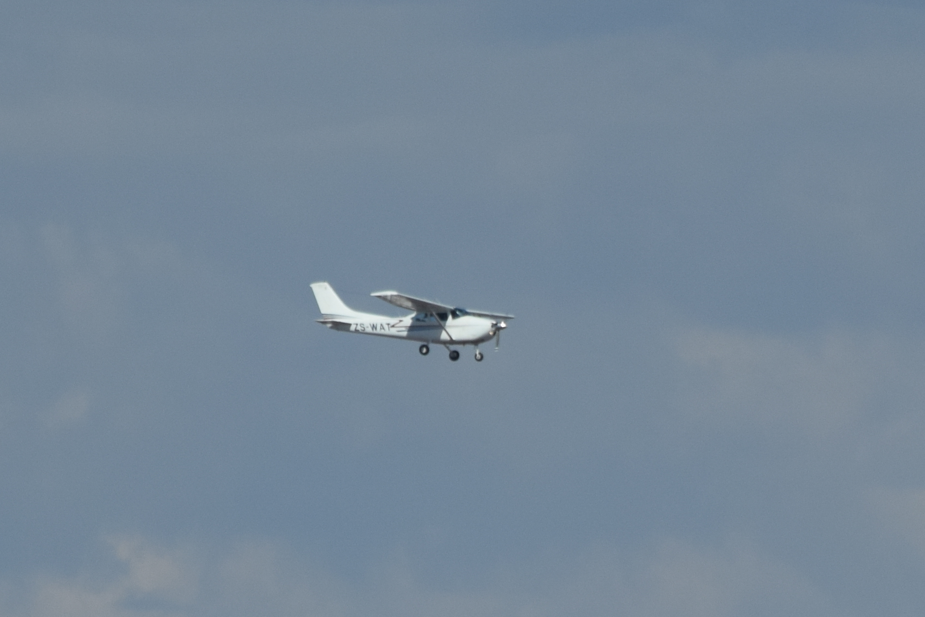
ability and to learn the airspace around Lanseria Airport. We pulled ZS-WAT out
of the hanger, and I did a careful check to get to know this Cessna 182 that I
would be flying for the next 17 days. The only minor problem was excessive
static on the #2 radio, so that radio would be off and used only as a backup.
After start-up, Silke and I told the controllers we would “route to Pilanesberg“
Airport. During the pre-flight run up, we did an aggressive leaning, pulling the
mixture until the engine ran rough, then back to smooth which was peak power,
then 3 turns of the mixture control rich of peak. This gave the best power for
take-off at the high altitude Lanseria Airport. We took off on runway 07 and
turned left for a northbound departure to the UTRUK intersection. I talked with
Lanseria Tower until “zone out,” then with anyone who was listening in Special
Rules Traffic, giving my position reports for Palindaba Power Station, the south
shore of the lake made by the dam, and when over the Harteesport Dam.
At UTRUK intersection, we turned northwest to Pilanesburg Airport, set the altimeter to 1013 hPa for standard flight levels, and contacted Johannesburg Information for flight following. In South Africa, a local altimeter setting is used for flight less than 2000 feet above ground level. When the local altimeter setting is used, altitude is reported in feet above sea level. At and above 2000 feet above ground level, the standard altimeter setting is used and attitude is reported in flight levels. Johannesburg Information had a weak signal on the radio, and I could not make out what the controller was saying. Fortunately, Silke understood and she handled the radio, arranging a climb to flight level 085 (about 8500 feet above sea level or 4000 feet above ground level), then for a diversion on the route to Pilanesberg. Silke asked me to demonstrate a precautionary touch and go landing at Rustenburg Airport, then over to the practice area for an approach stall, demonstration of engine failure procedures, and a go-around over an empty field. We routed back to Lanseria Airport, contacted the tower, reported abeam the satellite tracking station, and requested to join the circuit for landing. We were told the join for a left base to runway 07, report final, and I did another touch and go landing. Then right traffic for the third landing. My first flight in another country was 1.8 hours, and Silke wrote “validation successful” in my log book was written to allow me to be pilot-in-command of a South African Cessna 182.

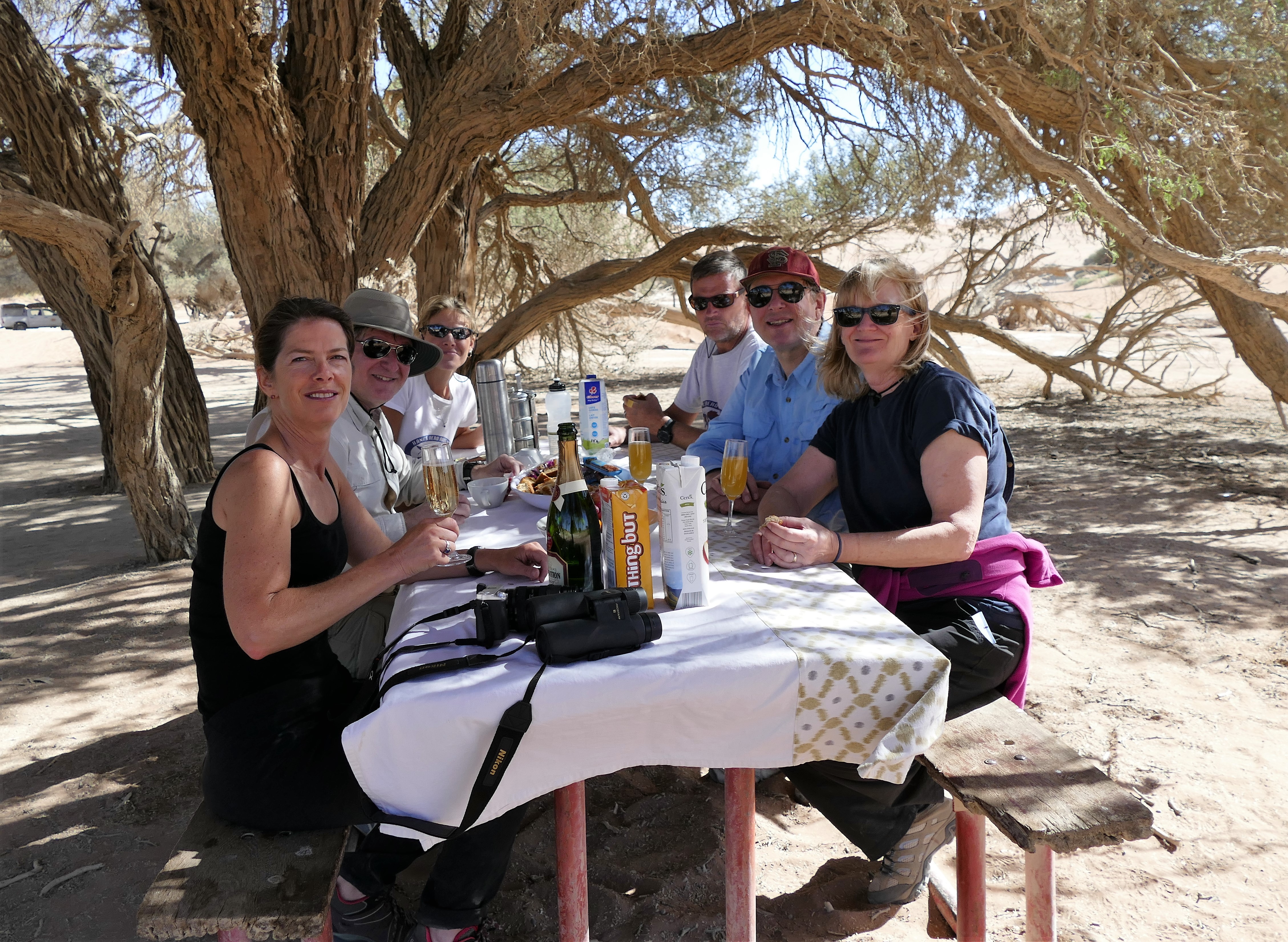
Hank’s Aero Adventures arranged for a car rental from Avis, and Liz got the paperwork completed while I was flying. Liz spent the time with Louis, our flight leader with expert photography skills, learning how to use our new camera. He kept reiterating to use the rule of thirds when composing photos, and so photography skills improved by 30 percent.
In the rental car, I found myself sitting in the right seat having to drive on the left side of the road. Paying a massive level of attention, and with Liz carefully watching, we made it back to the hotel. Only one time, we found ourselves turning into ongoing traffic in the lane. Traffic around Johannesburg is harrowing because many busy intersections of 4-lane roads have non-functioning traffic lights and so become like 4-way stop signs. With traffic stopping in all 8 lanes, there is no logic as groups of cars lurch into the intersections while pedestrians attempt death defying crossings. It seems that all of the cars stopped for 2 seconds, enough time for several drivers simultaneously to realize that everyone has stopped and it was a good time to move into the intersection. Incidentally, in South Africa traffic lights are called “robots. “
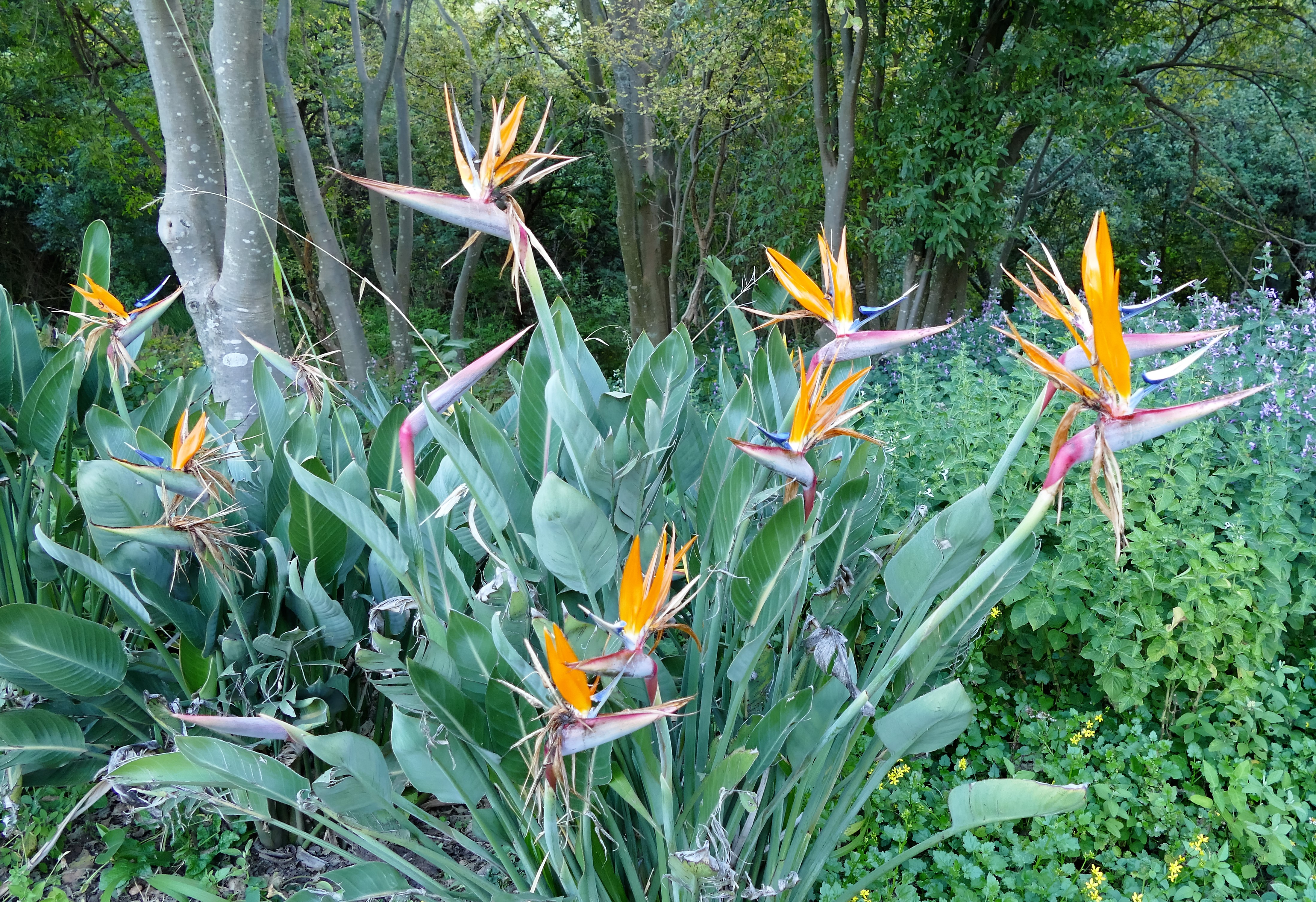
With some of the afternoon left, we decided to brave driving in the traffic again and go to the botanical gardens about 30 minutes to the west of Lanseria. Google Maps kept trying to get up on a highway, and we finally gave in to the cell phones yelling and entered the highway to avoid the intersections. Driving through the neighborhood to the gardens, I kept telling myself, “right turn to left lane” to try to avoid turning into the wrong lane. We arrived at the Walter Sisulu National Botanical Gardens and found parking, about an hour before the gates would close for new visitor. We found the walk outdoors to be refreshing. We found the Eagle’s Fare Restaurant for a quick late lunch. I ordered a tramezzini, which turned out to be 2 tortilla shaped pieces of flat bread with filling sandwiched in between, looking more like a quesadilla. We walked to the waterfall, then onto the woodland walk along the Crocodile River to the boardwalk over the wetlands to watch the ducks. The gardens were close to closing, so we drove on the left side of the highway back to the hotel.
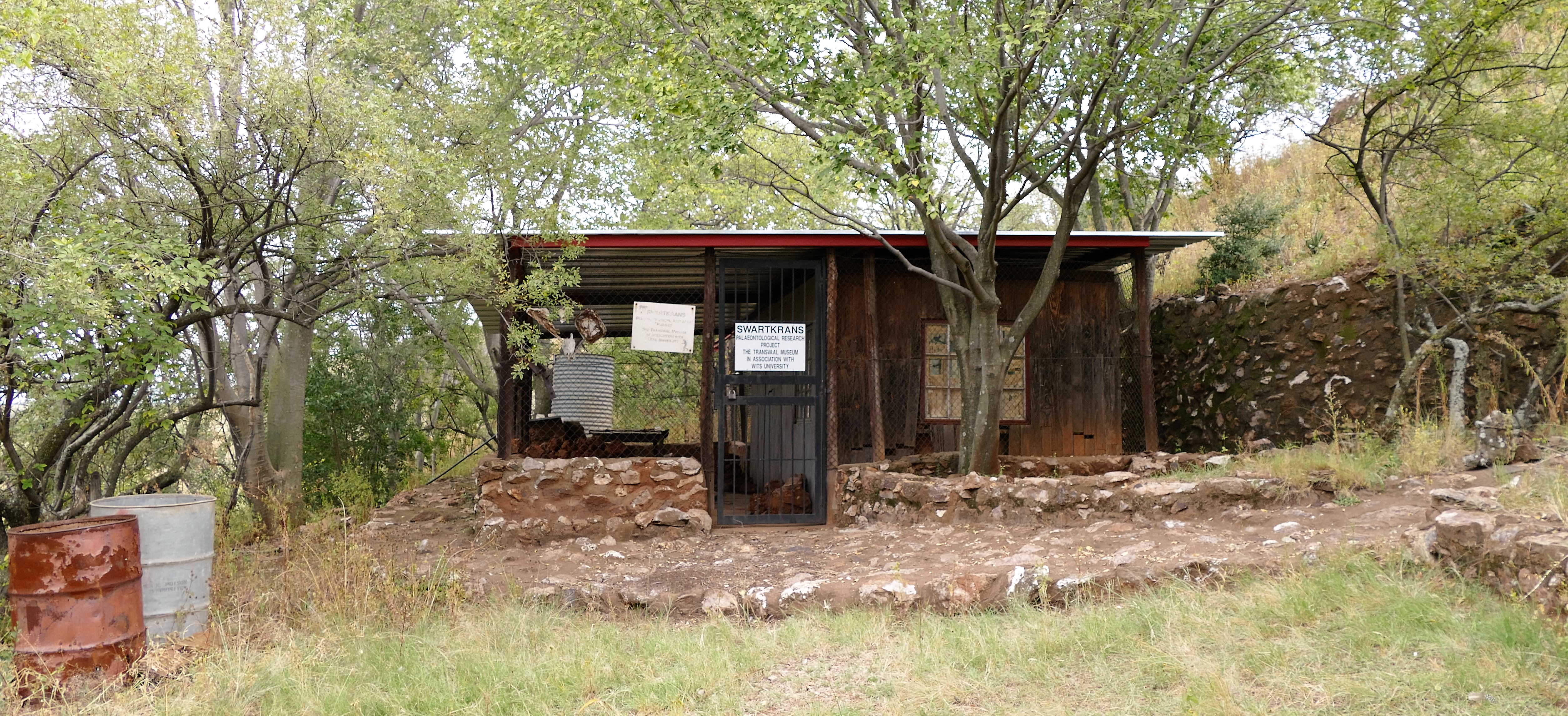
5/10/16: Cradle
of Humankind & Safari Briefing
We drove east
about an hour through rolling grassland to get to the Cradle of Humankind. While
looking out the window of the car, I imagined early man living and hunting on
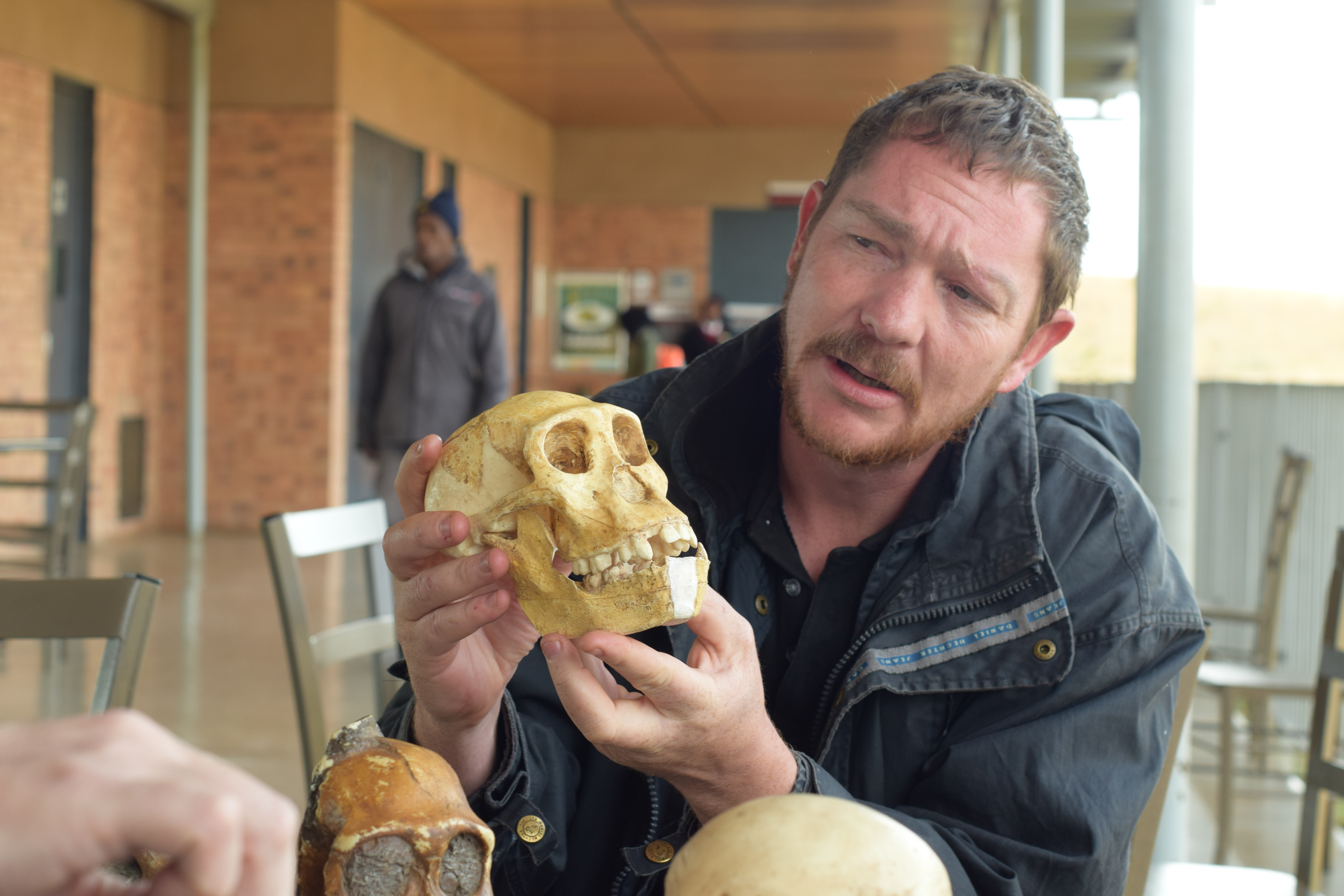
these hills. Upon arriving, we met our graduate student was to give us a tour.
He dashed my imagination of early man saying that the Cradle of Humankind was
not where mankind originated, that would be in the Congo. The Cradle phrase was
a marketing idea. The Cradle was unique in that the geology had preserved bones
of hominid humans in the limestone. We walked up a hill to an archeological dig,
then down into the dig. The graduate student was able to show us bone fragments
incased in the limestone, and he described the excavation process by which they
found hominid bones. It was fun doing the easy climb in up the ladder out of the
cave.
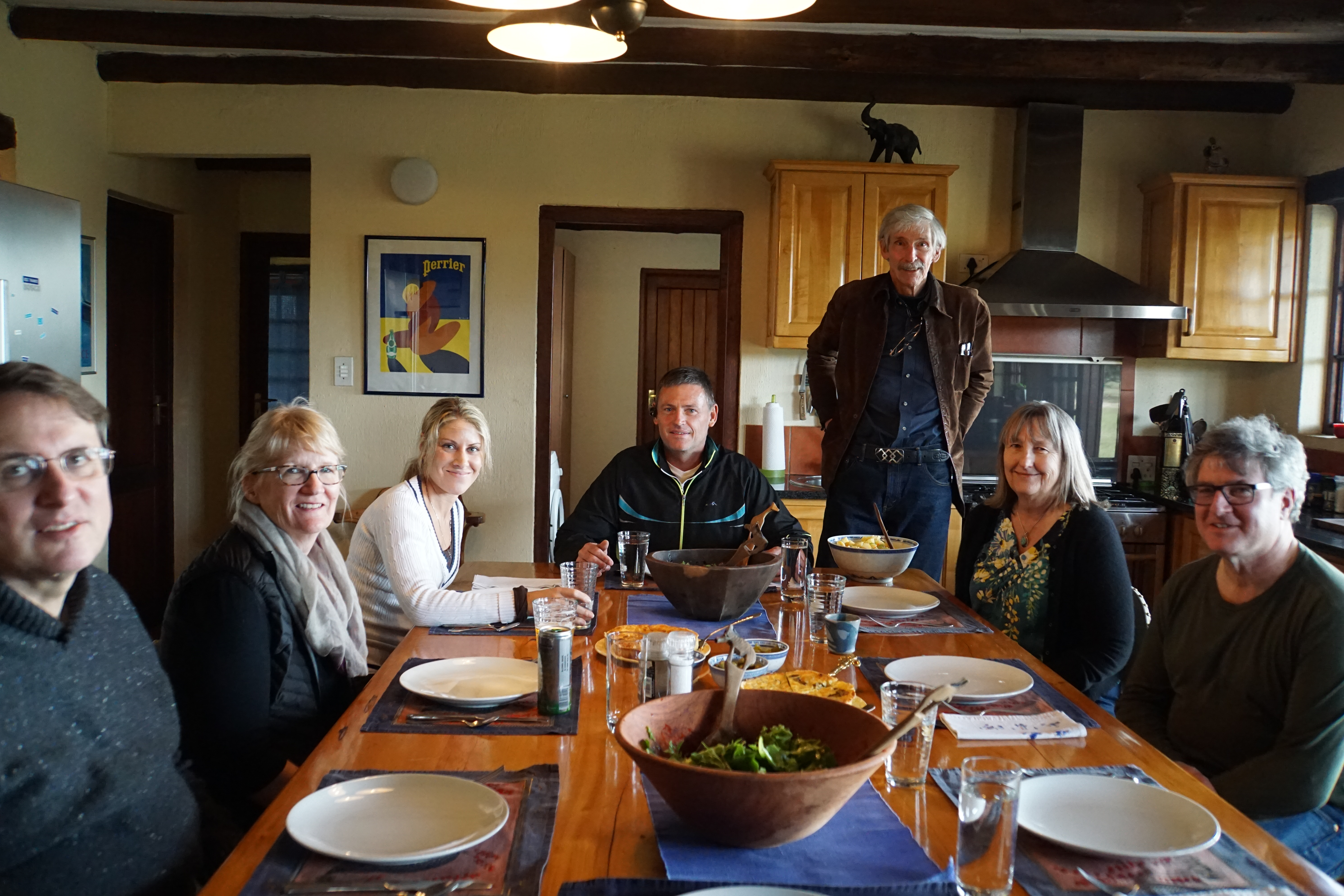
Nick and Chris Hanks live in the middle of a game preserve. We drove a long, bumpy dirt road to get there. At their house, we were given lunch and an extensive briefing for the entire trip. Each aircraft would have a milk crate full of supplies, including a first aid kit, survival kit, water, 2 quarts of oil and a funnel. Unless arrangements are made well ahead of time, most airfields might not have fuel. It's Africa and it's best to be prepared for anything and everything. Two airplanes got a DeLorme satellite text and GPS device so the Hanks could track our flights from their home. Nick thoughtfully included a pint of Jack Daniels whiskey to be used only if there was an emergency landing somewhere in the bush. We were also given a binder containing envelopes with complete information about each leg of the trip. These “tripkits” included runway information, altitudes, frequencies for the departure and destination airports, route information, frequencies, and alternate airports, as well as a route map and an overhead of the airports from Google Earth. We were also briefed on numerous possible emergencies and inconveniences that could occur on the safari.
After returning to the Hartford Hotel, we walked out of the south gate to a strip shopping center to get water and cookies from the supermarket and Rands from the ATM.
Leg 1 - Lanseria (FALA) to Upington (FAUP)

5/11/16: Into the bush
Launch
day arrived! At Lanseria Airport, we pulled the Cessna 182 airplanes out of the
hangers and the fuel truck topped them off with avgas. Supplies and luggage were
loaded, headsets were plugged in, and a portable GPS and iPad mini with flight
plans were clamped to the yolks. A pre-flight briefing was given. In South
Africa, flight plans are required for VFR flights to and from towered airports.
Flight plans for any VFR flight helps with rescue when the aircraft does not
arrive at its destination. Also, pilots flying visually are supposed to maintain
radio contact and give position reports to air traffic controllers along the
way. Ready to go, we found ourselves delayed by a runway closure when a small
airplane landed without lowering the gear. This closed the airport to all
traffic in and out until the runway was cleared. Our planned takeoff time came
at 11:00 am and
went. We were a bit worried that if our departure was delayed too long, we would
be arriving after sunset at 5:55 pm in Upington. But, it's Africa. No use
getting upset, be patient with a smile. The commercial traffic would get to land
and depart before we would be permitted to leave.
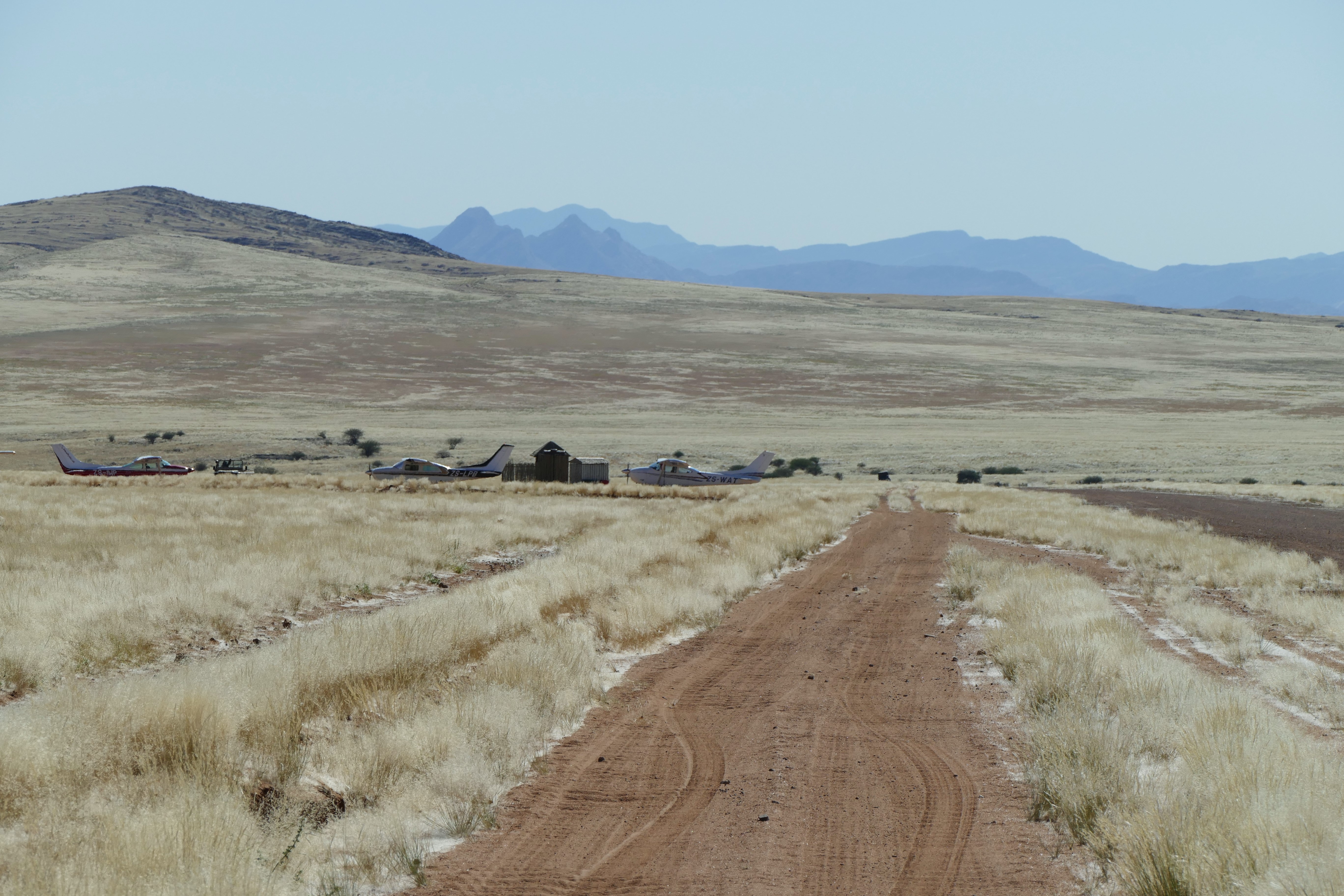
Launch for first leg of the safari finally occurred around noon. Our escorts,
Louis and Shana Ashpole in their Cessna 210, ZS-LPB, were followed by the
Davidsons in their Cessna 182, ZS-IWP, then my 182, ZS-WAT. All took off, flew
west to the Tracking Station, then southwest at flight level 075 to Upington.
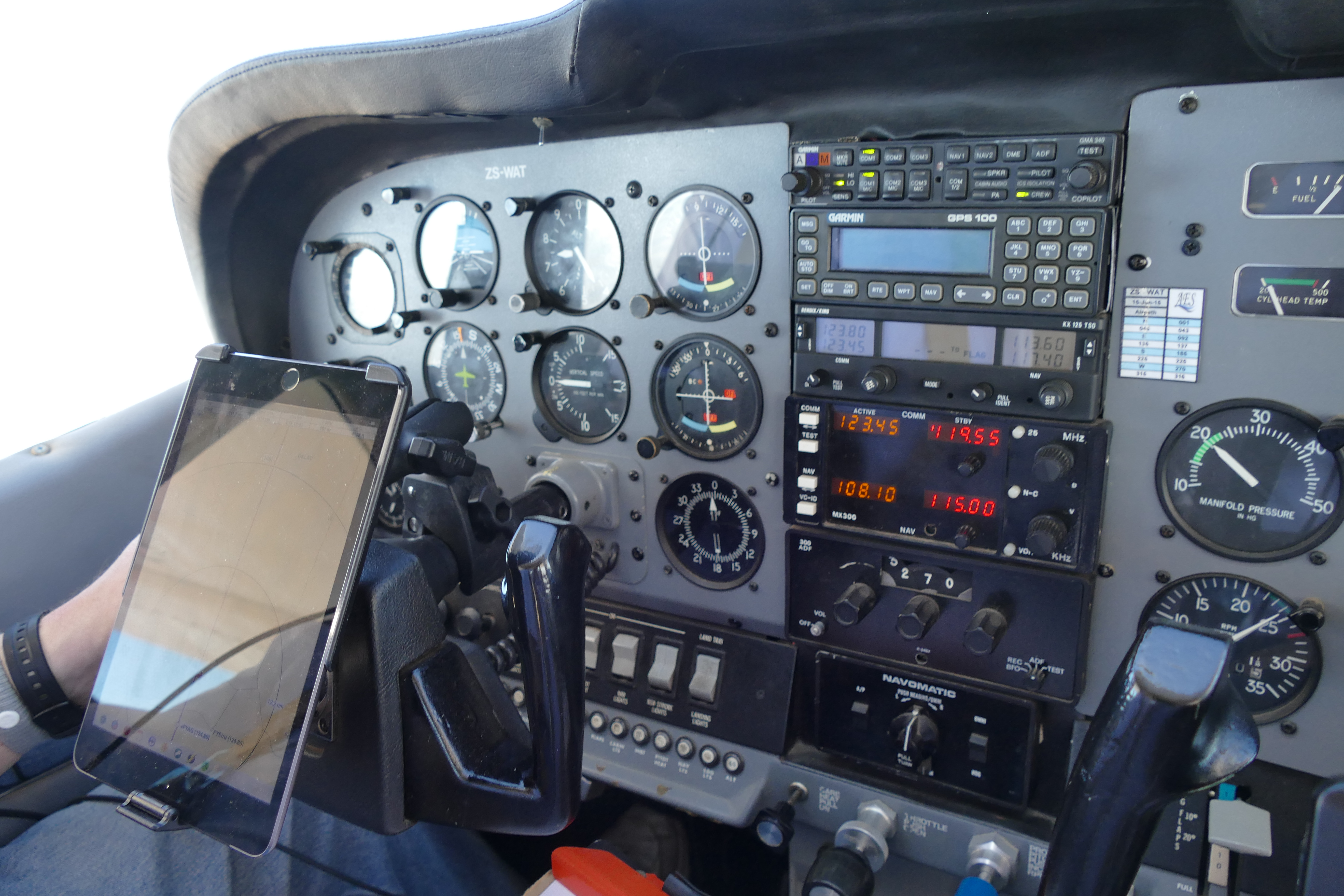
Skies had scattered high clouds and 50 mile visibility. For VFR navigation, we
were using the Easy Cockpit app on our iPad minis. The flight plans Louis loaded
depicted our route, and Easy Cockpit displayed the radio frequencies, and showed
our location with a moving airplane icon. The controllers always asked for
estimates of the time arriving at certain reporting points, which was easily
obtained from the Flight Log screen.
During
the flight, we saw farmland gradually change into ranch land, and finally there
was nothing but semi-arid desert. I had difficulty hearing the FIR controller,
so Louis told me to “go to numbers,” that is, frequency 123.45, so he could
relay what I needed to tell the controller. The flight itself was a little over
4 hours long due to 20 knot headwinds. Cookies and bottled water came in very
handy after flying 2 ½ hours. During the last 40 minutes, we followed the
reflection of the sun off of the Davidson's airplane. They had radioed their
position about 10 miles ahead of us. We flew over some low mountain ranges
before reaching the control zone of the Upington Airport. After contacted the tower and
heard the Davidsons reporting turning final, yet we still saw the reflection off
of their airplane straight ahead of us. We later found out that the reflection
was not their airplane, it was actually a solar tower. The airport blended into
the sand. It was when the tower told us to turn downwind that we said ourselves,
"there's the airport!" After landing, we were picked up and taken to the Bain's
House .
We stayed the night at Bain’s house, a very comfortable bed and breakfast. We
were driven to Bi-Lo for dinner, drank wonderful South African wine, and had a
lively discussion about South African politics. Louis said that South Africans
think that they are smarter than everyone else, so everything has to be done
their way and often be checked be the authorities. An example is that an
American Aviation GPS can't be used for instrument approaches unless first
certified be the authorities. I ate ostrich steak, which has the appearance and
texture of beef steak, but much milder in taste. Liz ate Hake, which is a mild
white meat local fish and springbok as an appetizer.
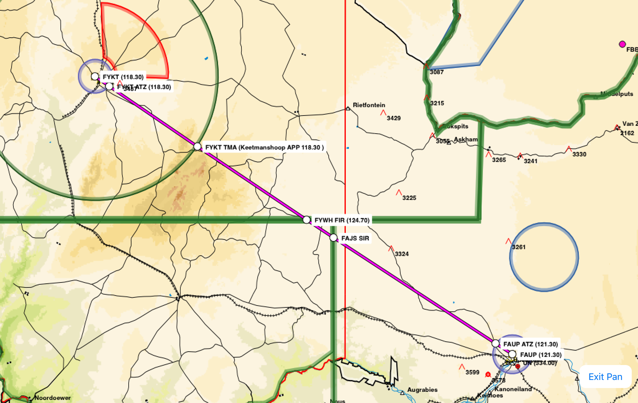
Leg 2 - Upington (FAUP) to Keetmanshoop (FYKT)
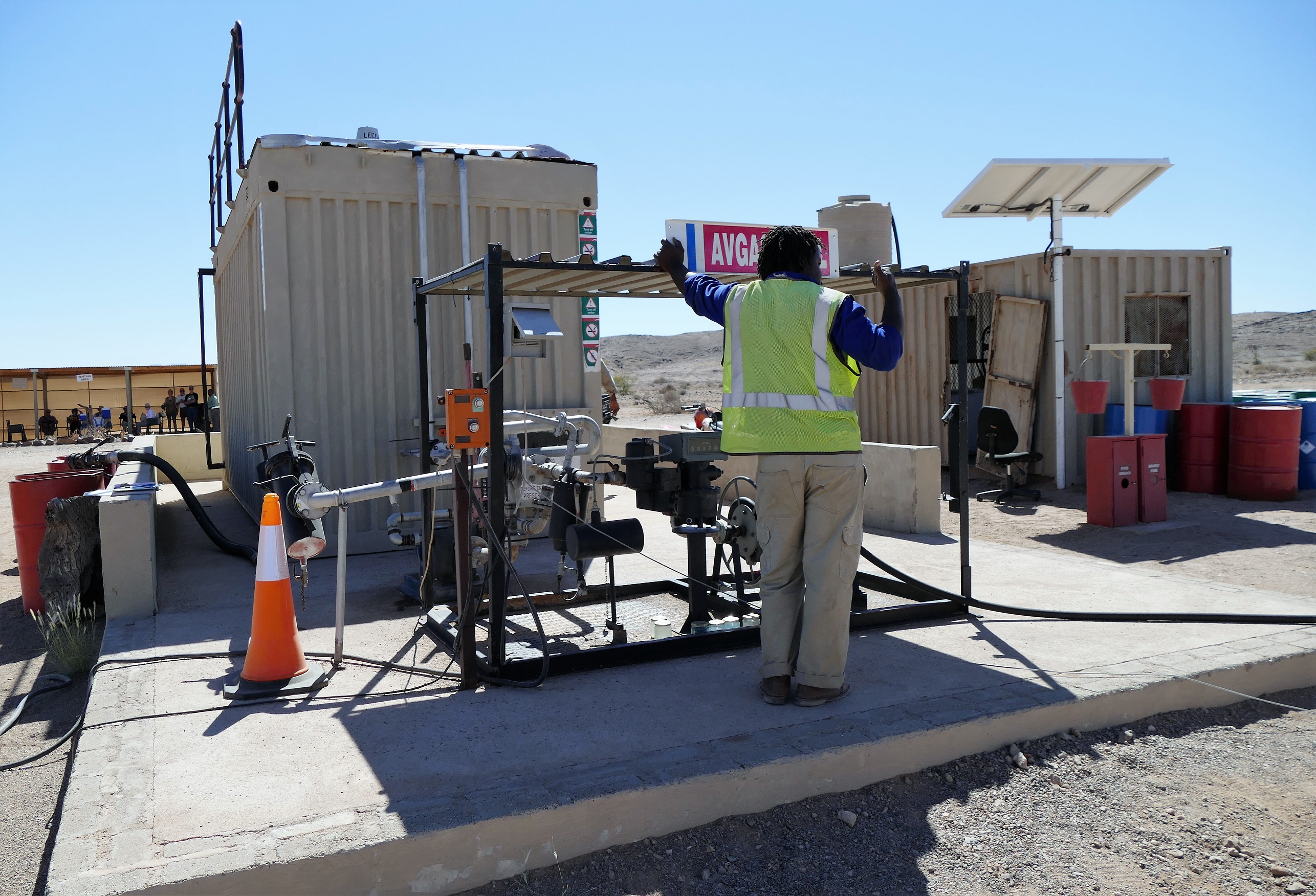
Hand pumping avgas into the wing tanks
5/12/16: Border Crossing into Namibia & Fish River Canyon
Today’s flight
involved crossing an international border and dealing with government employees.
For this reason, we both wore pilot uniforms which consisted of a white pilot
shirt with epaulettes on the shoulders. The commercial pilots of the King Airs,
Caravans, and other turboprop airplanes used for air taxi all wore pilot
uniforms with epaulettes. The airport staff expected flight crews to be wearing
uniforms, and the uniforms allowed for easy access to the flight apron and the
airplanes. We ordered the shirts and epaulettes from mypilotstore.com. We wore
navy epaulettes with 3 gold bars. I ruined the effect by wearing jeans, but Liz
looked quite professional in black slacks.
After returning to Upington Airport, we found that we would have to have our
luggage checked to get back to our airplanes. We also had to go to the
immigration office to fill out forms and have our passports stamped before they
would fuel our airplanes. Takeoff for leg #2 was easy enough, but we found
ourselves dodging rain storms. We deviated 20 miles off course to avoid the bad
weather. Headwinds made the flight take even longer. Louis contacted Windhoek
Area South with the number that Nick Hanks previously obtained permission to fly
over and land in Namibia. We each had a copy of the Namibia application for
overflight and landing authorization on board. We flew in a loose formation with
the Davidsons in sight until landing in Keetmanshoop, Namibia. Total flight time
was about 2 hours, 20 minutes. Although this was an international airport, there
was nobody in the control tower there. Louis said the controller might not have
come to work. Yes, it's Africa! Louis tried to land on the long asphalt runway, but he had too
much of a crosswind. We all landed on the shorter gravel runway.
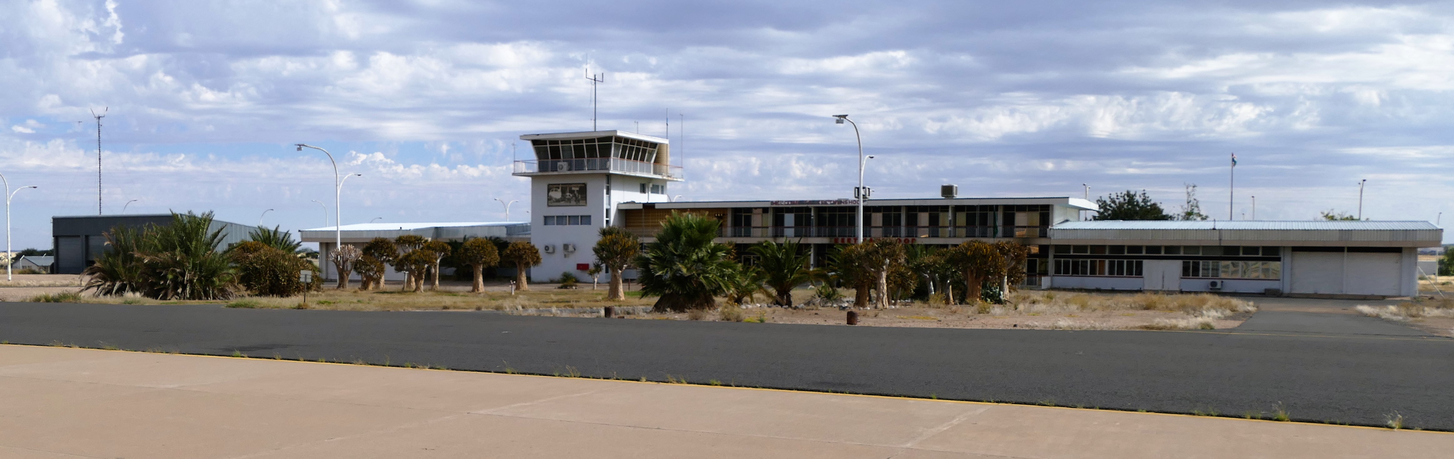
After
parking at Keetmanshoop International Airport, we had to go inside to the
customs window to fill out immigration forms and get our passports stamped with
a Namibian tourist visa. Then, customs staff inspected our luggage, opening each
of our duffle bags. I had to tell the customs women about the purpose of every
prescription bottle. Another man had a checklist to inspect all of my pilot
documents, the aircraft documents, and the airframe. Then, the customs and
airplane inspectors abruptly left. Louis said it was lunch time. Two men rolled
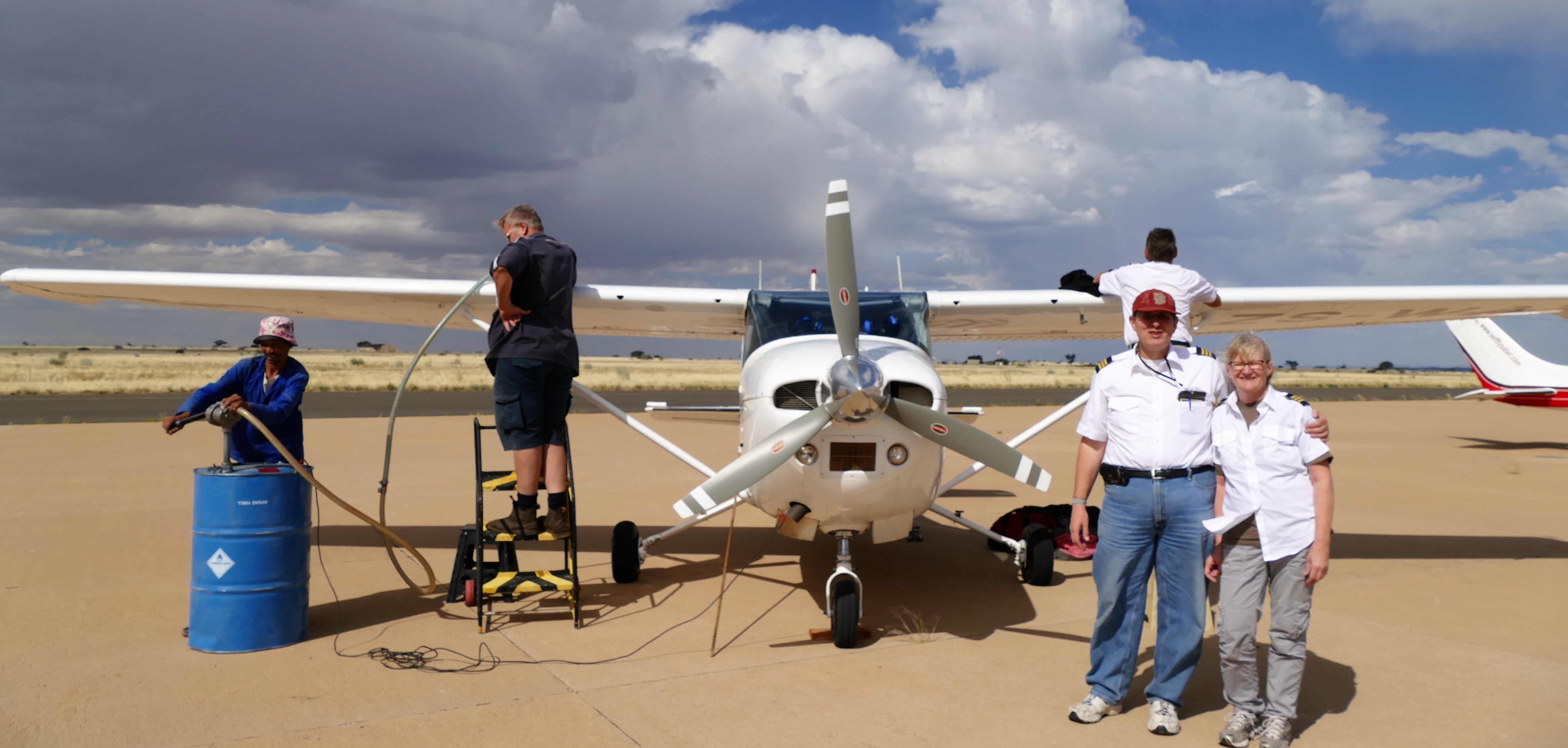
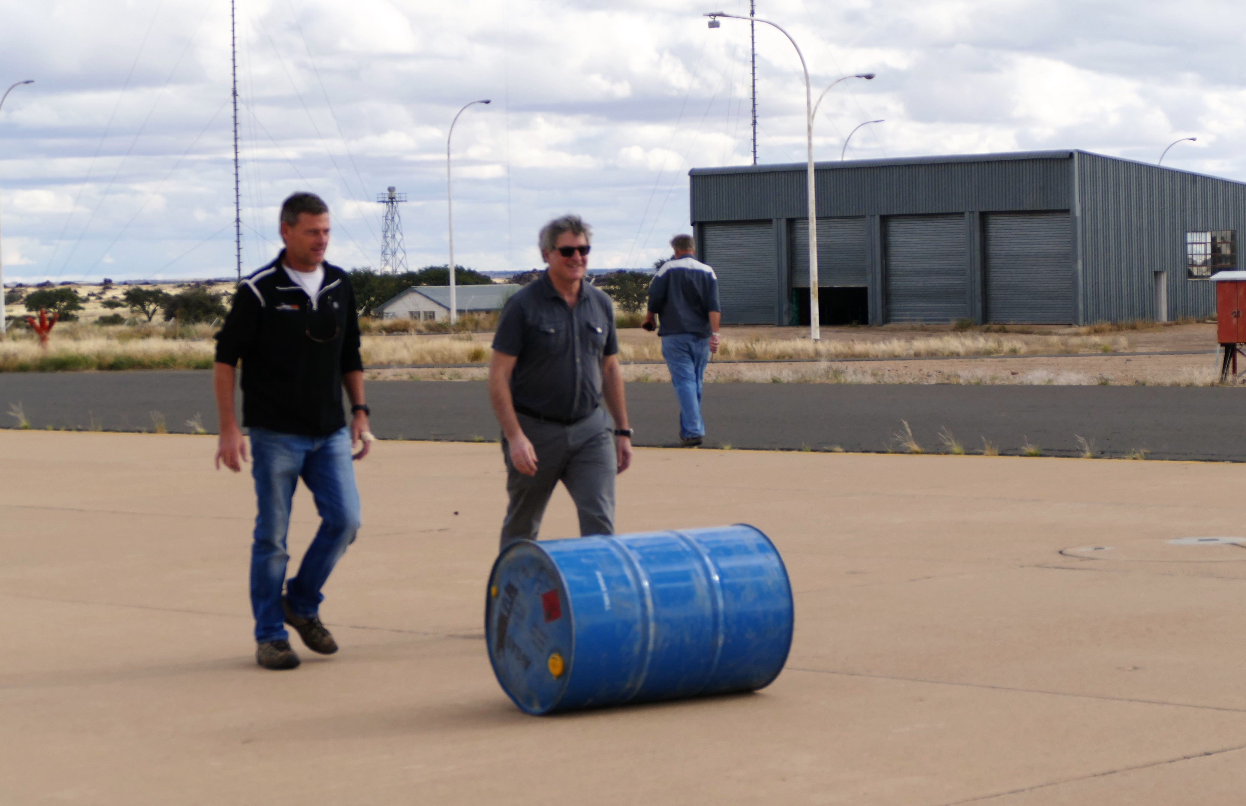
over a 200 liter drum of 100 LL aviation fuel and used a fuel pump to add avgas
to our tanks. I started my engine with 200 liters, or 4 hours of fuel.
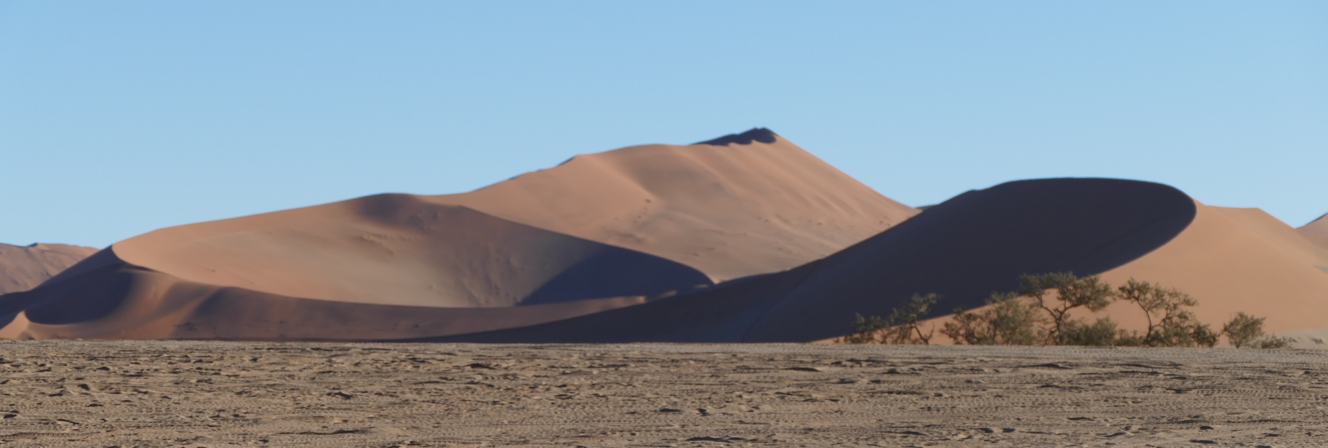
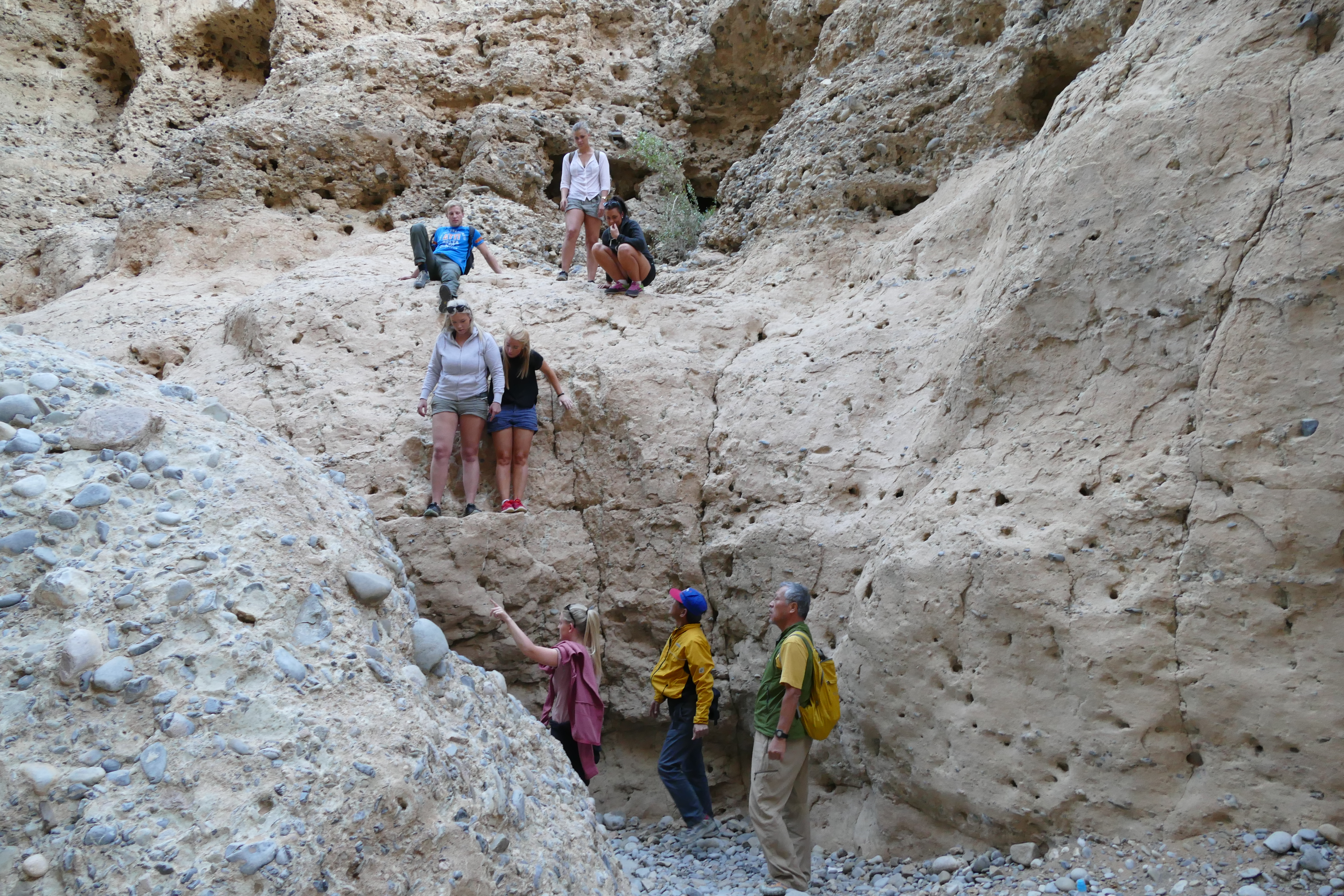
Fish River Canyon
Leg 3 - Keetmanshoop (FYKT) to Karios (FYKC)
View out back of Canon Lodge
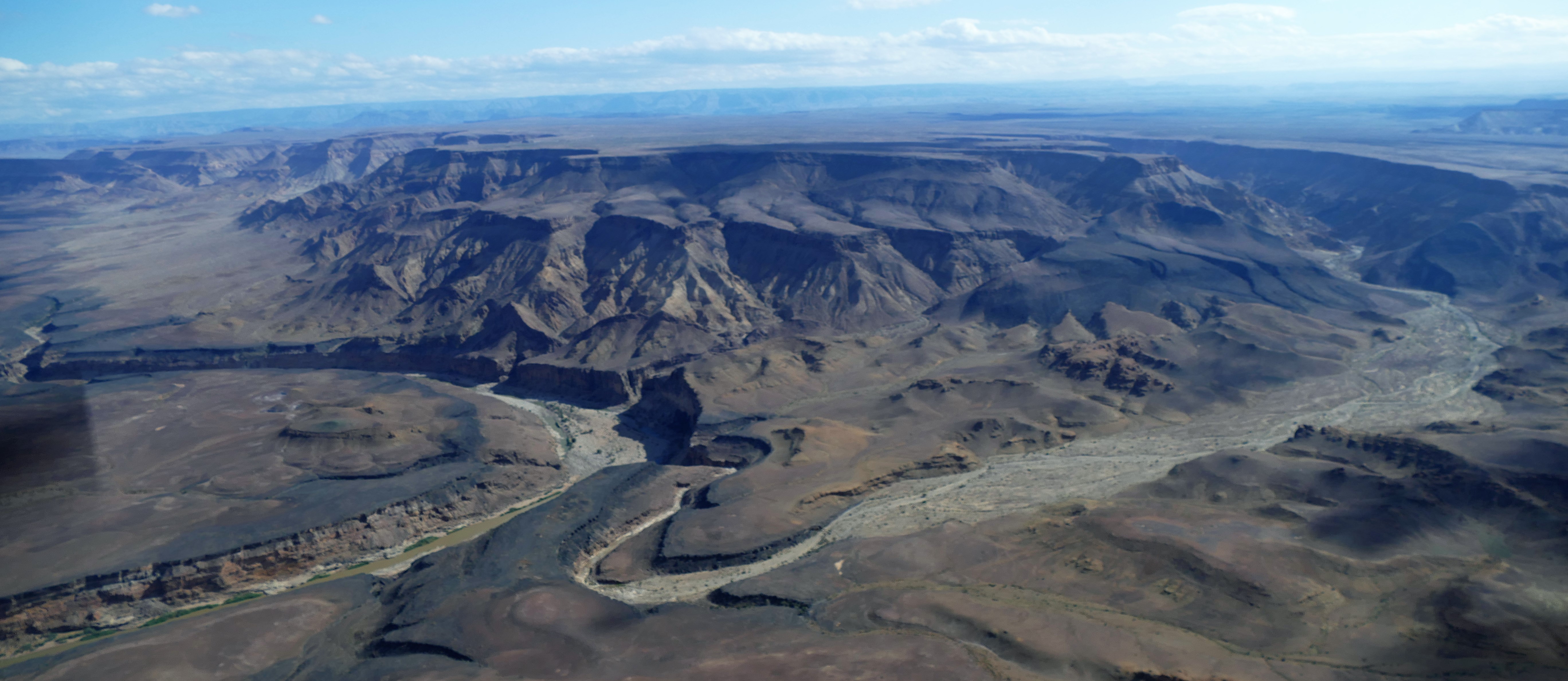
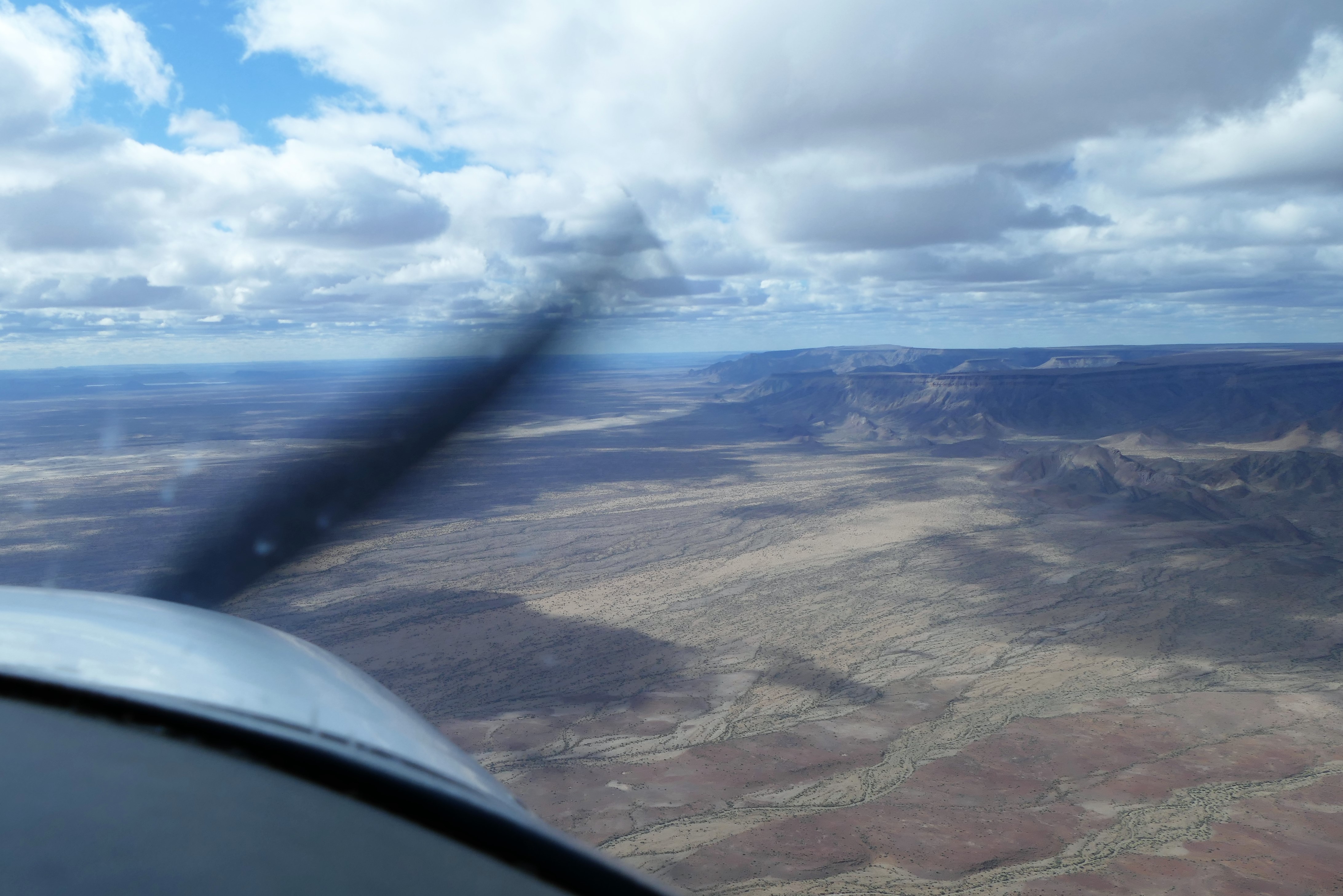
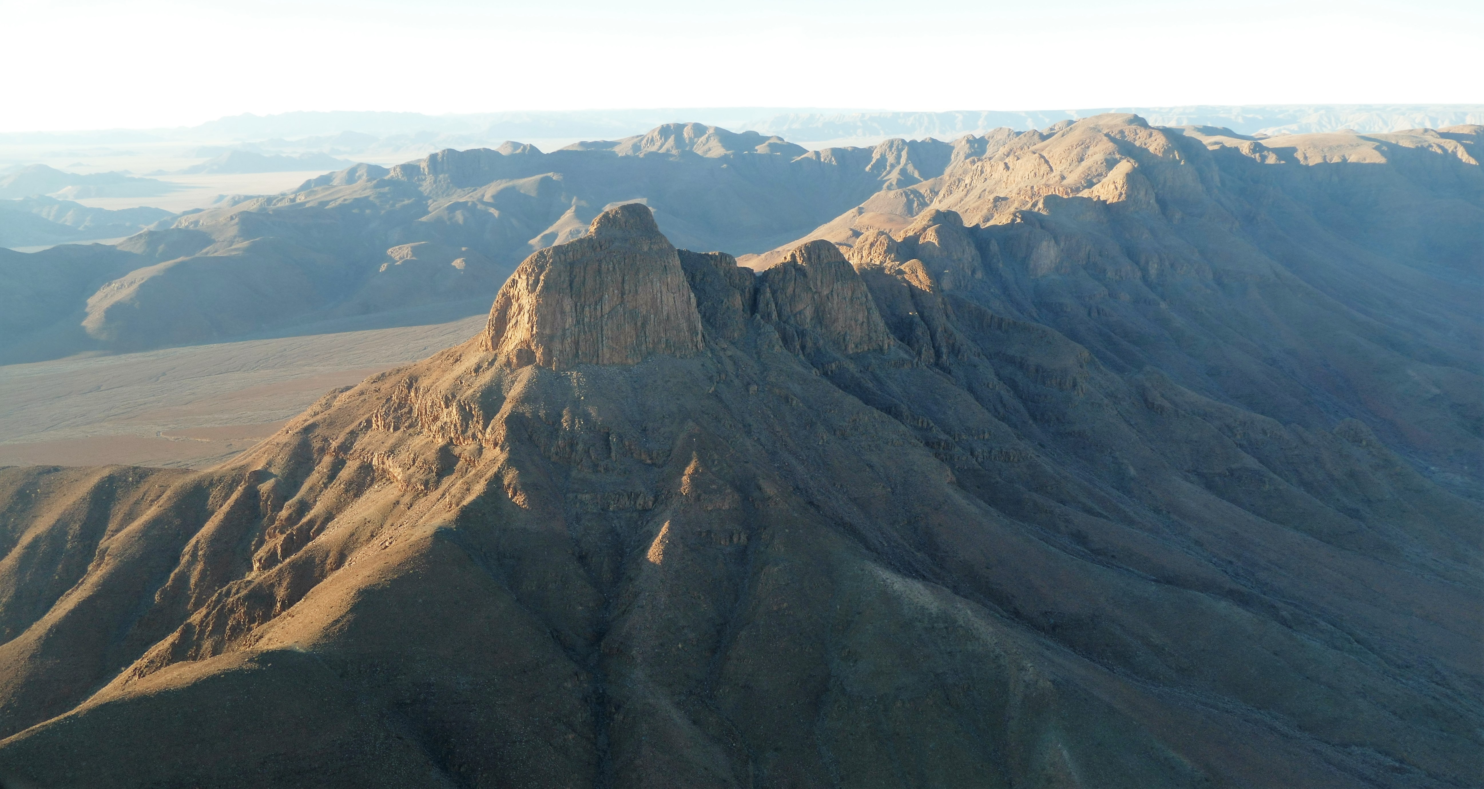
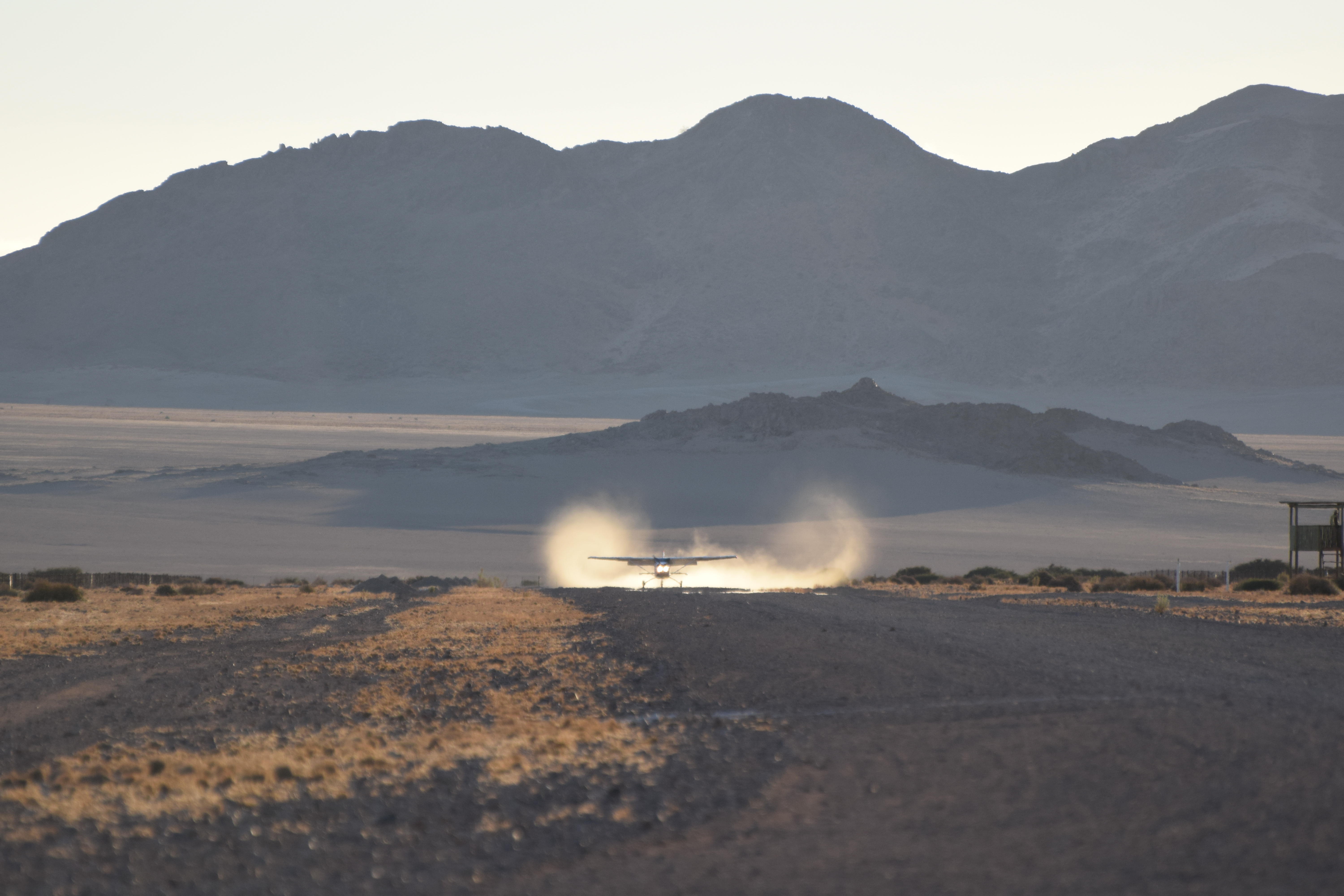
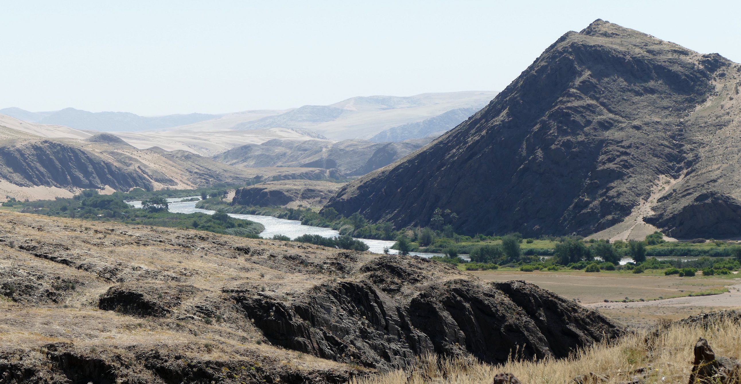
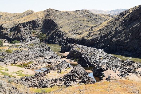
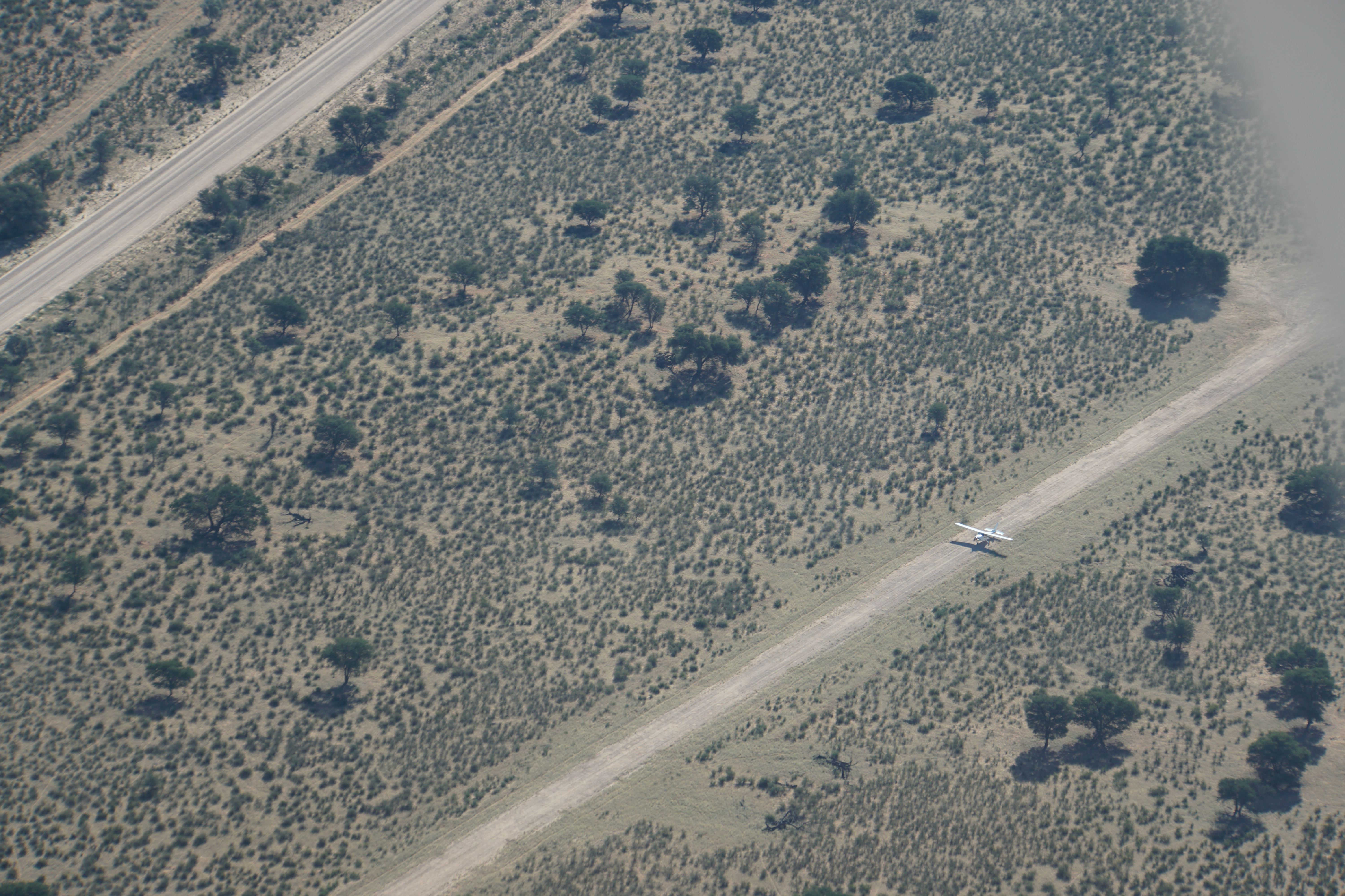
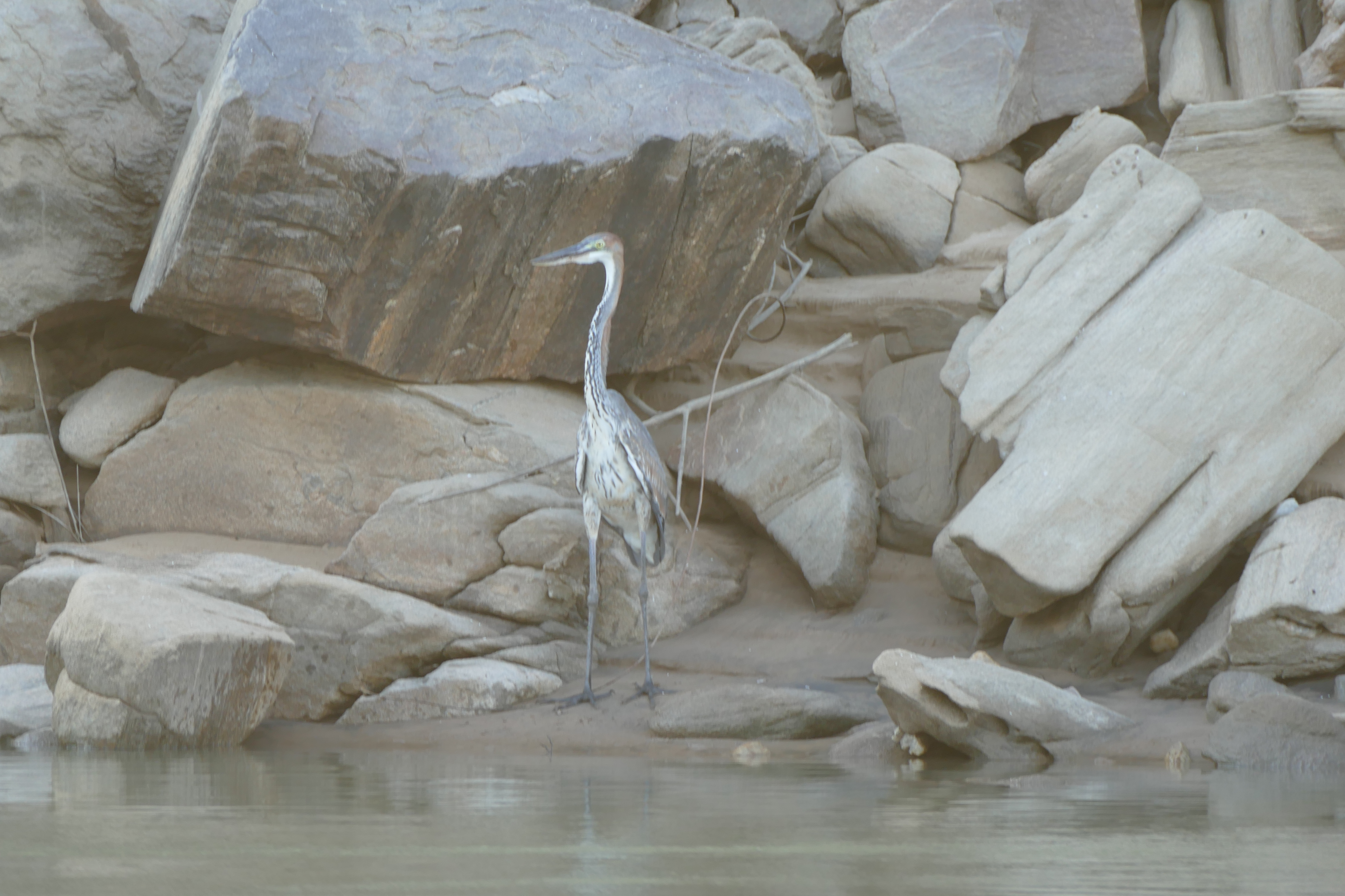
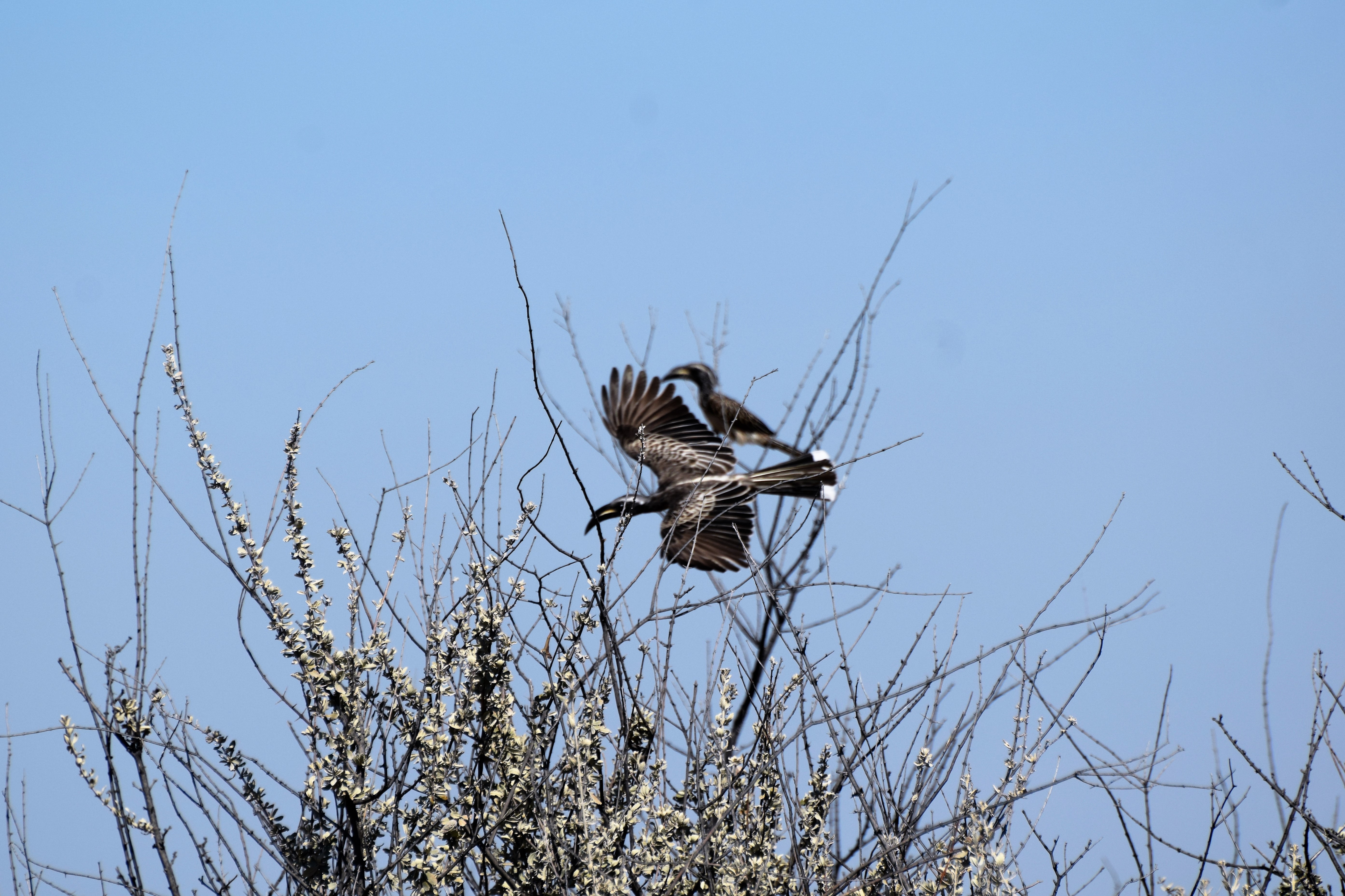
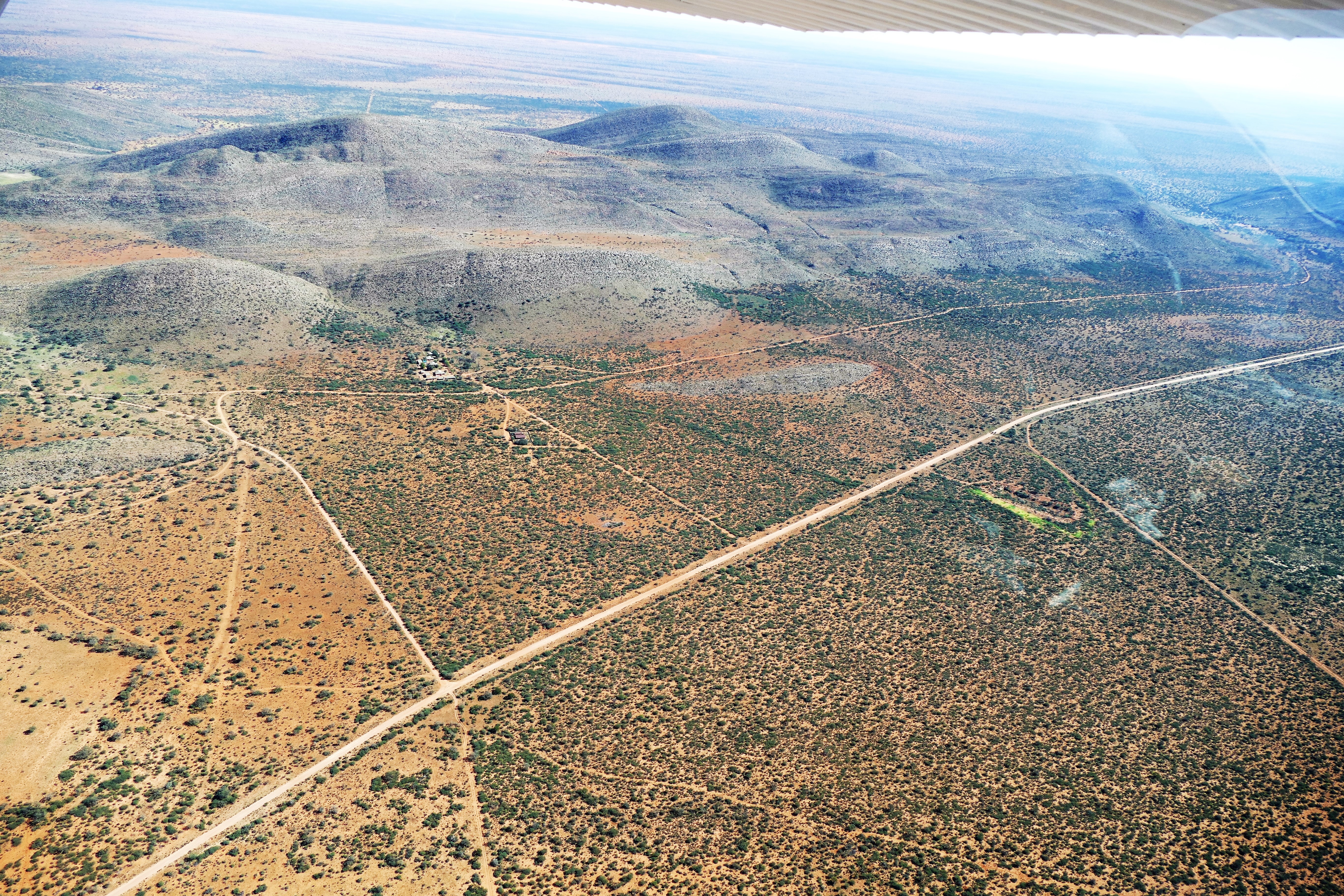
As we flew southward on leg #3, we could see the narrow Fish River growing into a vast series of increasingly larger canyons. It was a marvelous sight. We flew turning with the river until we reached a vast canyon complex. There were thick overhead clouds and thundershowers were about 50 miles to the west, but visibility was excellent. We made our way to Karios Airstrip, which was a single runway of packed sand. Louis landed first and radioed that there were animals crossing the runway. The Davidsons landed next, and when Karie announced short final, I flew to the airstrip, announcing my position several times adding, “looking for animals.” The others were off their radios, so there was no answer. I over flew the airport then set up for landing, flying a steep final so we could make sure the runway was clear, before landing on the packed dirt. Flight time was 1 hour.
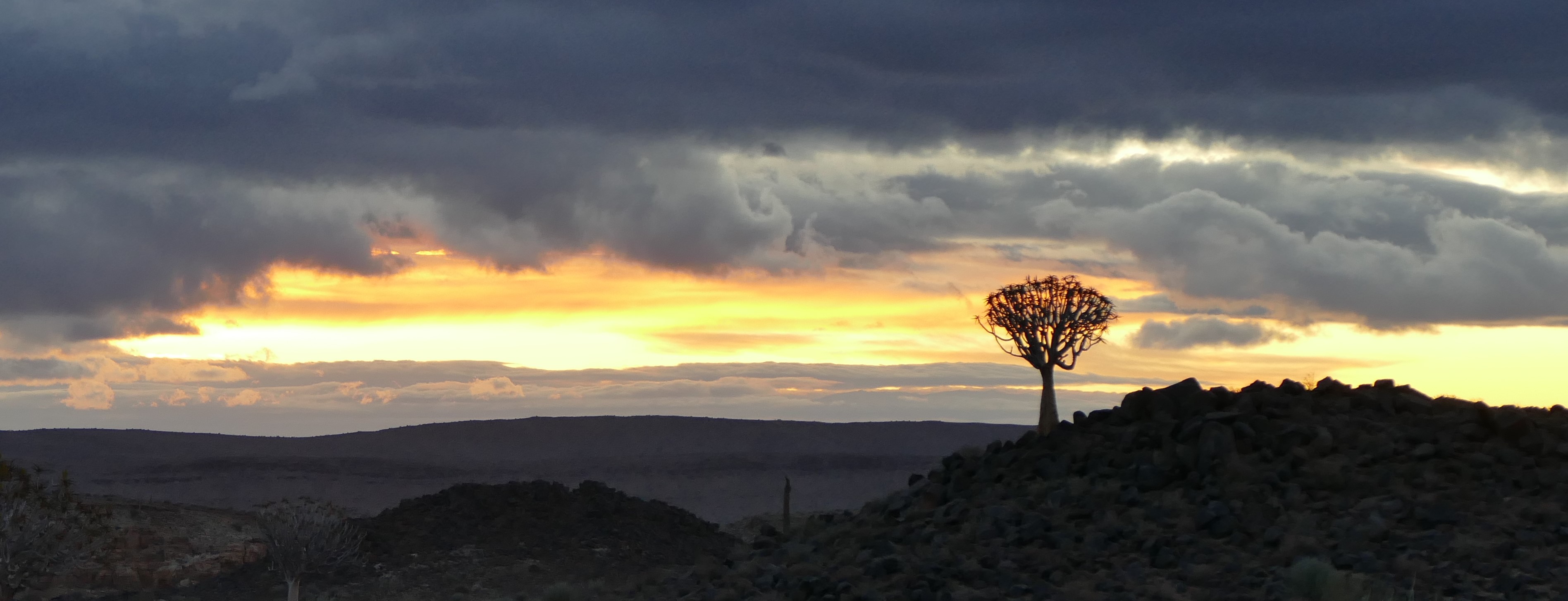
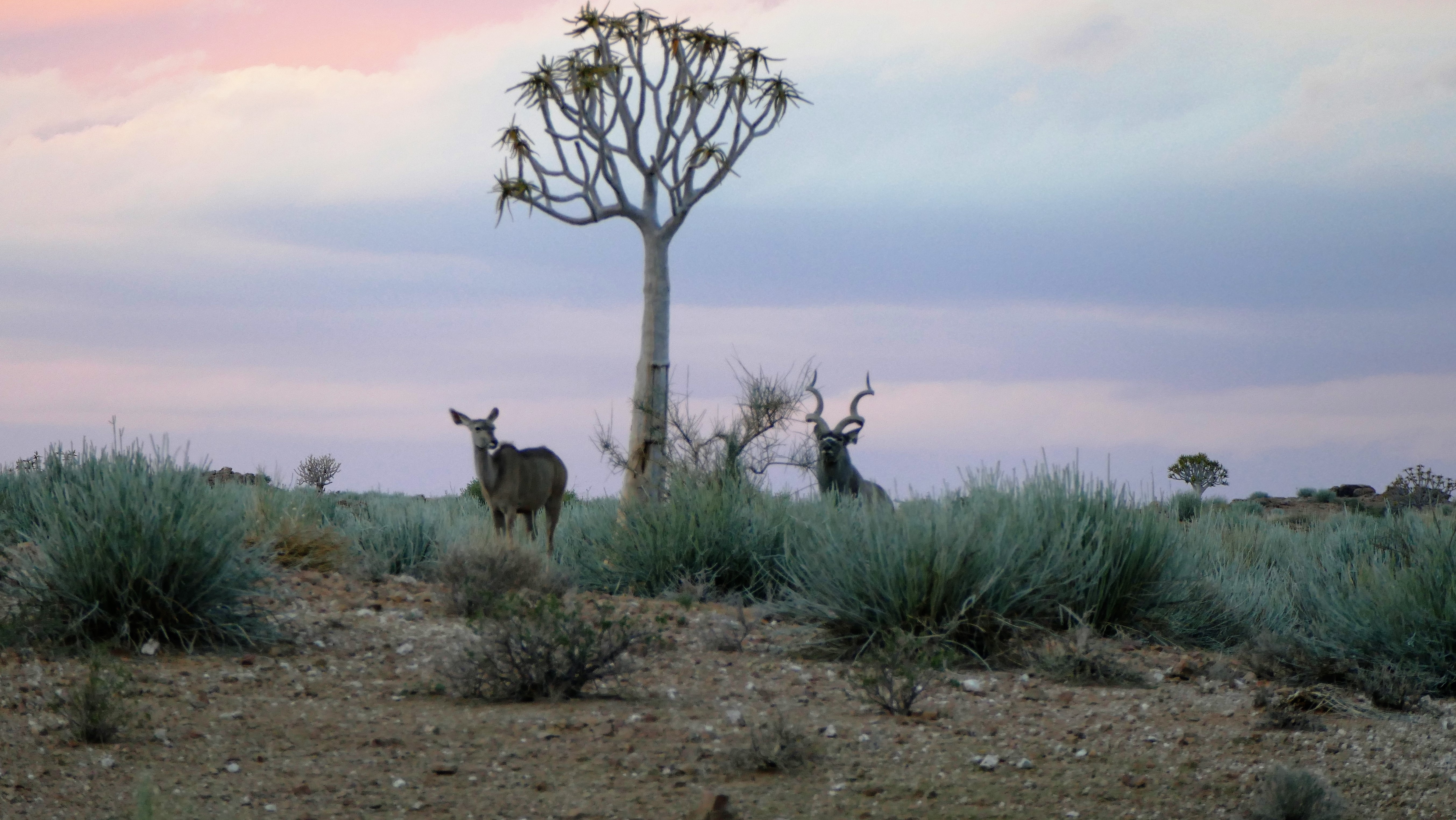
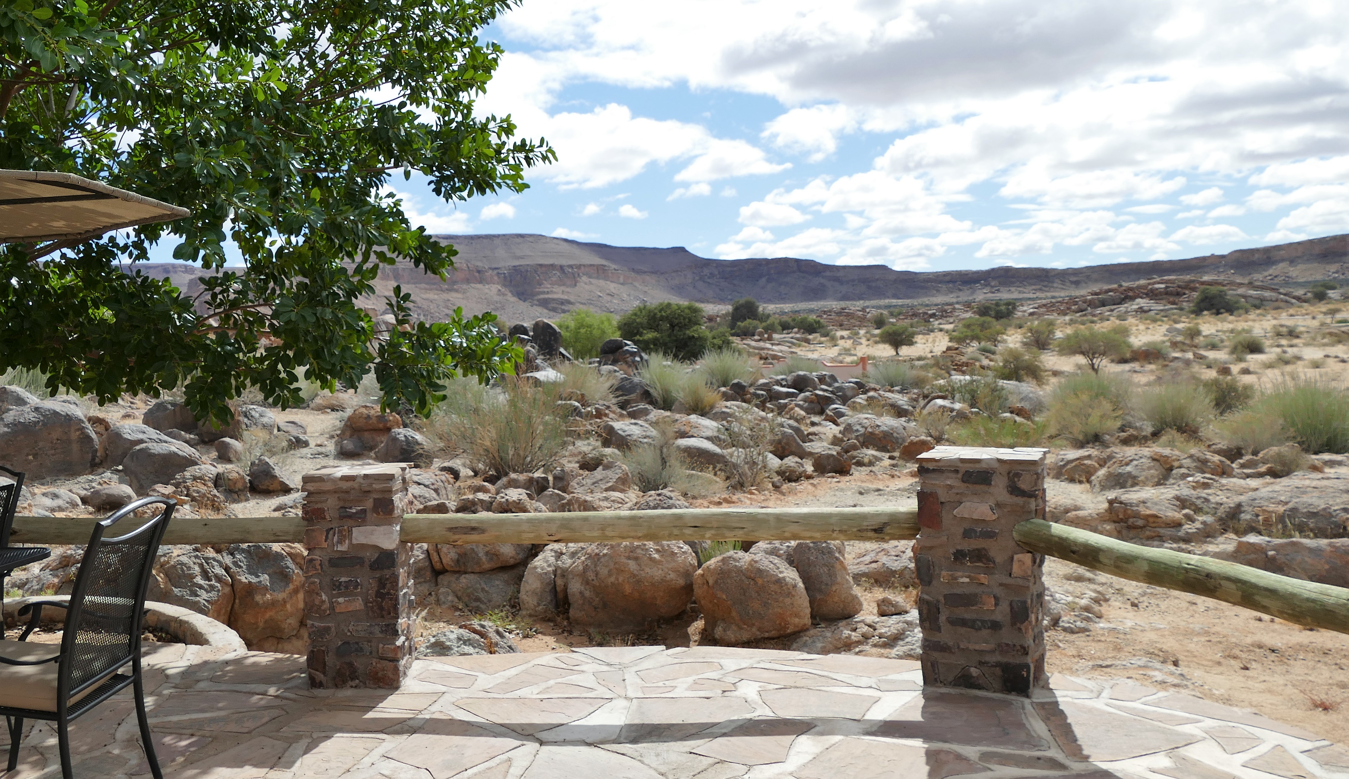
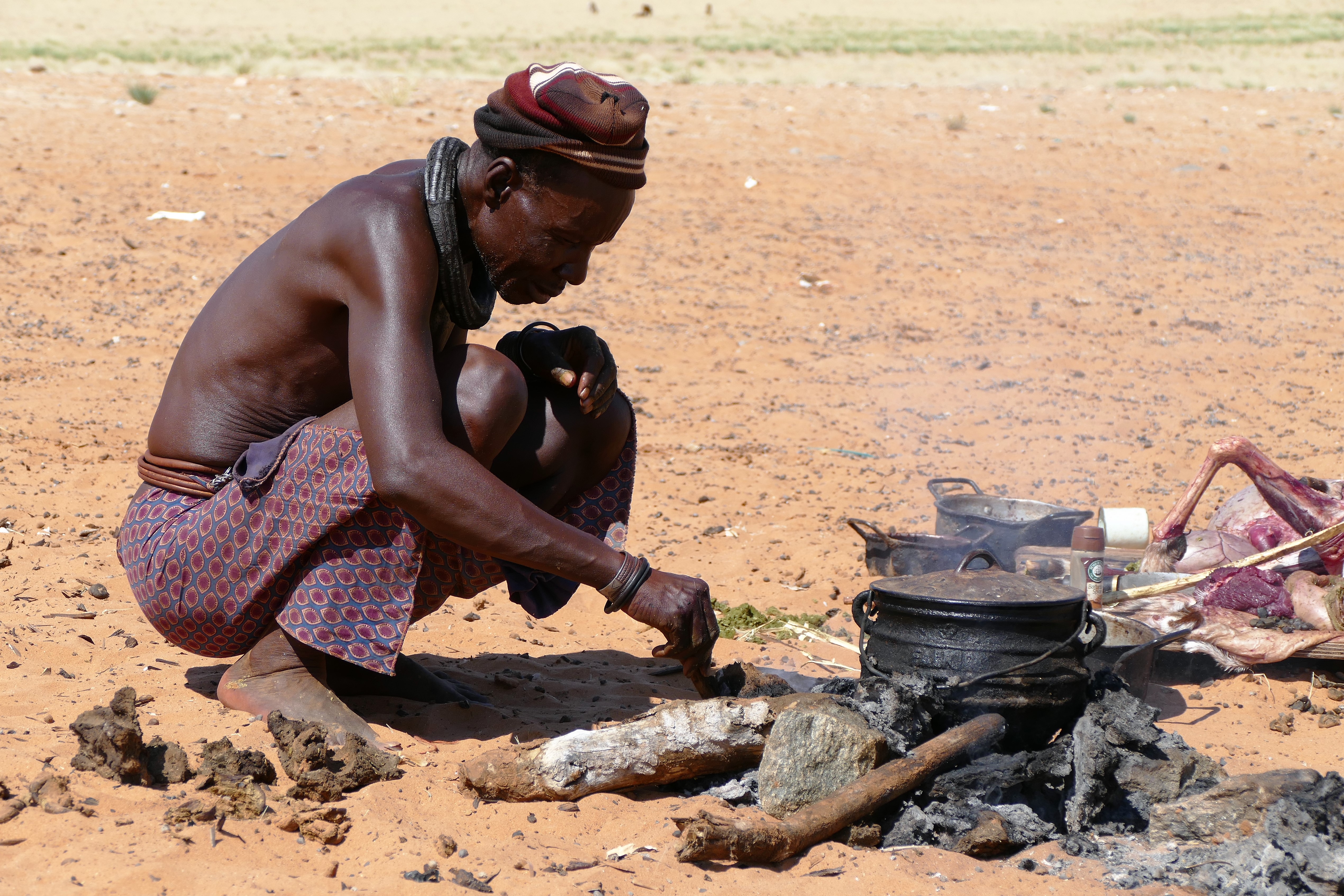
At the Canon Lodge, we were given snacks of grilled ham and cheese sandwiches along with a drink of Gin and tonic. We checked into our little cabins which all had cemented stone walls and thrashed roofs making them look like Hobbit or Smurf cabins. We went on a ride looking for animals, but we only found a Kudu couple and a Martial Eagle. We spent more time photographing the sunset through the clouds, and a tree with the sunset through the clouds. We came to a place with chairs line up to watch the sunset, and where given snacks including biltong made from game, and another round of Gin and tonics. Dinner was a buffet, including springbok, and we discussed the possibility of fog at Luderitz Airport and the difficulty of finding fuel elsewhere within 2 hours of flight. We were tired after the busy day and we all went to our Smurf cabins early.

Leg 4 - Karios (FYKC) to Keetmanshoop (FYKT)

Leg 5 - Keetmanshoop (FYKT) to Gulek (FYGK)
At the breakfast buffet, we talked about Luderitz Airport being fogged in. Our validation was for VFR, and Luderitz Airport did not have an instrument approach. Louis checked the weather repeatedly, and we waited for the clouds to lift at our destination. Two hours later, the weather did not improve for Luderotz. It looked like we would miss out on flying up the Skeleton Coast of Namibia. Nick Hanks called back and said arranged for more fuel to be available at Keetmanshoop. By the time we reached Canon airstrip, the winds had picked up considerably. The 15 to 20 knot winds made pre-flight and loading challenging, and the co-pilot’s door on the Davidsons’ 182 became damaged from a wind gust blowing it open. The back-taxi down the runway was a little harrowing because of the wind, but the takeoff for leg #4 occurred quickly with the headwind. The sky was clear with unlimited visibility. We flew 30 minutes back to Keepmanshoop Airport, which was again uncontrolled. We waited for our fuel guys to arrive, roll 3 barrels of 200 liter avgas to the airplanes, and hand pump the fuel to top off our tanks.
Airborne again for leg #5, we routed north to Gulek airstrip. Skies remained clear with unlimited visibility. For Liz and I, our CRM, Cockpit Crew Management, was coming together nicely. I flew the airplane and checked the Easy Cockpit on the iPad for navigation. Liz fed me information from the Tripkit and monitored the display on the portable GPS. We both listened to radio transmissions and often compared what we heard with each other before responding. At 1 hour before the estimated time of arrival, we would brief the landing information in detail. Liz would recite the runway direction, altitude, length, and composition, the circuit altitude, surrounding obstacles, and the radio frequency. We looked at runway diagrams, determined what we would expect to see on the approach, and planned the descent profile. This planning helped us avoid surprises and last minute searches for information, resulting in relaxed, predictable, and safe landings.
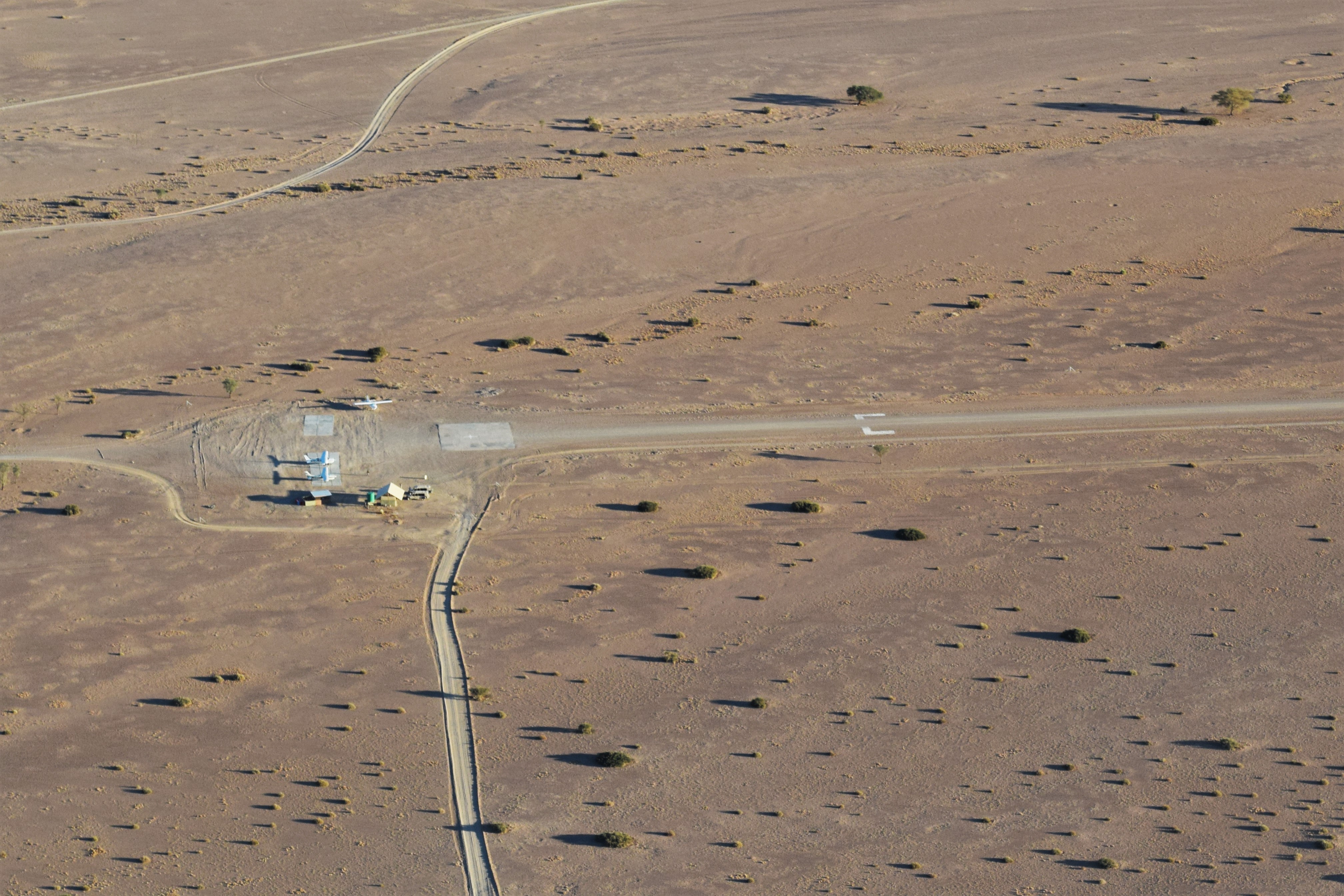
At Gulek, the airstrip blended in with the surrounding terrain, and was difficult to see until we were upon it. We were able to confirm that it was the correct landing strip by seeing the other 2 airplanes in our group on the ground. The standard VFR approach to uncontrolled airports in South Africa and Namibia is to over fly the airport at 2000 feet above ground level to look for traffic in the circuit and check the safety of the runway. Then enter the downwind while descending to the traffic pattern altitude, typically 1000 feet above ground level. While circling the landing strip and while on final, the runway should be checked to make sure it is cleared of animals and other debris. We reported positions in the circuit on 124.8, the Common Traffic Advisory Frequency for all of Namibia. As we landed on the gravel strip, we could see the red sand dunes. Flight time was 1 hour 35 minutes.
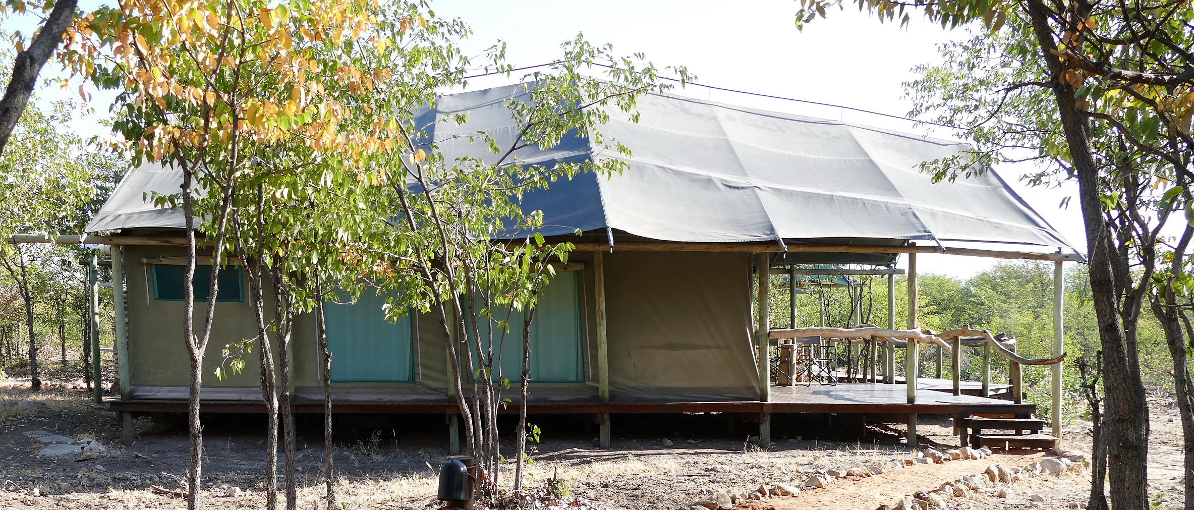
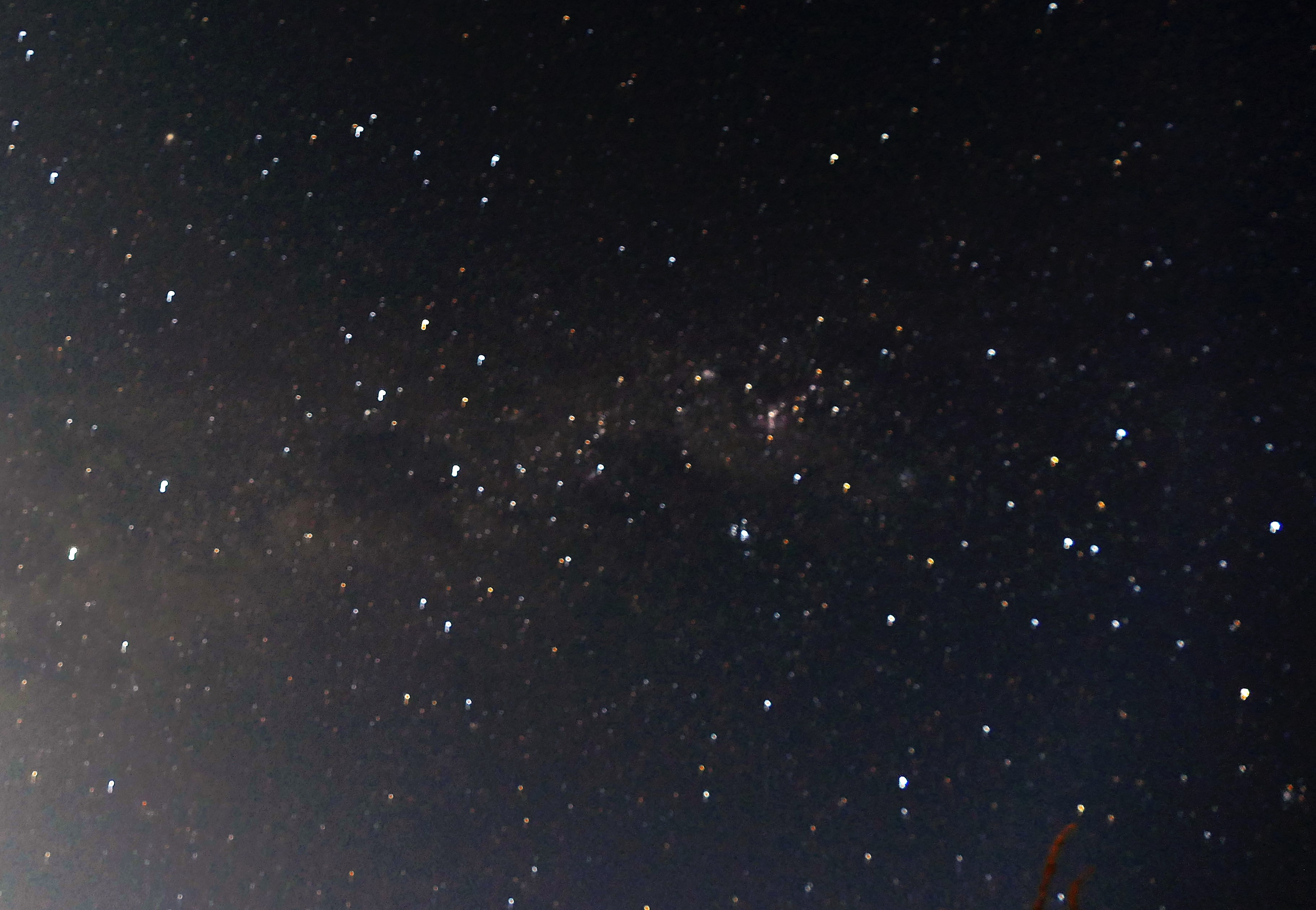
After landing, we were met by our guide, Foster, and were given water bottles which could be refilled. We were driven to the Little Kulala Lodge where we were greeted with a washcloth for our faces, a glass of sherry, and staff singing a happy African song. The Lodge is part of Wilderness Safaris, and accommodates only 22 guests at a time. We checked out our nice "kulala" (the word means 'to sleep'), that had a view to the stunning mountain sunset. The dual walk-in shower was very nice. And surprise, laundry was included. We realized that we over-packing 7 days of clothes, when all we needed was enough for 4 days. Dinner included kudu. Foster told us he would wake us up at 530 am in the morning, so we ate dinner and went to bed early. The sky was very clear showing vast amounts of stars and the Milky Way galaxy.


5/14/16: Sossusvlei
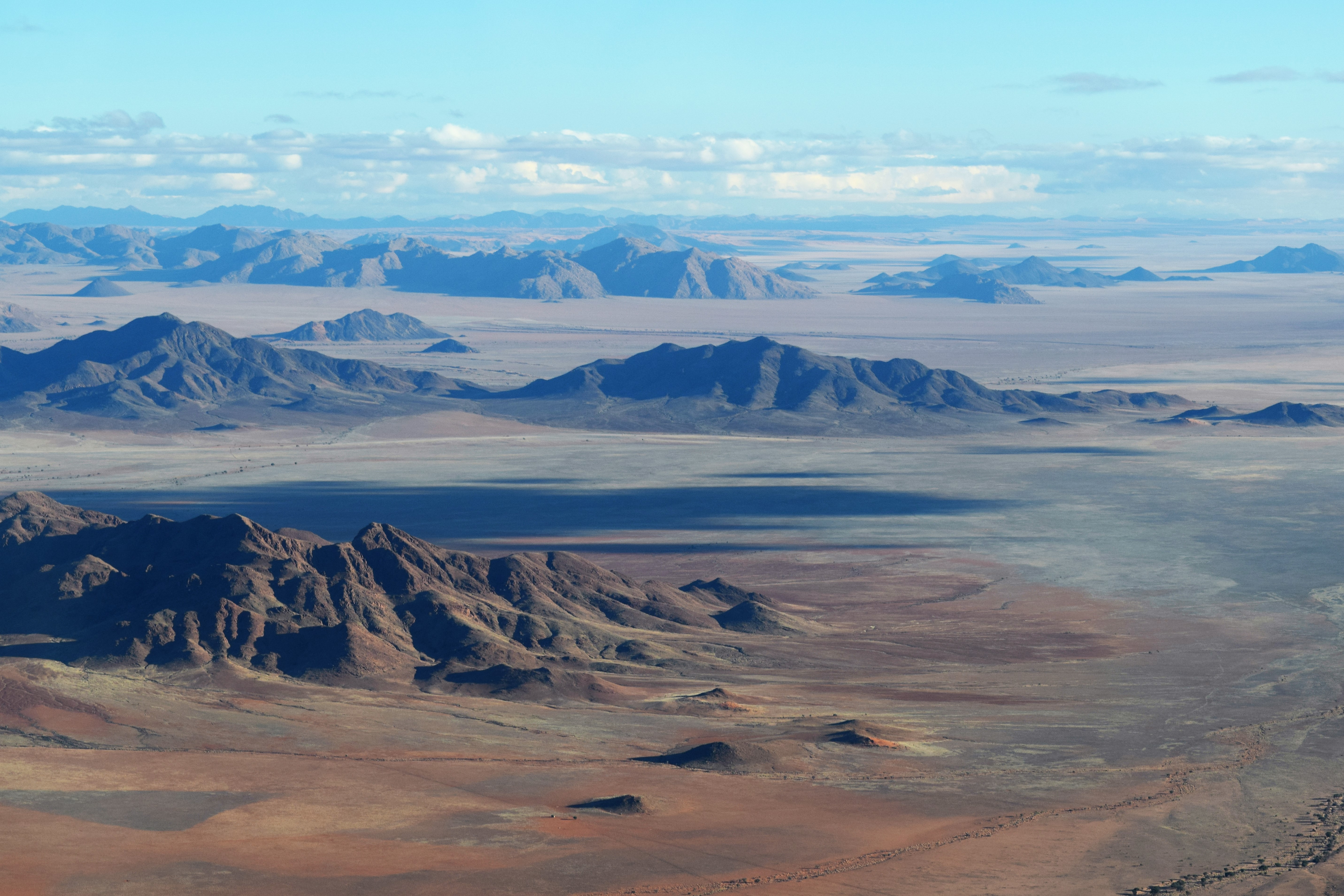
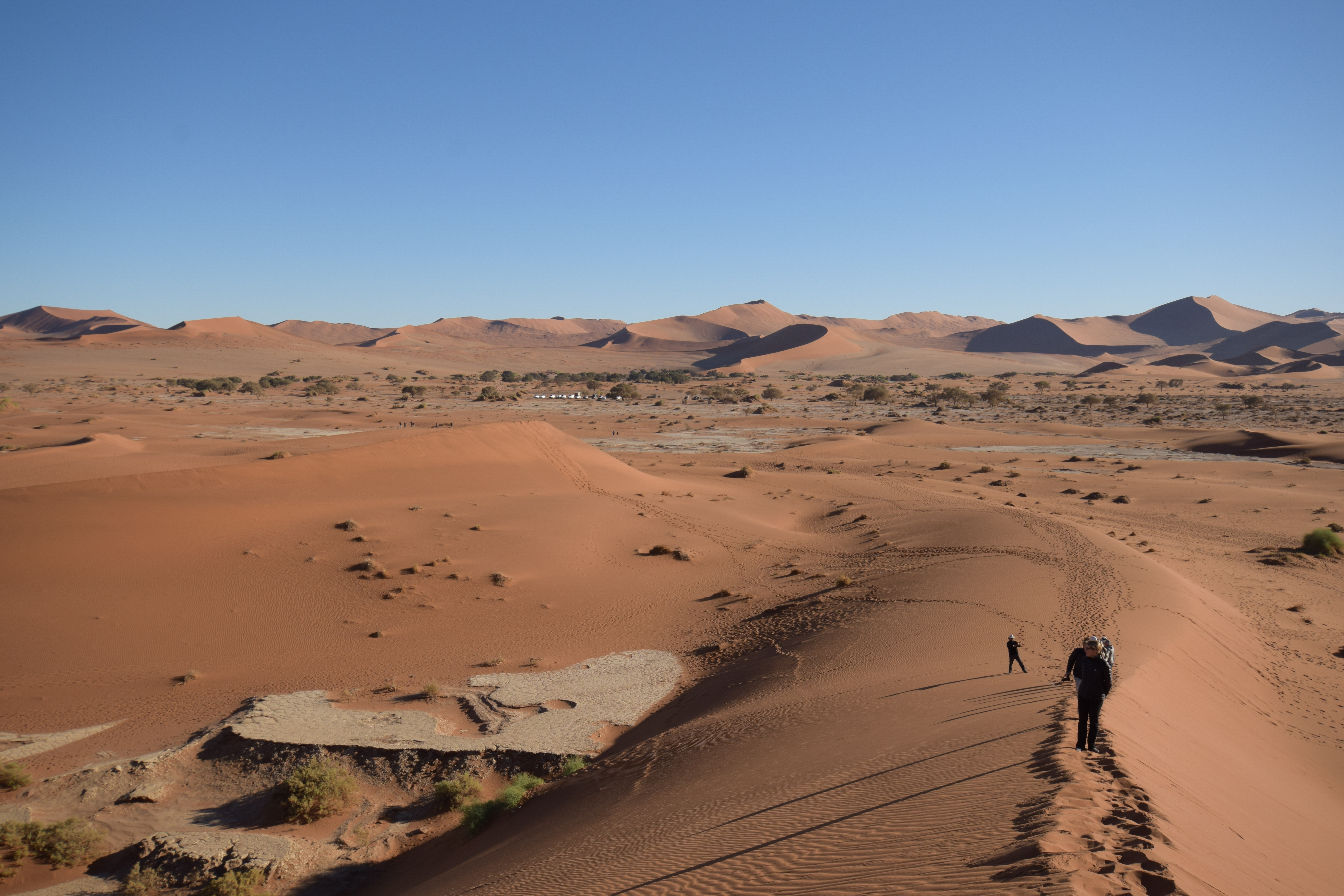
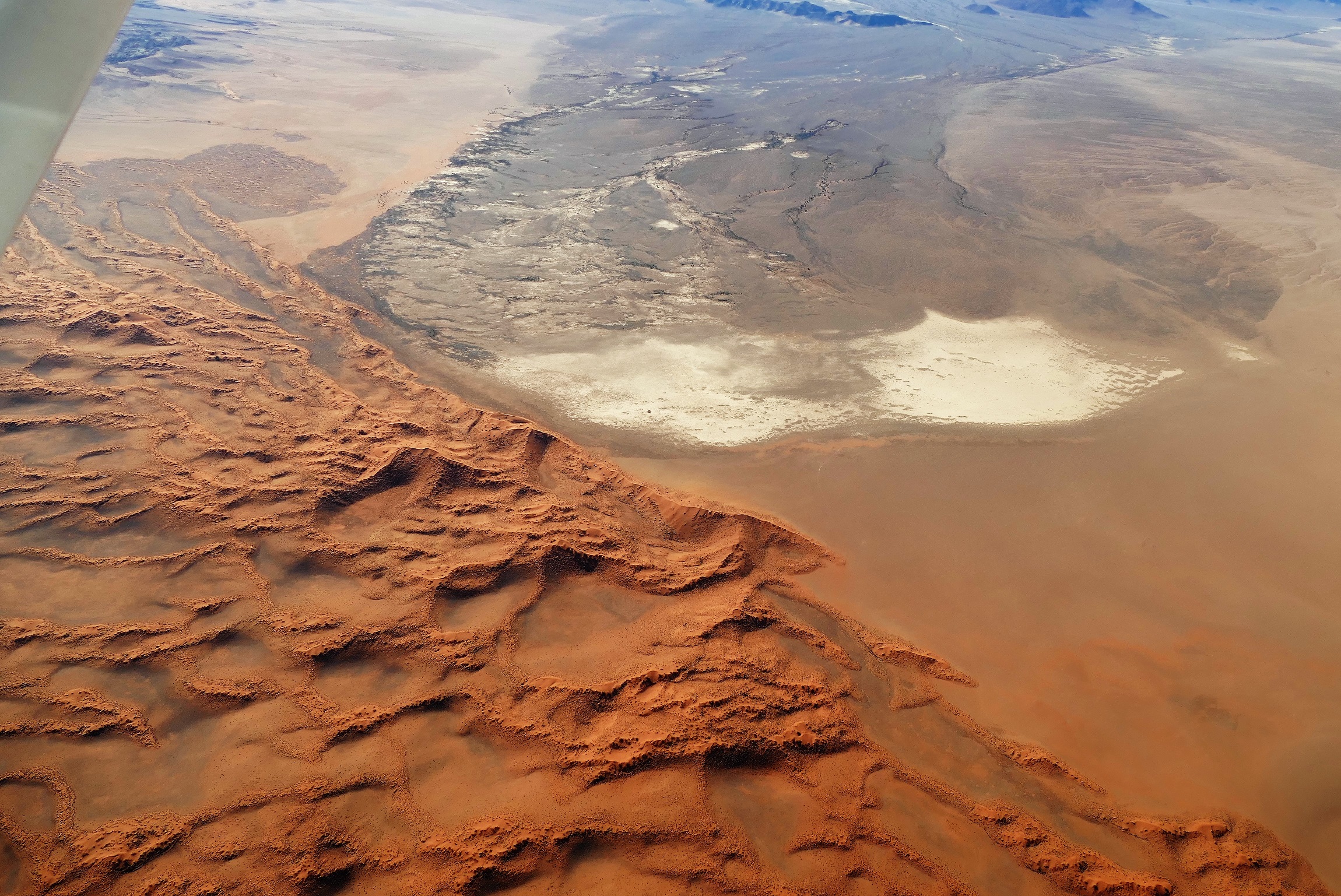
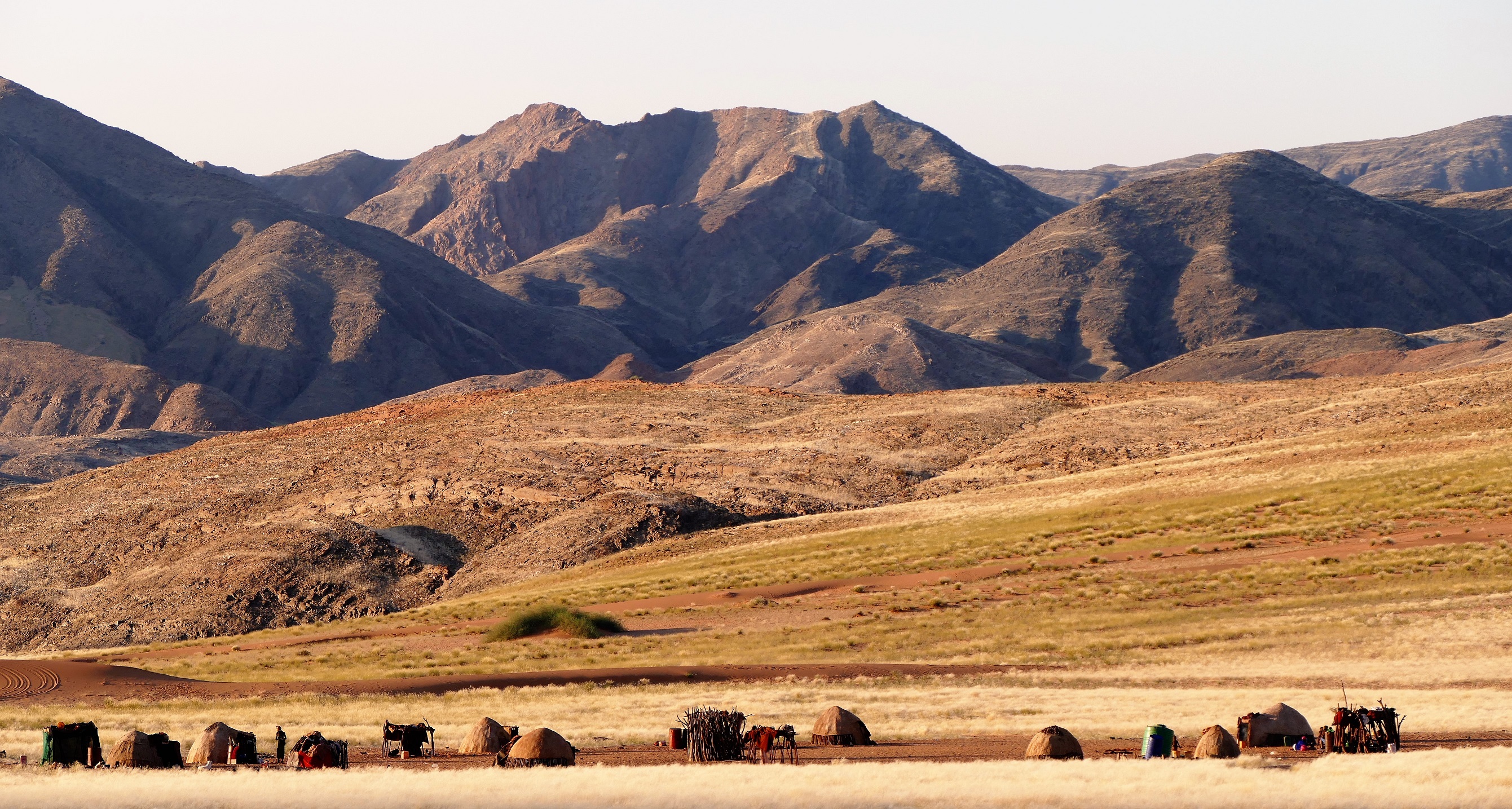
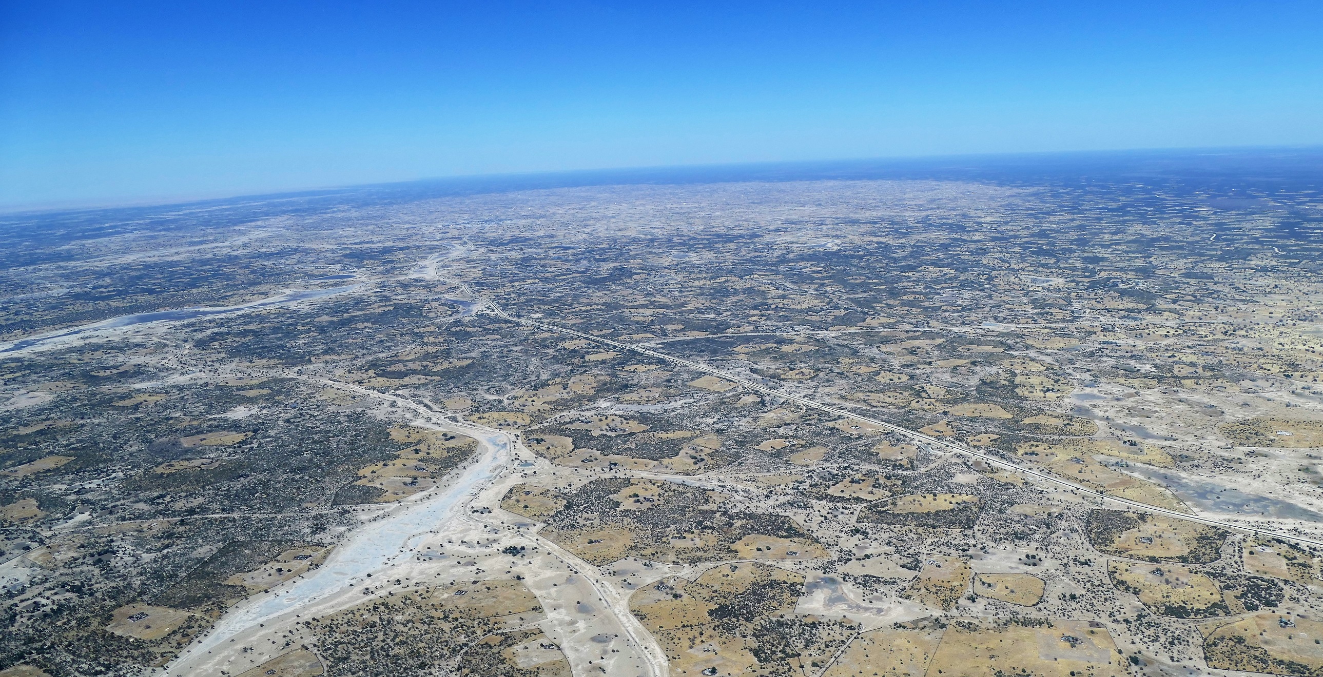
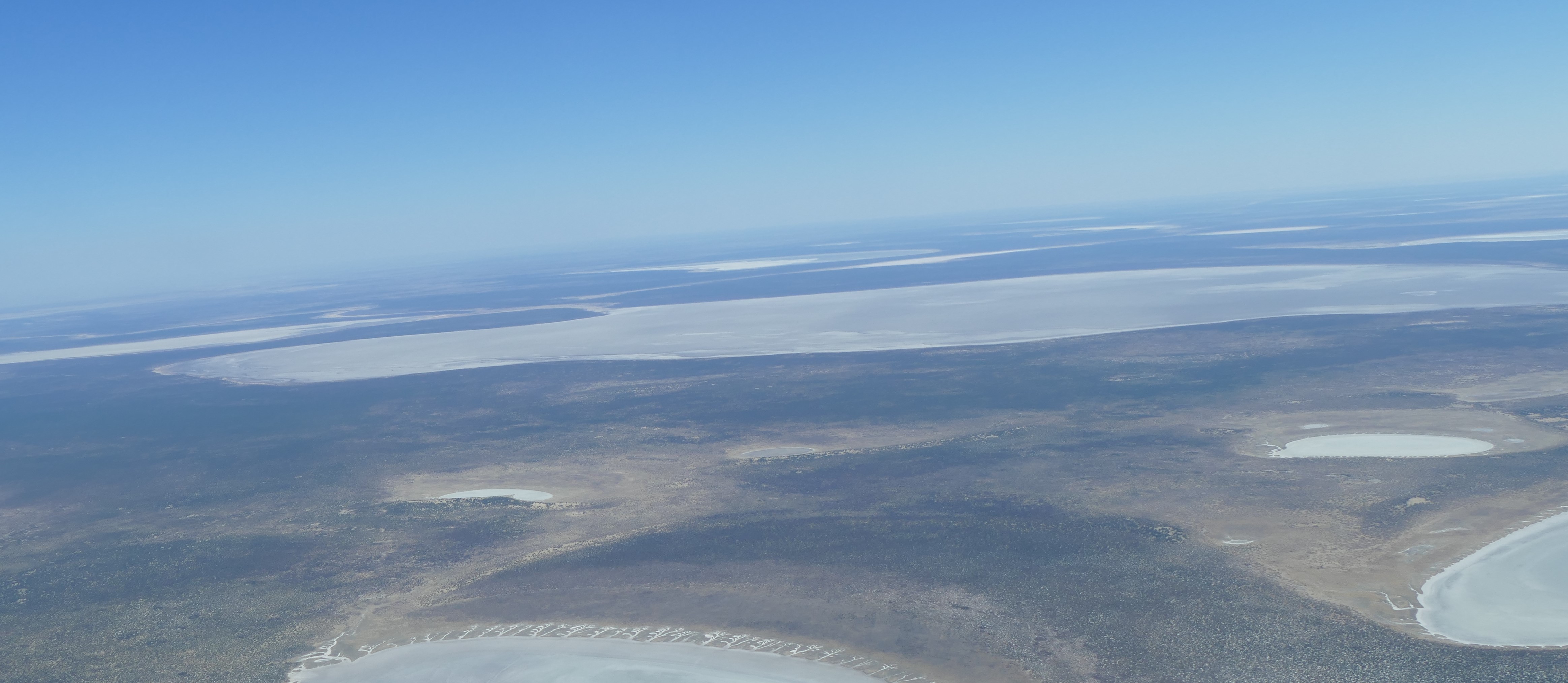
We were up well before dawn. After breakfast, Foster drove us to the orange dunes of Sossusvlei just as the sun began to rise. The Namib sand sea (UNESCO site) name comes from the term wet Namibe and coined by the bushman. Drawing a map of Namibia with markers on the inside of his windshield, Foster explained that the desert of Namibia was the world’s oldest desert. The sands came from the action of the ocean on the mountains of South Africa, moved by ocean currents onto the shores on Namibia, and then carried inland by the winds to be deposited onto the vast area of sand dunes. The iron in the sand gives it the red color. The colors are richer just after sun rise and just before sunset. Foster gave the best geography lesson ever! Towards the south diamonds are mined. Uranium is mined in the central coastal area and towards the west. Only 2.3 million people live in Namibia. The biggest population is located in areas of more rainfall. They have had 3 presidents in the past 26 years. Housing became expensive on the coast due to foreign interests. Some areas get only 300ml of rain per year.
We drove on an
asphalt road into a long clay pan that was flanked the great red dunes. The
dunes were striking in the sunrise, showing the contrast between the sun lit red
sand and the shadows behind each dune’s crest. We passed dune 14, the
“beautiful dune,” where people were already climbing. We continued to the end of
the asphalt road, were we stopped at “the last decent toilet,” although there
was no sink for hand washing. Foster then drove us onto the sand to the dune
called “Big Daddy,” the tallest dune in the area, some 150 meters tall. On the
other side of the sand valley was a dune called Big Mama, due to its “sexy
curves.”
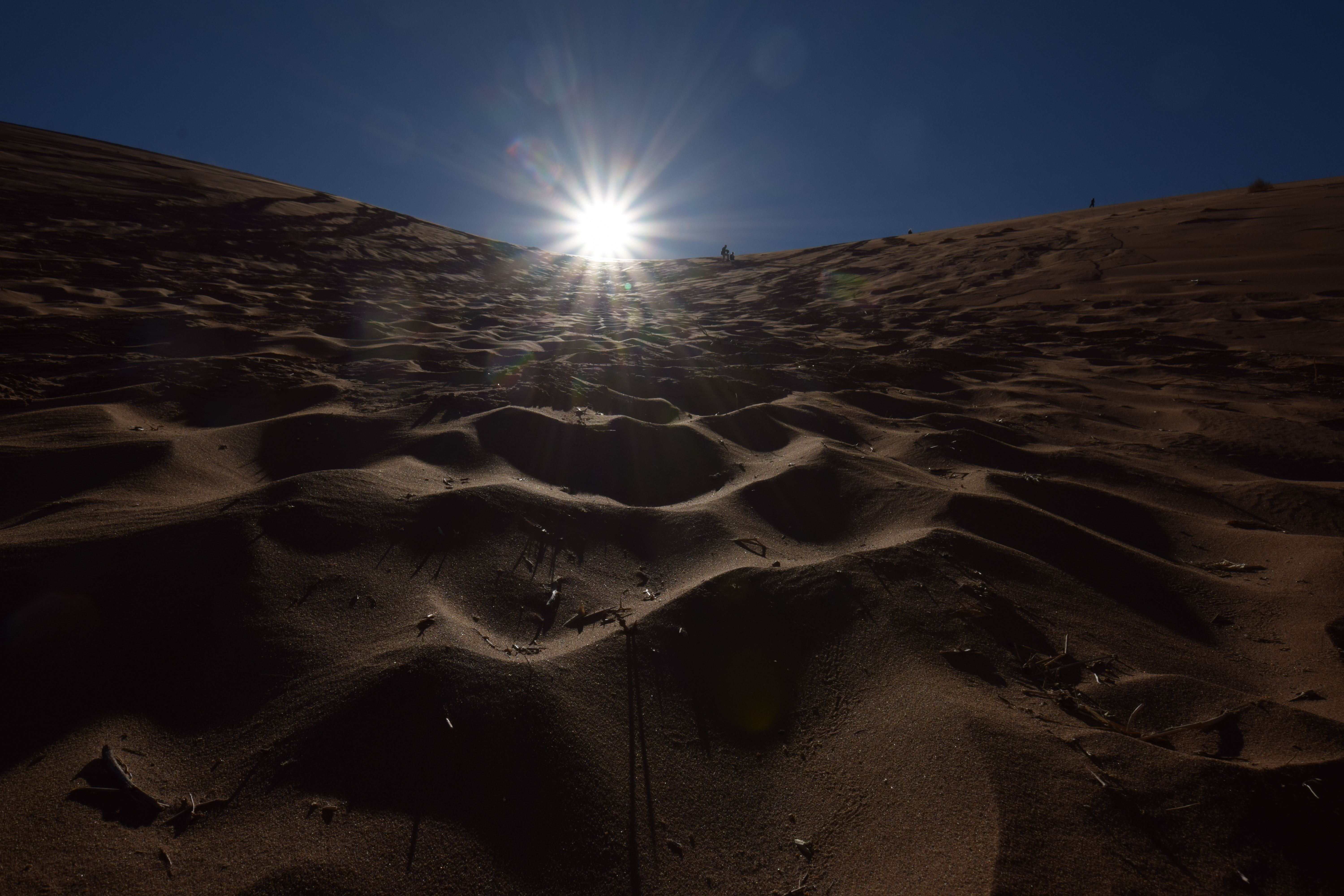
We decided to climb on the top of the arm of Big Daddy which was 70 meters high
above the valley, and 325 meters above sea level. Climbing was on the crest,
where the incline was less steep than the sides of the dune. I found the
climbing to be very difficult. My feet would quickly sink into the sand making
it difficult to keep balance. Putting my feet in the footprint of another was
some help. About half way up, I accepted Foster’s offer to lead me by the hand,
then to use his walking stick as well. I made it to be the flat area about 50
meters up. Liz and the others were able to go on ahead a little higher. Foster's
friend was standing there; ready to go down the side, so I took him up on his
offer to lead me down. Walking down the side caused feet to sink above ankle
deep into the sand on each step. I fell back on my butt a couple of times, and
found that the sand was soft and comfortable to sit in. Liz moonwalked down
further ahead. At the bottom of the hill, was a dry pan, a flat area of white
clay called the Dead Vlei. I found a dead, leafless tree and sat in the shade.
Soon, everyone in our group came down, as by that time, there were many people
coming to climb Big Daddy and the surrounding dunes.
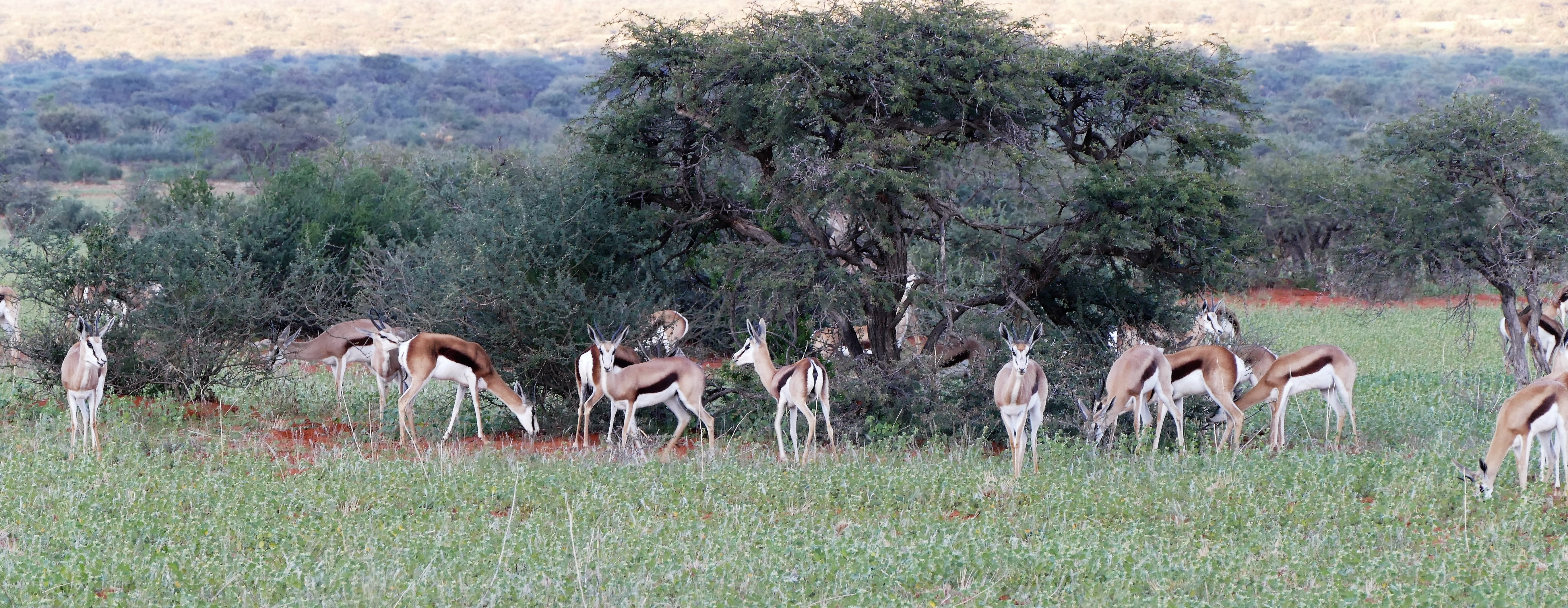
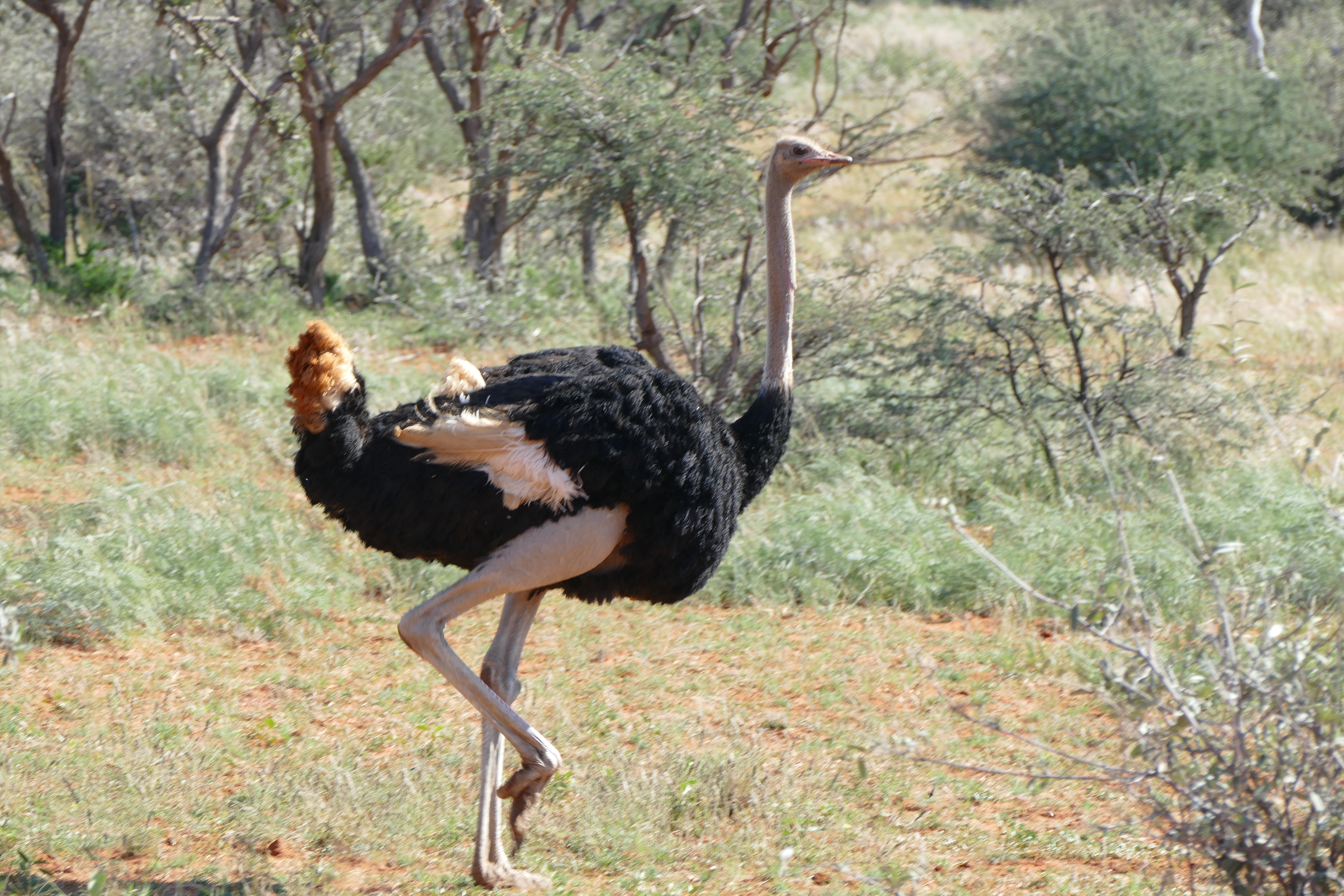
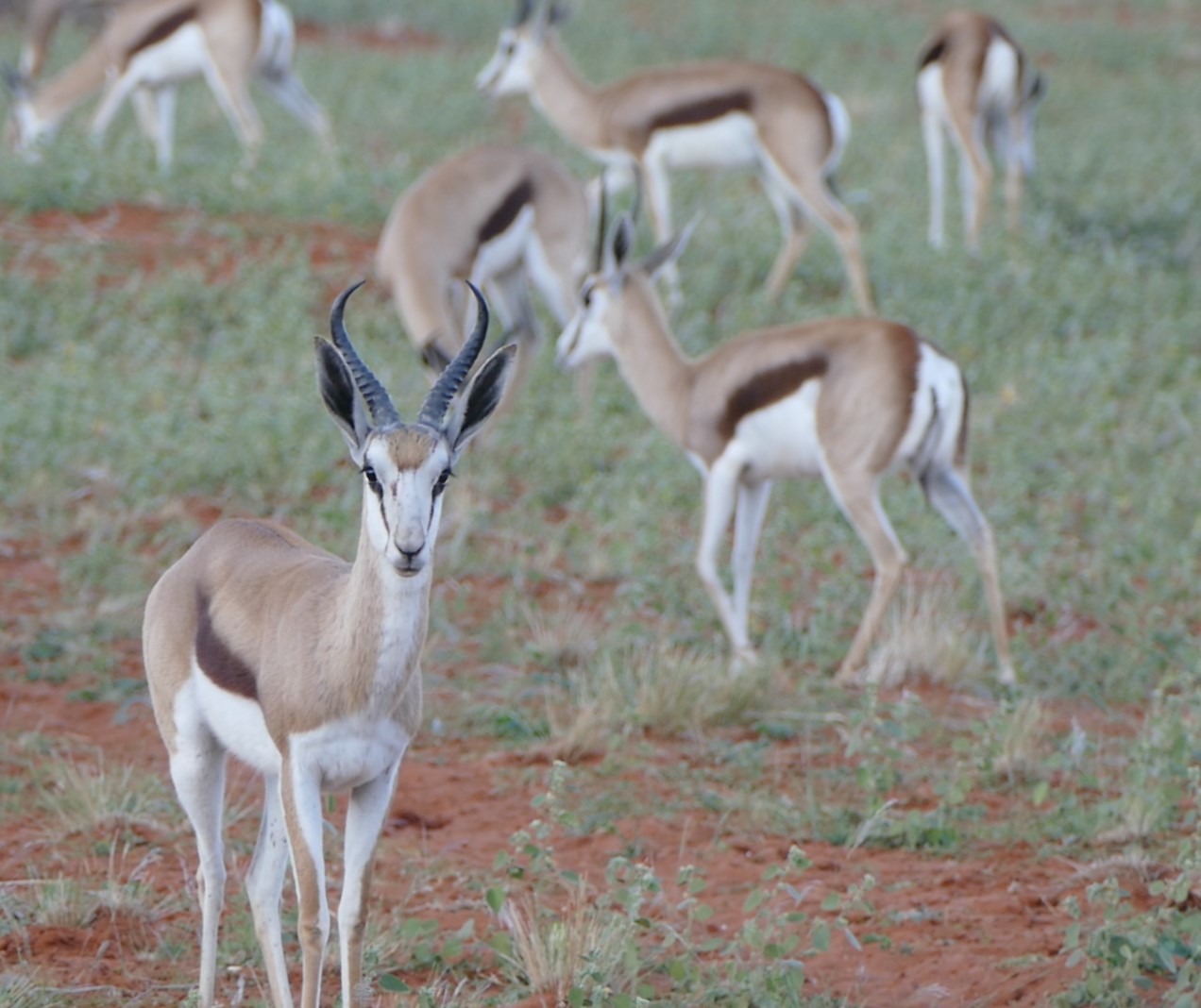
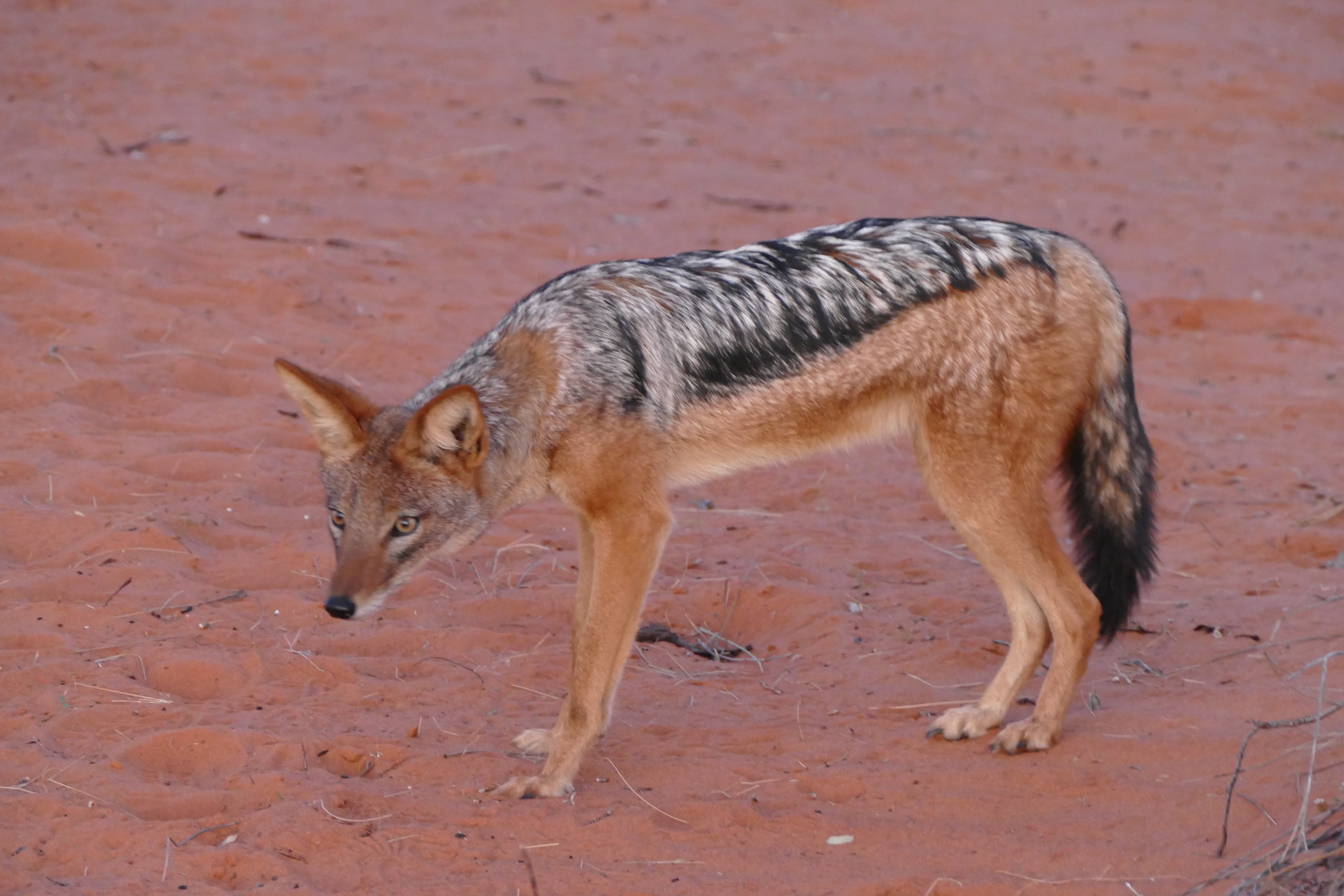
As we drove around, we saw ostrich, springbok, oryx, baboons, jackal, and a white snout lizard. Springbok live around 16 years and if a horn breaks it doesn’t grow back. Springbok move in big groups are jump up and down when warning of water, predators. Jackals mate for life. Before leaving the dunes area, Foster drove us a shady area were we ate snacks and drank Mimosas.
After lunch at
the lodge, we drove by fairy circles on the hillsides. Many theories exist on
why fairy circles exist. One theory is that ancient termites lived in these
areas and grass would not grow in the circular area around the termite mounds.
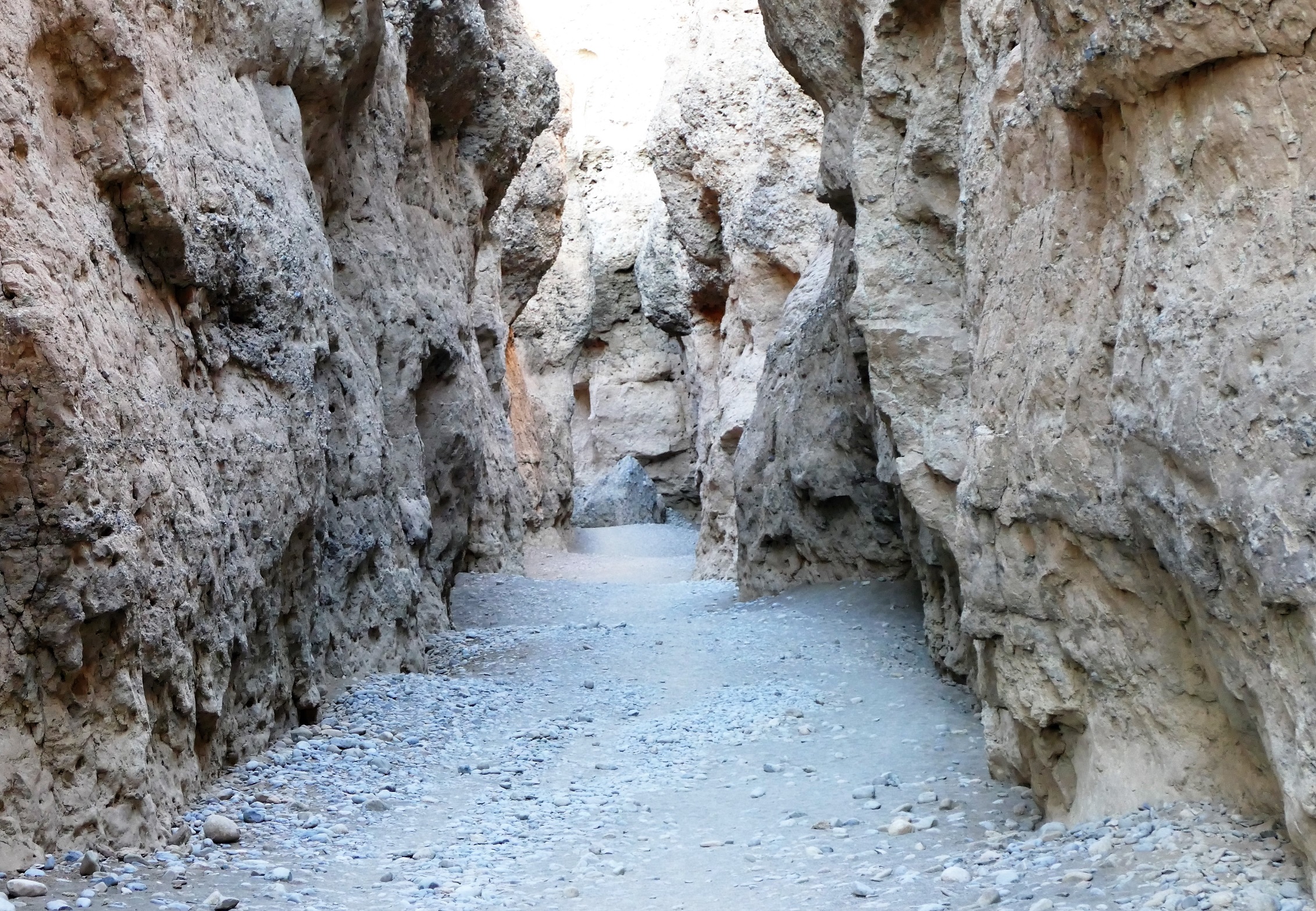
We arrived at Sesriem Canyon, and we walked down a path to the canyon floor.
Foster showed us a shepherd bush, which was considered sacred because it always
supplied leaves for animals to eat in the desert. The shepherd tree communicates
with other trees. If it gets nibbled on, it sends a signal to other ones and
tegu will produce a bitter taste. The acacia trees in the area are hundreds of
years old. Foster said that 80% of the people in Namibia were Christian, either
Catholic or Lutheran. The people in the villages kept to the old religion,
Sacred Fire. They prayed to their ancestors. They sacrificed a lamb over the
sacred bush.
We walked to the end of the canyon, where the water would enter if it were
flowing. We walked back to find some young adult girls and a boy, stuck after
they tried to climb down the wall of the canyon. Foster gave then ideas about
how they could get lower. Louis helped two of the girls jump down by holding his
hands where their breasts could fall into them while the girls grabbed his
shoulders. Louis seemed to get a thrill out of this and woke up the next day
with a back ache.
We were fed dinner on the deck. We learned that the foggy weather was forecast
for the Atlantic coast, so we would not be able to make a fuel stop at
Swarkopmund. Nick Hanks arranged for 3 drums of fuels to be available for us at
Dora Nawas, so we could fly there directly. We could then leave a little later
and sleep a little later, although we lost the opportunity of flying up the
coast.
That night, we decided to try to sleep outside on the roof deck, under the moon
and the stars. It was a beautiful star filled sky, but the wind became intense
and woke us up at 2 am. By that time, the moon had set, and the stars were so
bright that the stars themselves gave some illumination. The Milkry Way Galaxy
was very clear overhead from horizon to horizon, and we could clearly see the
bulge to the center of the galaxy. But the noisy wind forced us inside to go
back asleep
Leg 6 - Gulek (FYGK) to Dura Nowas (FYDN)
Finally, a gas pump at Dura Nowas!
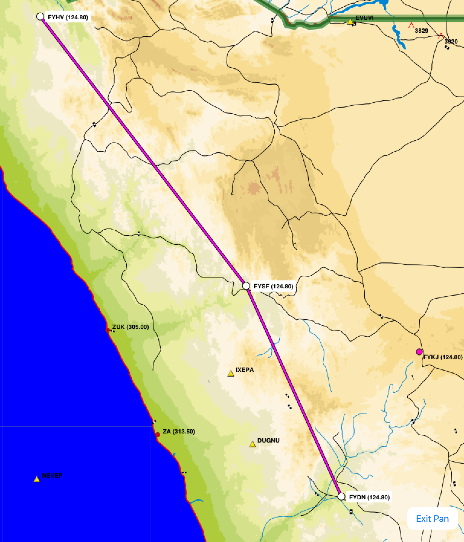
Leg 7 - Dura Nowas (FYDN) to Hartman Val (FYHV)

5/15/16: Over the coastal mountains
After
breakfast, Foster drove us to the airstrip where the wind was 20 knots with
dusty, sandy gusts. We each had been given a
bagged lunch with a yummy sandwich, cookies, a drink, and water. Most of the
lodges gave us lunches to take on our flights, and this made the flying more
enjoyable. Our original plan that day was to refuel at Swakopmund Airport with
sand/gravel runways, a part-time control tower, and avgas fuel pumps. Much of
the Atlantic coast of Namibia, including Swakopmund, was still fogged in. From
Lanseria, Nick Hanks check our second stop, Dora Nowas, and found they had
plenty of avgas. This changed the fuel situation because we now had a 2.5 hour
flight ahead. Although there were plenty of bush strips, since most lodges have
one, there were very few places had had avgas. Availability of avgas had to be
arranged well in advance. In flight, a Cessna 182 burns 13 gallons or 50 liters
per hour. I had 180 liters in the tanks, enough for the flight to Dora Nowas 1
hour reserve.
Louis
gave directions about holding the aircraft nose down during back taxi in the
wind. Takeoff for leg #6 was surprisingly uneventful and we headed for Dora
Nowas. Louis later told me that it looked like I did a short field takeoff,
although I actually did a gusty wind takeoff where I delayed rotation until
enough speed built up to overcome gusts and the airplane refused to stay on the
ground. Flight conditions were clear and visibility good, except as we passed
abeam of Walvis Bay, we could see the fog and low clouds hugging the coast for
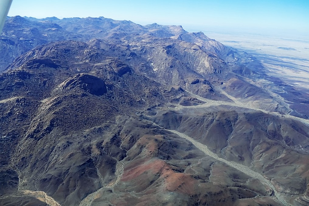
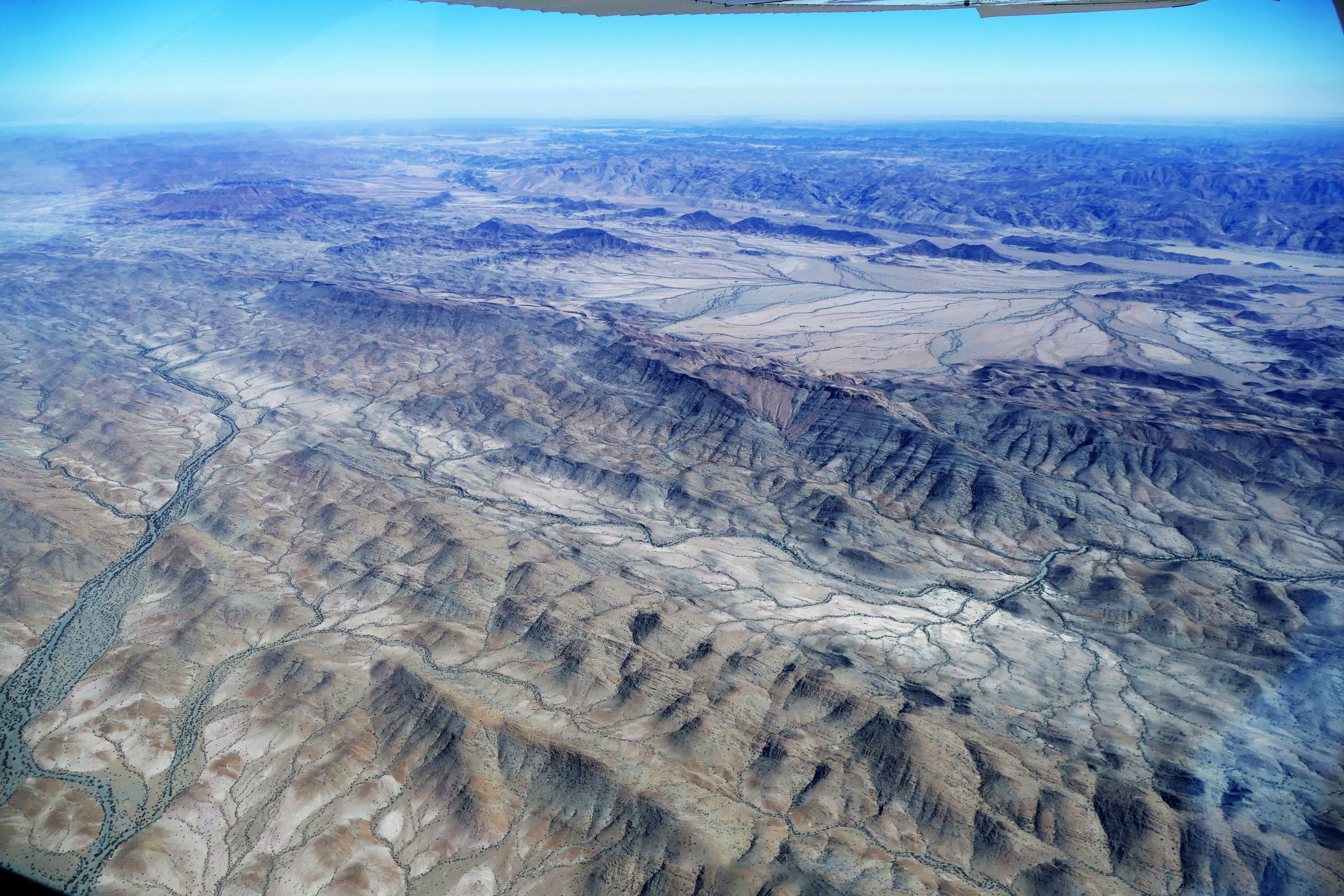
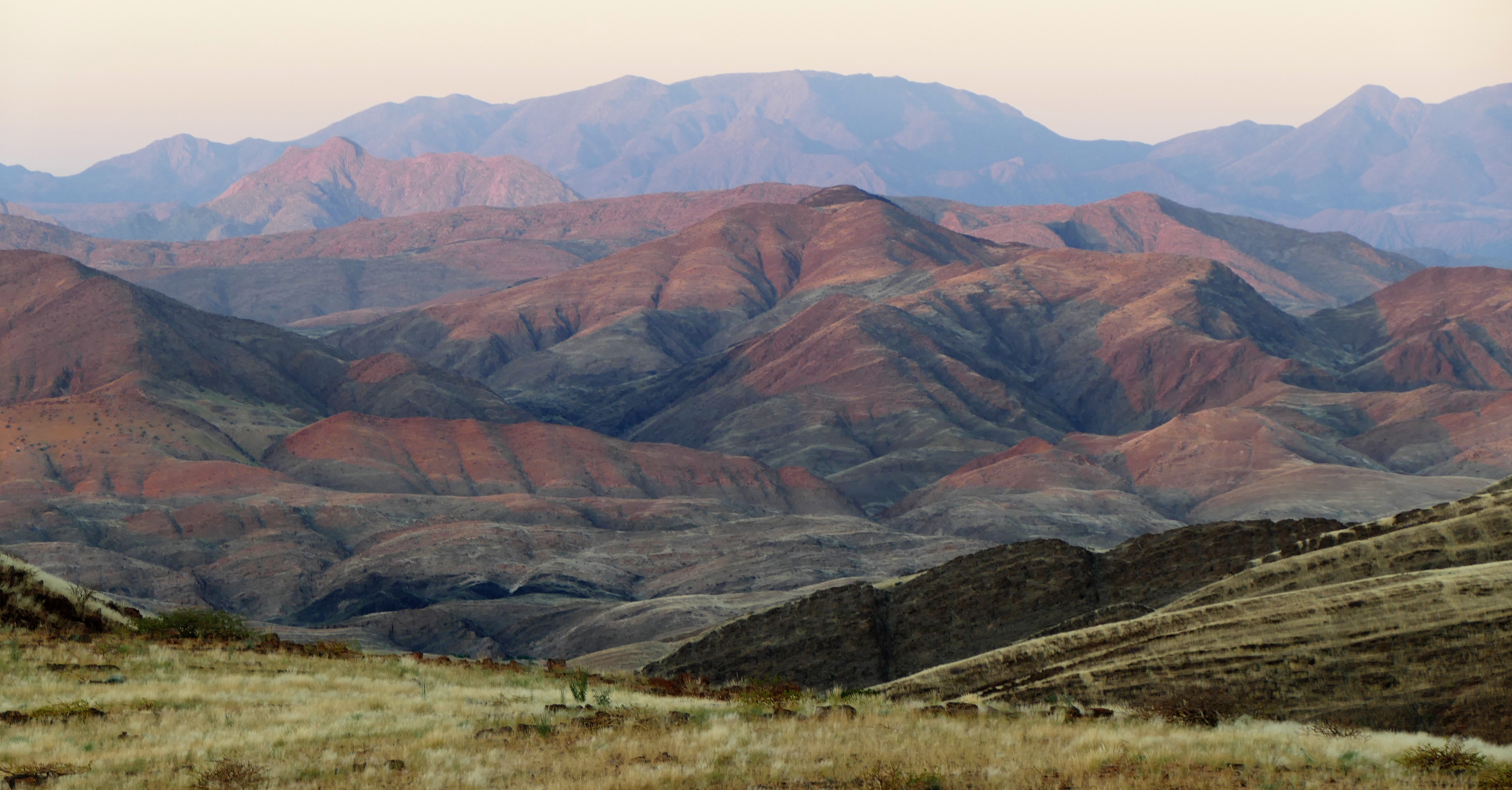
several miles inland. Our course to Dora Nowas would take us over Brandberg
Mountain, a problem because it was higher than out planned flying altitude of
flight level 085. We flew past the western slope of the mountain, missing a view
of an old airplane wreck on the eastern side. Flight time was 2 hours, 35
minutes.
We
landed at Dora Nowas, which is a gravel strip used as a fuel stop by bush pilots
in northern Namibia. We found out that Wilderness Safari supplies fuel to the
airport for their Cessna Caravans. There was a working fuel pump with sufficient
avgas available to put our fuel worries to rest. With full tanks, we
"saddle up" in the cockpit and take off on leg #7, into
good weather with some scattered clouds above our flight level. This was a fuel
critical leg with best economy leaning because there was 4 hours of flying until
the next available fuel. We flew over rocky, mountainous, desolate terrain which
showed me just how dangerous this flying really was. An engine failure would be
fatal because there would be no suitable place to safely land. At this point,
with Liz at the controls, I accidentally knocked open the pilot’s window twice
while taking photos of the terrain. Liz became upset, worried about safety, and
wanted to return the controls. This led to a little cockpit argument, but we
calmed and resume our duties, with myself as the pilot in command and Liz as the
crew.
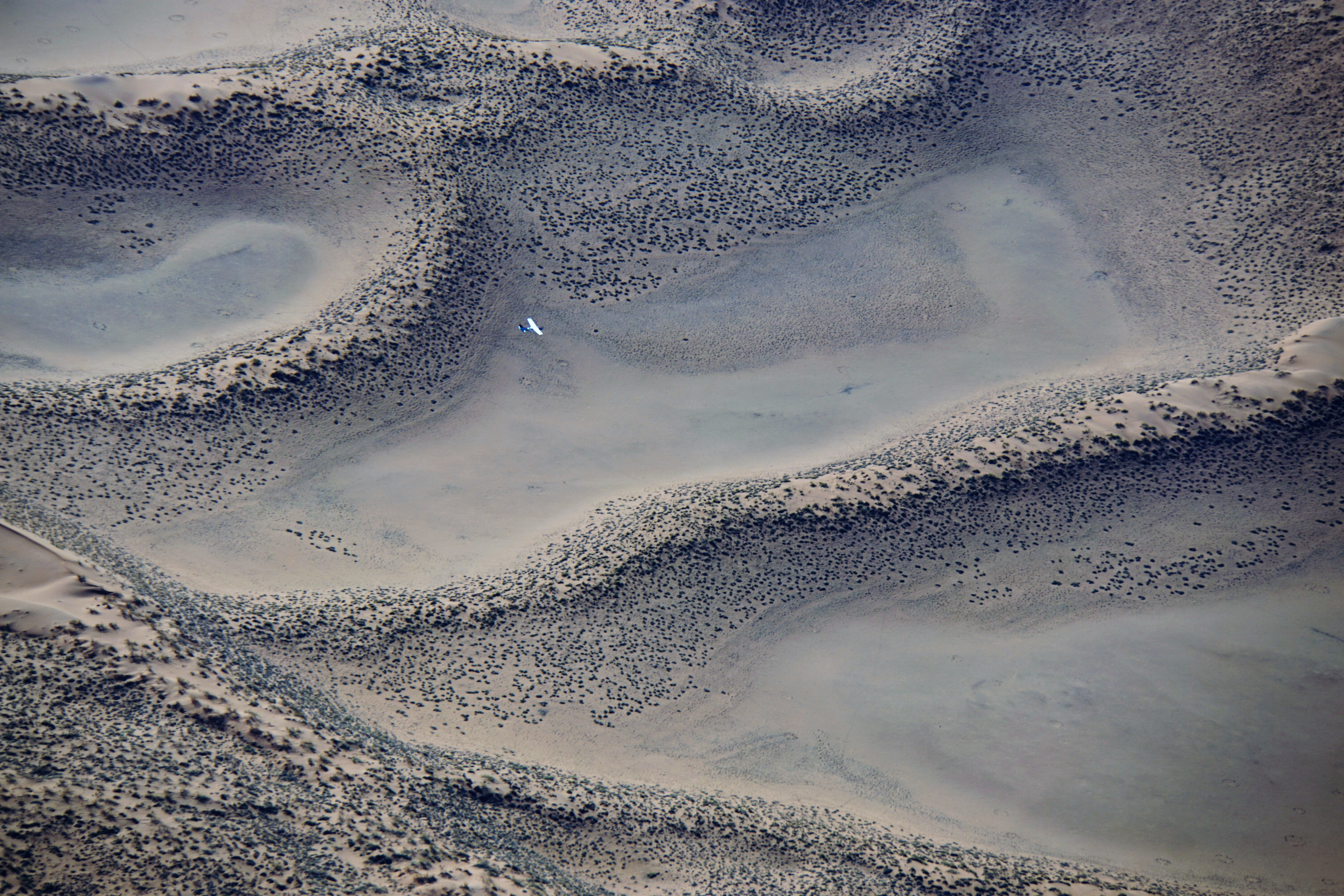
After flying 2 hours 10 minutes, we landed at Hartman Valley airstrip. This
strip also blended with the surrounding terrain in the valley, which all
appeared off-white due to drying grass vegetation from 2000 feet above ground level. When Easy Cockpit on the iPad showed our airplane over the strip, we looked down and saw the other
airplanes in our group. There is no information about weather or altimeter
settings at most of the bush strips. The bush pilots keep their altimeters on
the standard setting and report their position using flight levels. This makes
it easier for the pilots of 2 different airplanes on approach to the same
airport to keep track of each other’s position.
We were met by our guide Solomon, who brought snacks with him. The drive to Serra Cafema took more than an hour over very bumpy over sandy and rocky road. The land was strikingly beautiful, with flat sandy areas and high hills covered with white and green grasses, as well as brown and gray outcropping of rock and surrounding mountains. On the way we saw bunting, sparrow, Ludwig buzzard, and rock kestrel along with wild donkeys and ostrich.
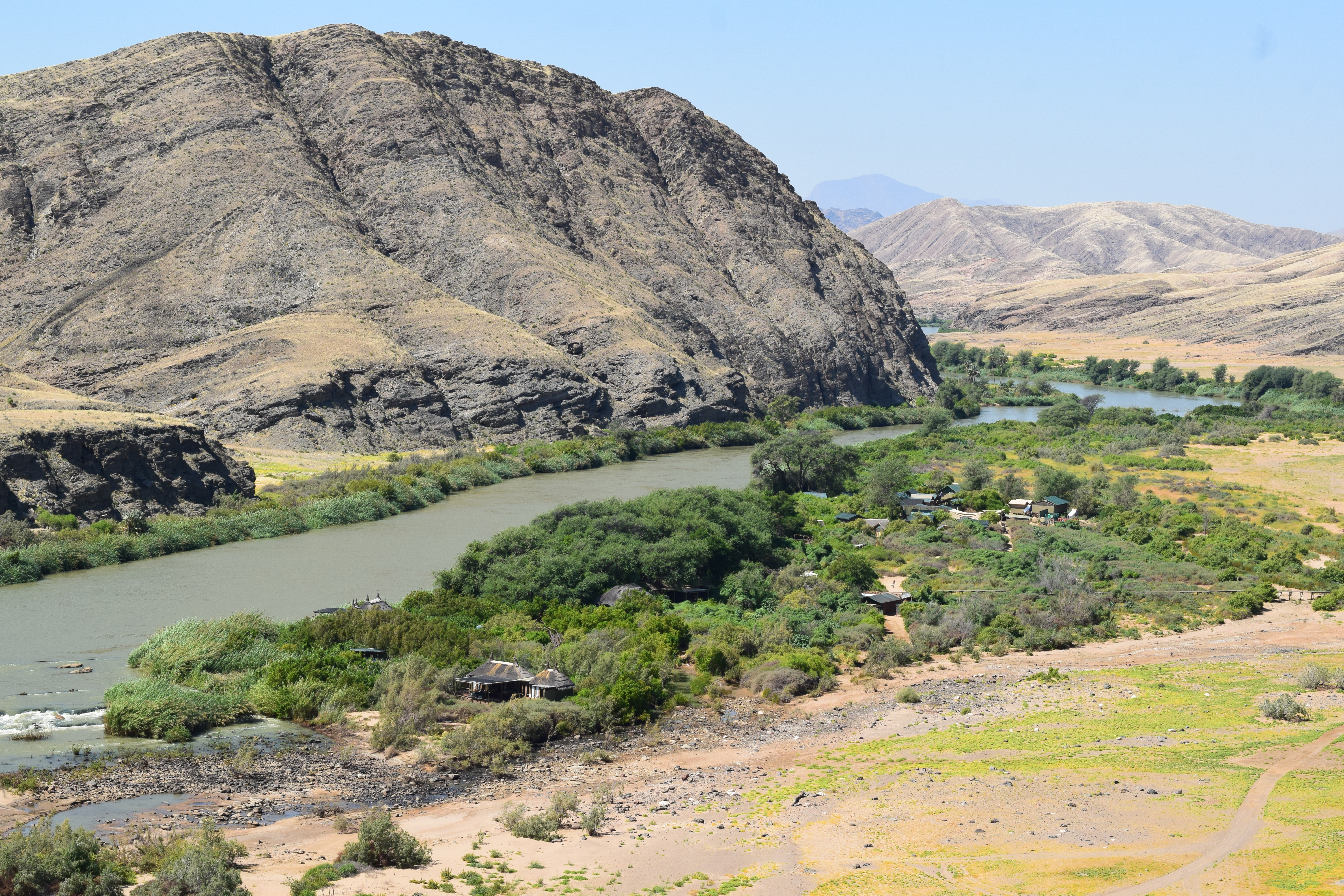
The Serra Cafema Camp accommodates 16 guests. It is part of Wilderness Safari, located on the Kunene River which separates Namibia from Angola in the north. It was very remote in the northwest corner of Namibia, about 50 miles from the Atlantic coast. There was no cell phone service and it was difficult to get internet access through the satellite enabled Wi-Fi. Almost all of the Namibia camps we stayed at had Wi-Fi connections, but very little, intermittent, useless internet access. By this time, my cell phone now longer booted after the post screen. Back in the States, I found it was not possible to reinstall the Android operating system. The Galaxy S4’s internal memory was not working, and I had to get a new cell phone, a Galaxy S7. Not having access to the news and the isolation from the rest of the world turned out to be very relaxing.
After getting settled into our villa, Solomon wanted to take us on a sunset drive. We drove five minutes to a nearby location where Solomon gave us gin and tonics with snacks. Karie used her iPod app to identify that the bright red star on the horizon was actually Mars. We were soon tipsy and laughing, which continued after we returned for dinner.

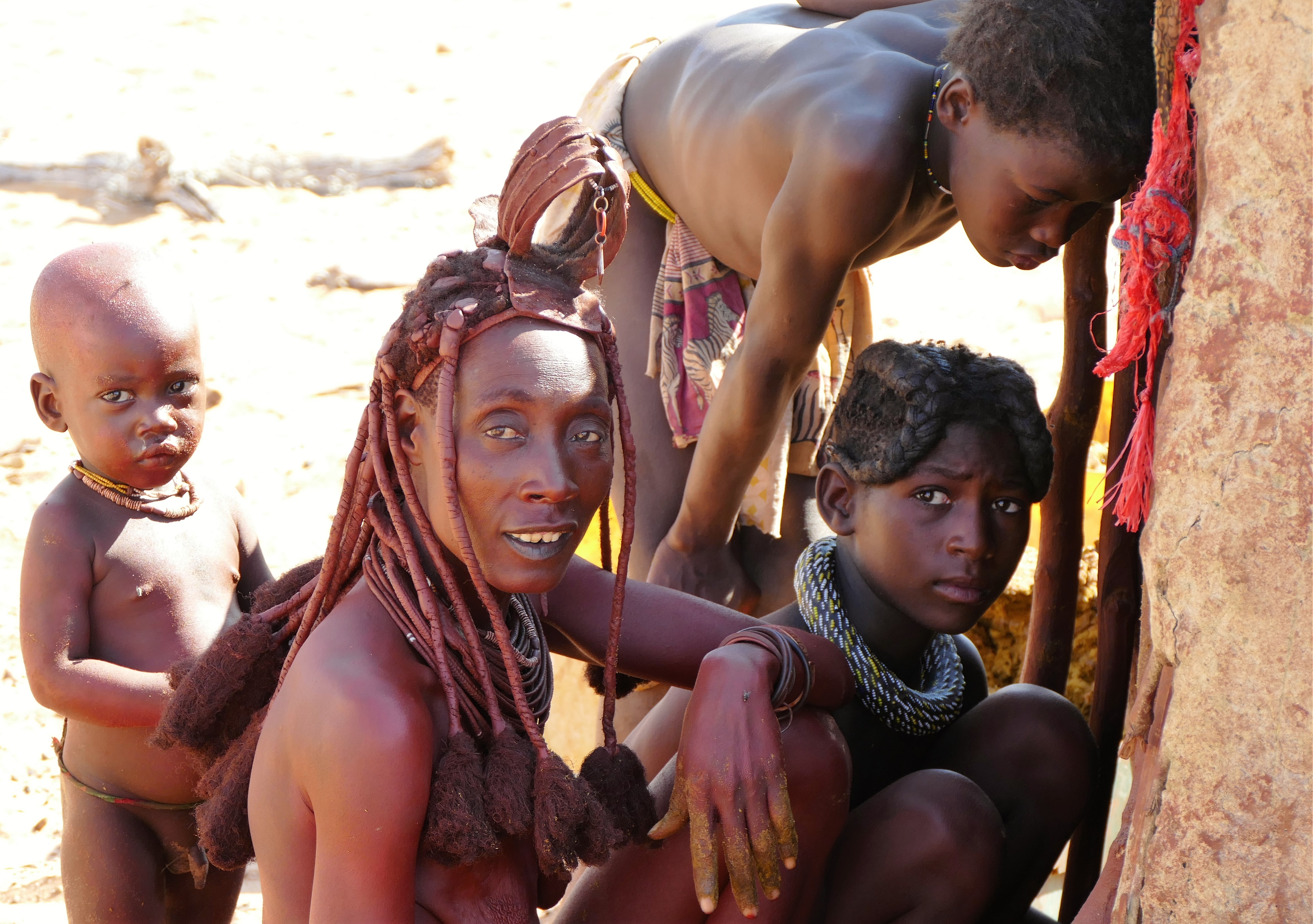

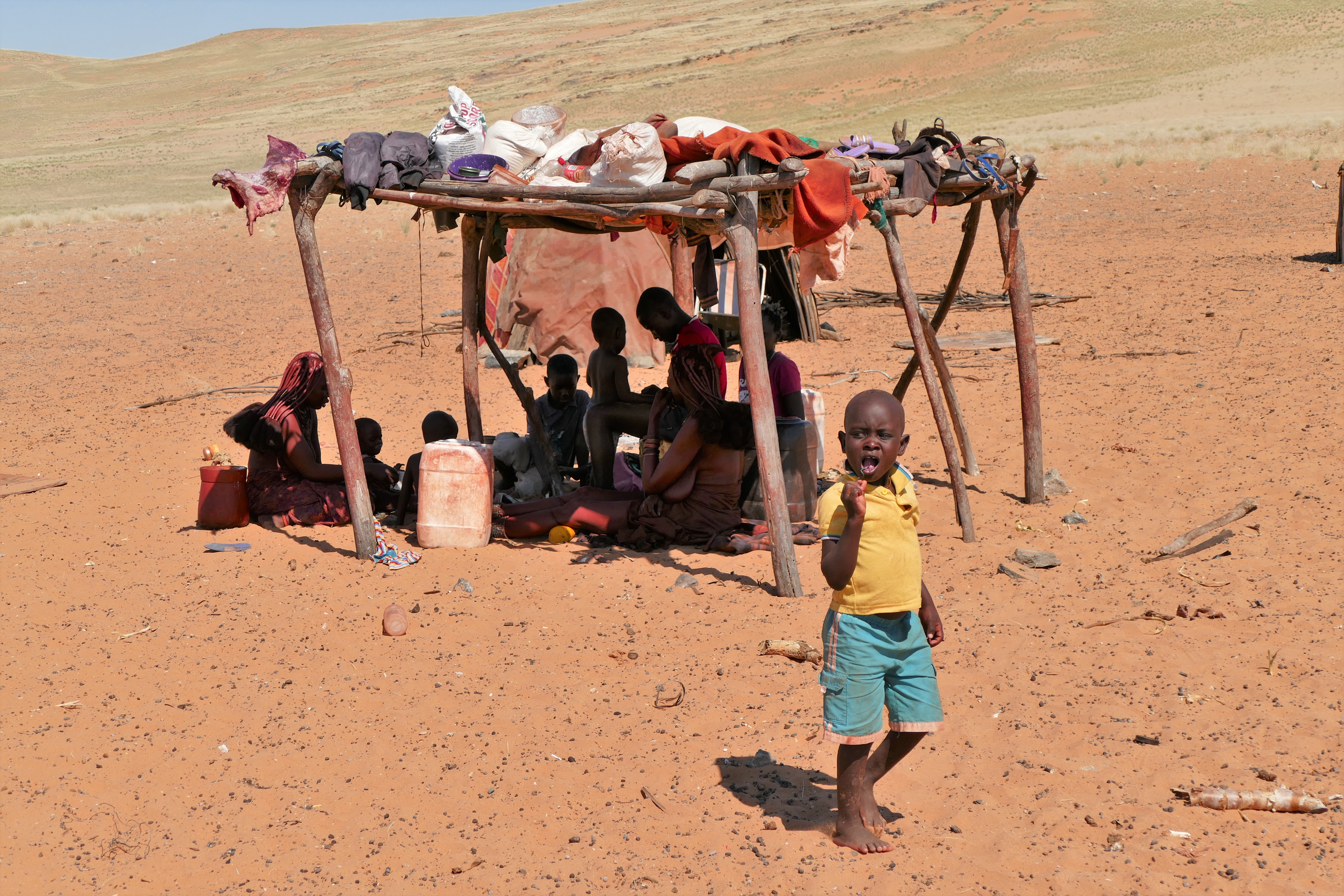
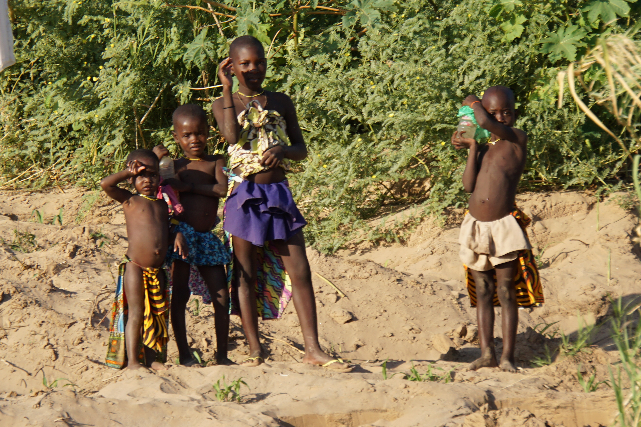
5/16/16: Himba
After
breakfast, Solomon took us to a nearby Himba village which had been there 20
years.. Before we arrived, he told us about the woman in charge, who was called
Crocodile because when she was younger, she was attacked by a crocodile when she
was at the river. The Crocodile bit into her left Breast and arm. A barking dog
caused the crocodile to let go. The crocodile went after the dog and both
escaped. Crocodile did not know her age in years. If asked her age, she would
say, remember when those rains came, I was born then. Based on this, it was
estimated she was in her 50’s.
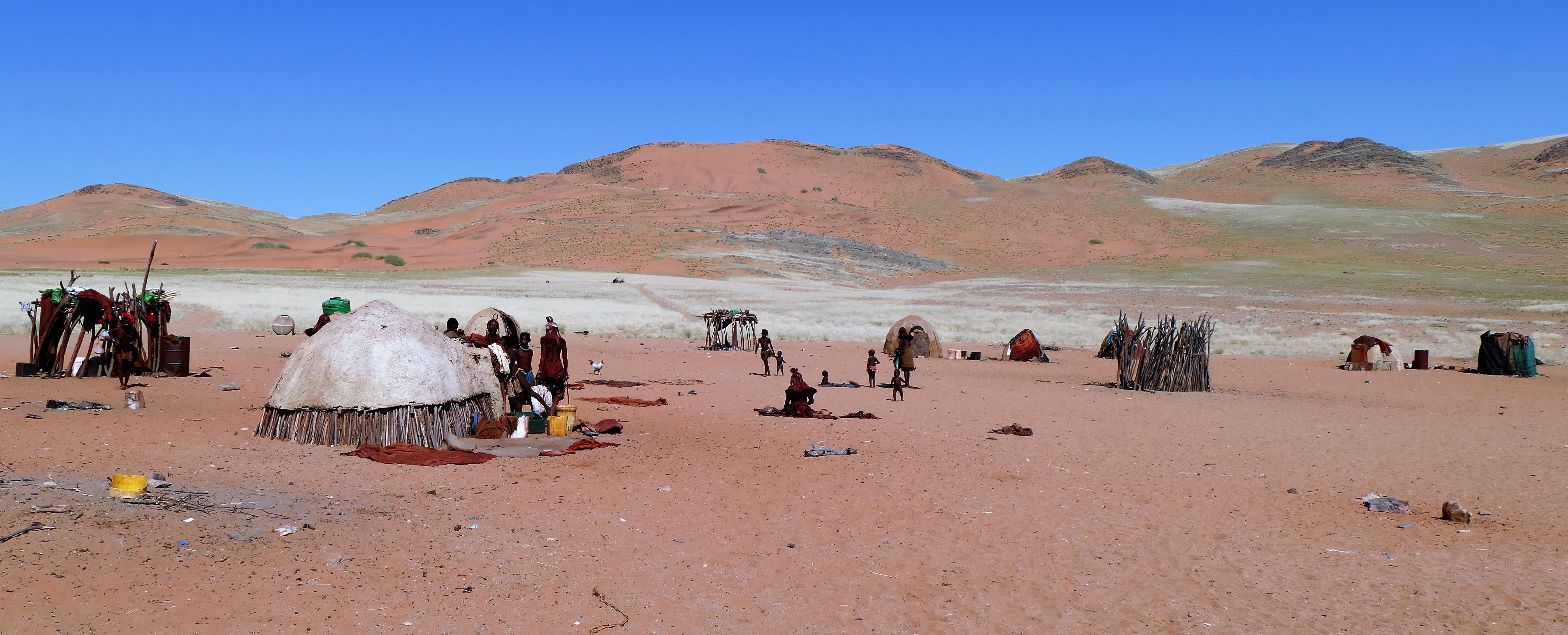
The men were gone from the village. The village consisted of small circular huts
made of sticks and covered with dried dung. Solomon said that for the first 5
years of his life, he slept in such a hut, which could sleep several people, and
it was cool inside. The women of the village were working on remodeling a hut.
Remodeling consisted of patting down fresh animal dung to patch the roof and let
it dry. Solomon told us the Himba word for hello, tjike, which we said. Solomon
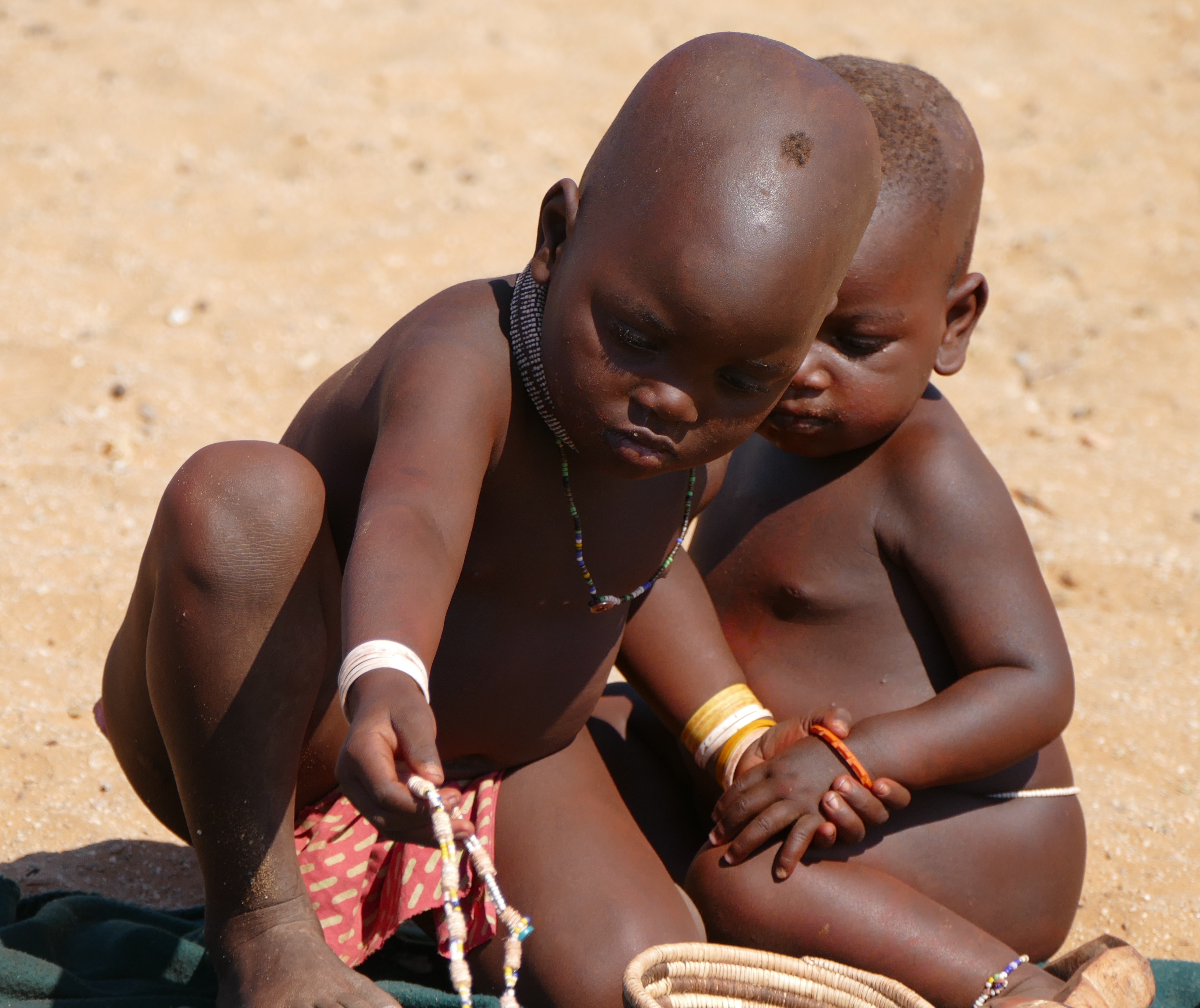
said that Wilderness Safari provided the village with water. The Himba villagers
were friendly and did not mind us photographing them. Some of the older children
and young adults were stringing plastic beads, which the men had obtained for
them. Solomon said that many of the children were sent to school in a town which
was an hour flight away. The Himba people were trying to preserve the
traditional ways, and some of the children stayed behind to learn the
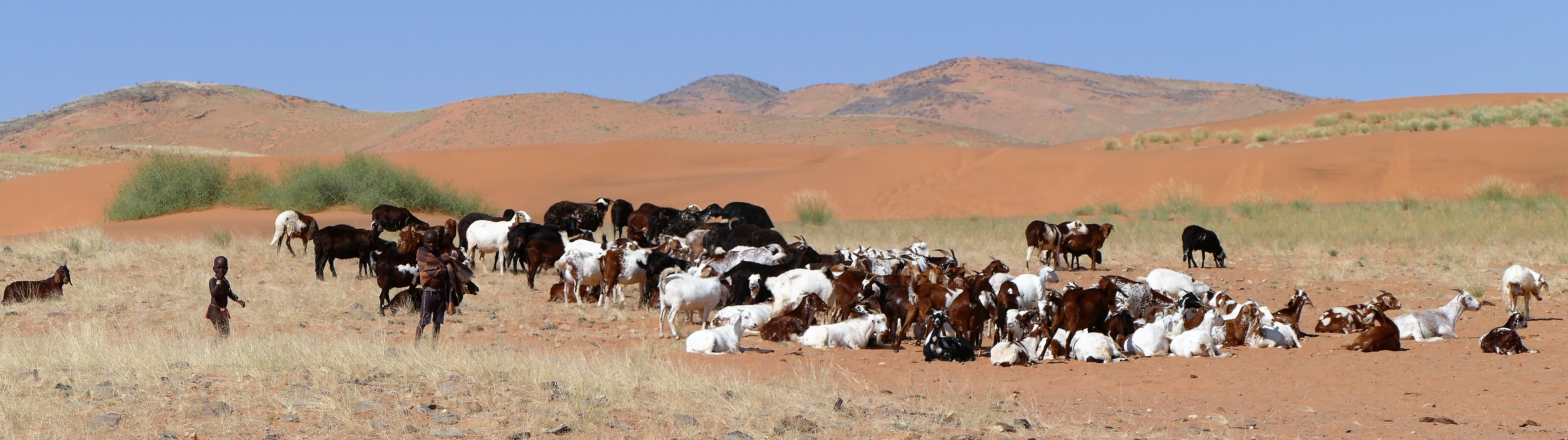
traditional ways. They herded cattle and goats; their herd was eating the grass
in the nearby hills. There was a stick coral in the center of the village to
protect the young animals at night.
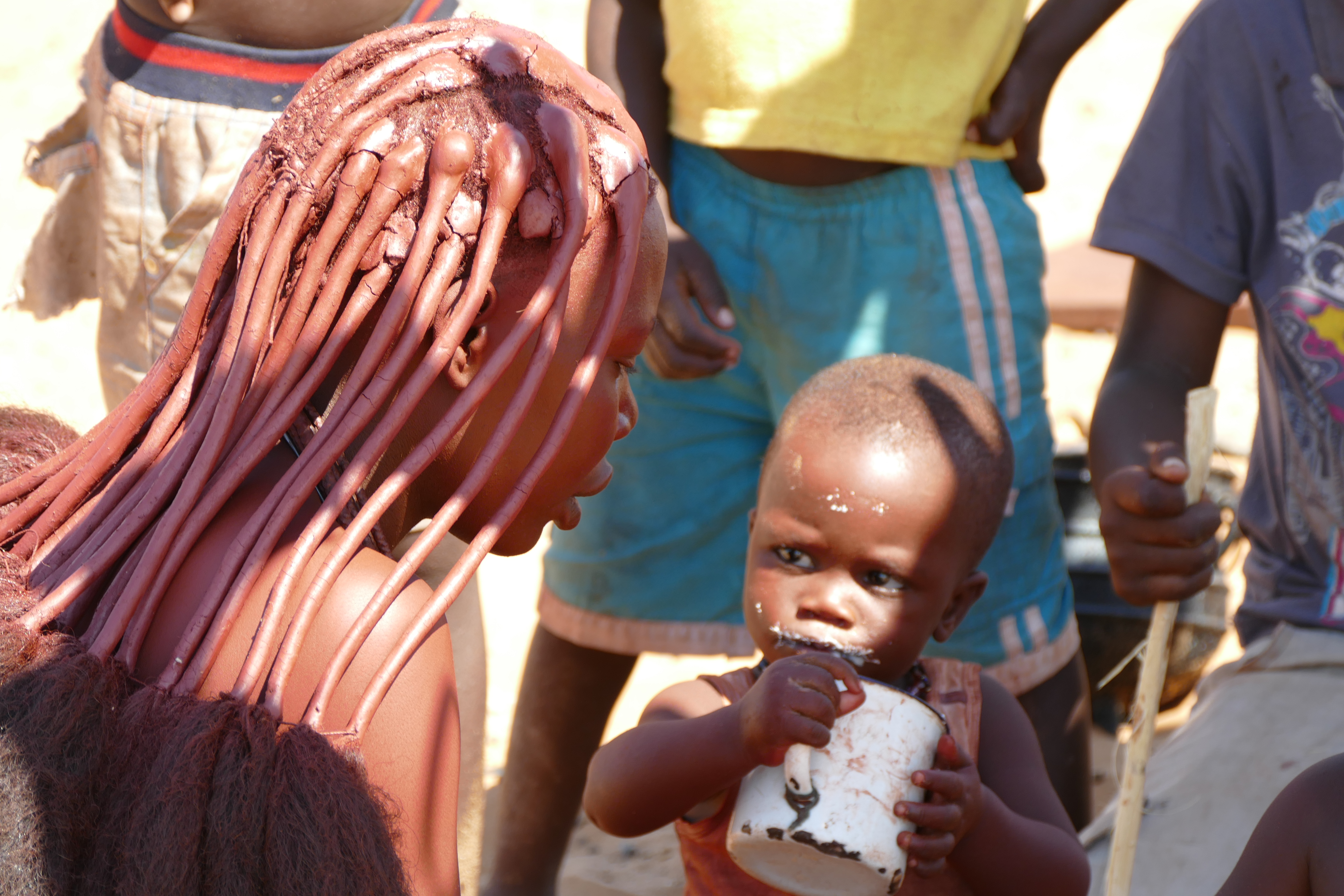
Solomon talked with the Himba women, and relayed what they said. Two women wore
a red U-shaped decoration on top of their heads, signifying that they were able
to menstruate and therefore have children. A late teenage girl had a wide brown
necklace signifying she was pregnant for the first time. One young woman who
also was pregnant had a young boy. She told Solomon to tell the boy’s father
that the boy needed milk. The boy's father worked for Wilderness Safari. The
women never bathed, but cleaned their bodies with Okra. They braided their hair
with okra to make themselves attractive to men. Liz and Carrie commented on how
good the Himba’s skin looked. Crocodile smoked a pipe, which Solomon said
contained a local plant that would make her high. Abruptly, the women and older
children laid out blankets in a circle and put out bead necklaces, small
baskets, and small wood carvings on the blankets for sale. Crocodile set the
price and collected the money. A small basket was $200 Rand, about $14 U.S. Liz
bought a colorful small basket, a wood carving of a bird, and a small wood ball
carving, which we thought could be used for a Christmas Tree ornament. Liz gave
Crocodile notepads and gel pens for the children. We said goodbye, kari nawa.
We then drove to a close by village, which was under construction. There were 2
men and 2 boys there, dressed in Western clothing. We then returned to the lodge
for lunch. Later after lunch, we drove for a scenic view and sundown. Solomon
had snacks and made gin and tonics for us. I asked Solomon about how marriage
worked, and he explained that for the Himba, if after dating, a man wanted to
marry a woman, he would first tell his parents. The man’s parents would then
send it messenger asking if the man’s parents could visit them. If the woman’s
parents were busy with a festival, the man’s parents would send a messenger
again. If the woman's parents agreed, the man's parents would come to visit with
gifts of coffee or something useful. The man’s parents would tell the woman's
parents that their son wanted to marry their daughter. The woman's parents would
be tough, wanting to know how many cattle he had, if he was wealthy enough to
support their daughter. If the woman's parents said no, then there would be no
marriage. If they said yes, a date would be set. The bride would have to stay in
a hut for a month; the groom would not be allowed to see her. At the wedding,
the groom would have to bring 2 cattle, and slaughter them both. The men would
eat separate from the women, and the bride would be given to the groom to care
for, and leave her village to live in his village. Divorce is simpler; the wife
goes back to her village to live with her family. If the husband dies, the wife
gets the children and the husband’s brother gets his cattle. A man can have more
than one wife if he has enough cattle.
I asked Solomon about his own life. At age 6, his mom was traditional Herero and
his dad German. He was sent away to school. It was difficult for him because he
could not see his mother every day. The school work was difficult; he did not
understand why he had to learn it. It got better for him around grade five, when
his brother and sister joined him at the school and he had to look after them.
After high school, he had to work because his father lost his job. His father
traveled looking for a job. Solomon took college classes to be certified as a
guide. He worked as a guide, but then got a job with Wilderness Safari where he
has been 9 years. He said his parents had to pay for his education. He had gone
to a Catholic school. He said he was Catholic, was not married, and had no
children. He plans to work for another year, then go back to take care of his
parents.
At dinner, Louis talked about the governmental prejudice against white people in
South Africa, along with the declining economy. Louis had taken over his
father’s 2-way radio manufacturing company, but he tried to do everything
himself, including accounting, marketing, and programming the software that
operated the radios. He admitted that they wanted to move to the United States,
and acquiring Hank’s Aero Safaris, an American company, might be the ticket to
immersion for them.


5/17/16: Hartman Valley
After
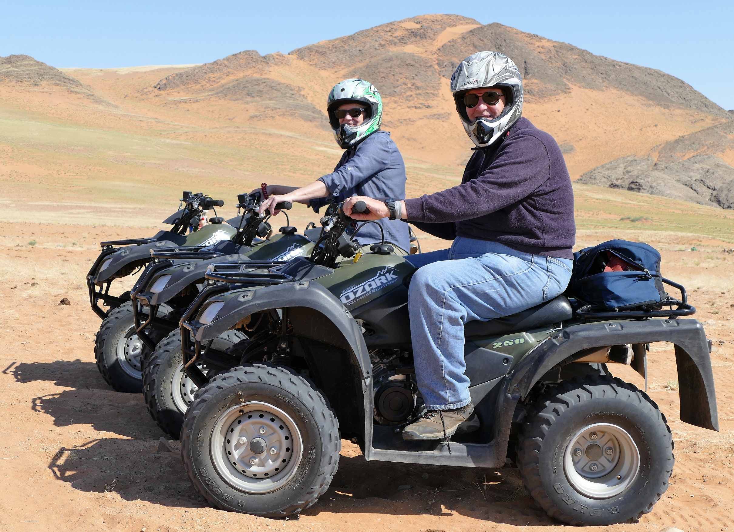
breakfast, Louis, Shauna, Liz and myself went with Solomon on a quad-bike ride.
Shauna quickly dropped out due to a stomach ache. We drove up a stone hill and
passed the Himba village, then up a sandy hill where Liz stalled because she was
in the wrong gear and I got stuck because I stopped to see what was wrong with
Liz.
We continued on to another Himba village. Solomon thought it was abandoned, but
people were there now. There we found a man sitting on a small lawn chair in the
shade of a hut. There was a woman, a young adult woman with a baby, a late
teenage girl, and several children sitting in the shade of a platform. Their
activity centered around cooking a slaughtered goat. Women pulled meat from the
carcass, which was pulled into strips of meat and hung on the platform. The man
got up from time to time to check a small pot that was on a small fire,
apparently cooking the meat. Solomon told us that the man owned the cattle, and
that the cattle were more important to him than the women or
children. Four
cattle wandered into the village and went straight to the man’s hut, and stayed
close by. Solomon told us that the man would sit and eat pot after pot of the
meat, and the women and children would eat little of it. Solomon found out that
the village had not received water in a day, and he tried to radio back to
Wilderness Safari to arrange a water delivery to them.
We continued to drive the quad-bikes through the grassy green Hartman Valley,
and then returned to the Lodge by going down a steep sandy hill. During the
excursion, we rode 28 kilometers and were gone over 4 hours. Shauna said she
worried that something had happened. In the late afternoon, we took a boat ride
up the river. We saw people on the Angola border side of the river. We saw
several crocodiles on both sides of the river.
Leg 8 - Hartman Valley (FTHV) to Ondangwa (FYOA)
Leg 9 - Ondangwa (FYOA) to Ongava (FYNG)
5/18/16: Flying inland
Leg #8 was a 2 hour flight direct to Ondangwa, a tower controlled approach and field. The tripkit warned us that this was a fuel critical leg. We leaned the mixture for the best fuel economy, and carefully maintained course while watching the fuel consumption. The Ondangwa tower controller talked fast with a thick accent and we both had to listen to interpret his clearance. Landing on the asphalt runway was uneventful, and we topped off the airplane with fuel.
The next flight, leg #9, was one hour to the Ongava landing strip. We had to be careful not to overfly the Etosha National Park, which was visible by the large salt pan. We flew on the west side and followed the road until Easy Cockpit on the iPad showed we were over the Ongava landing strip. We could see the land rover and and the other airplanes on the ground waiting for us.
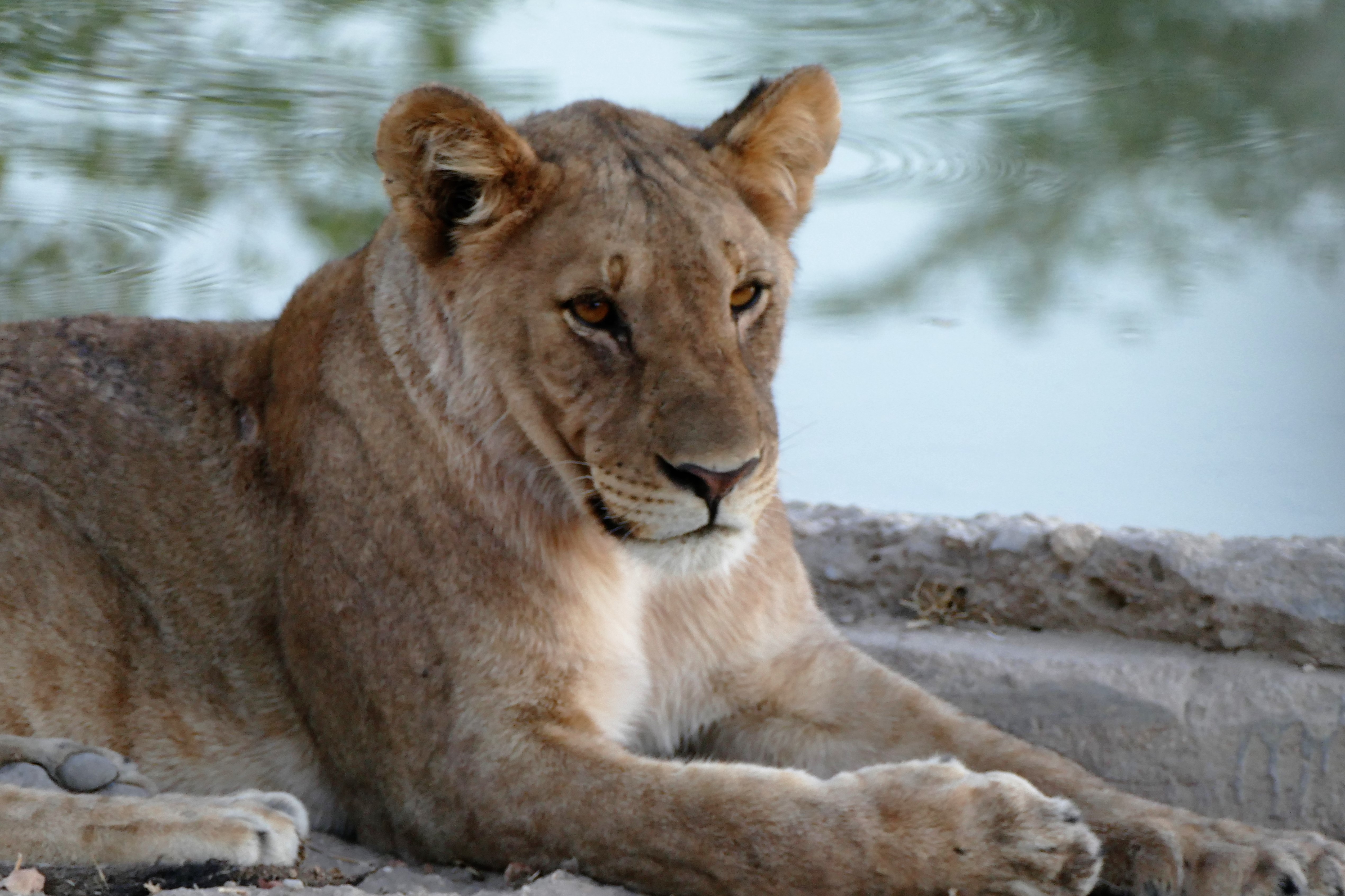

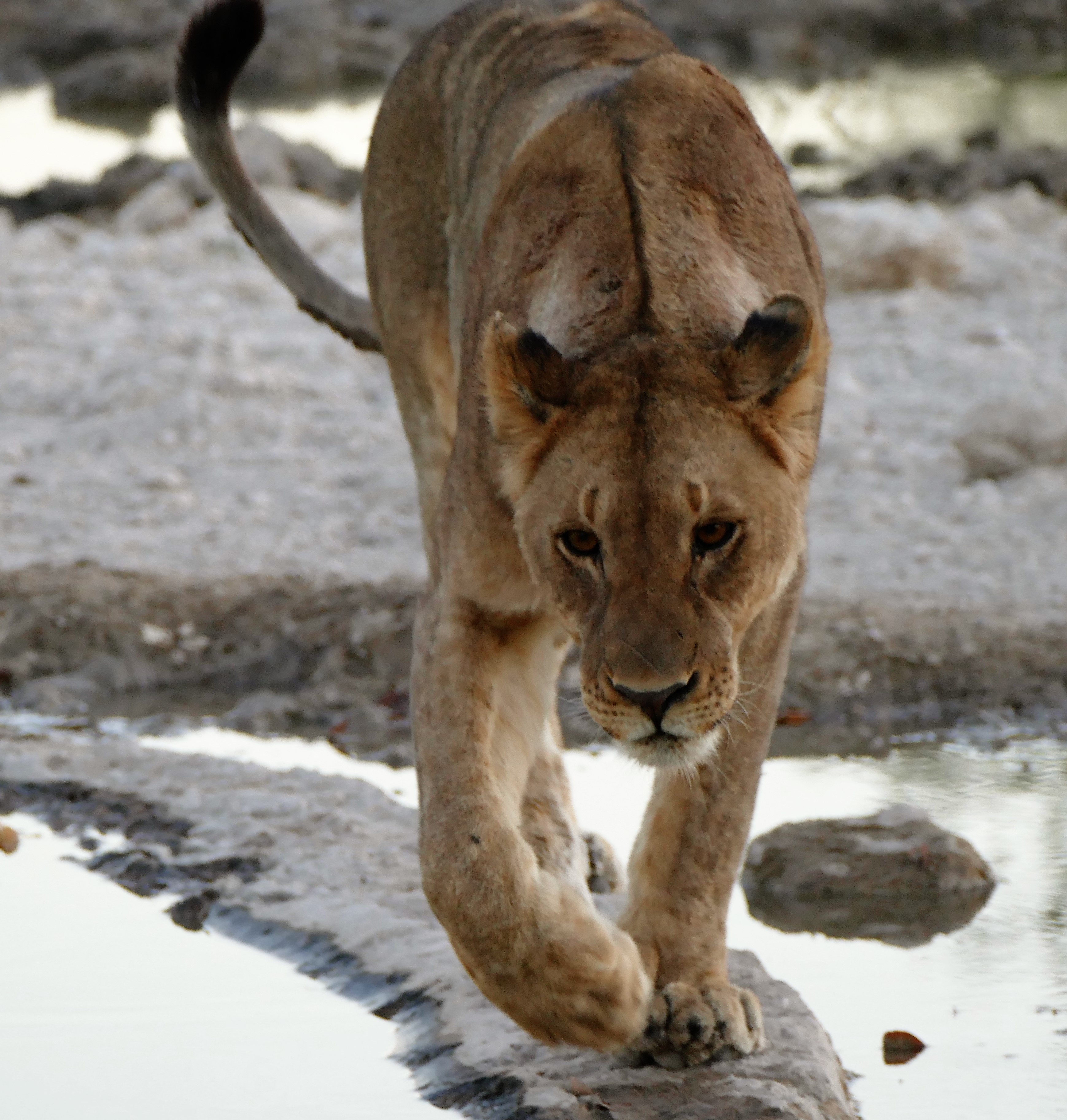
We stayed at the Onvega Tented Camp. These were obviously not Boy Scout tents, but were large, standup tents with a queen sized bed and full bathroom. The camp could accommodate 16 guests. Before dinner, we went on a game drive around the Onvega Game Reserve, and found several lions at a watering hole. We watched a mischievous lion cub who kept jumping on his older sisters. The sisters then pinned the cub to the ground and tripped the cup when he walking. The camp had no fence to keep out the animals, and the animals roamed freely through the camp as there was a watering hole in front of the dining area.
During dinner, one of the staff, Sidney from Walvis bay, told us the menu in the click language. He spoke the click language but Afrikaans was his strongest language. He had learned English in school. Dinner was family style and we were entertained conversing with 2 German brothers and their stories of being dentists while engaging in their hobby business of importing quarter horses from Texas to Germany. We also met Petra from Germany while travelled alone all the time. She had been to Kenya 10 Times. There was a young couple from London who talked politics with us. We could watch the animals that came to the watering hole while we ate. We were told that it was not safe to walk outside in the dark. A man with a flashlight and rifle escorted us to our tents after dinner. We were told to stay inside the tent until someone came by to wake us up in the morning. I asked the escort if he ever had to use the rifle and he said yes. I asked what for and said lions on the path.


5/19/16: Etosha
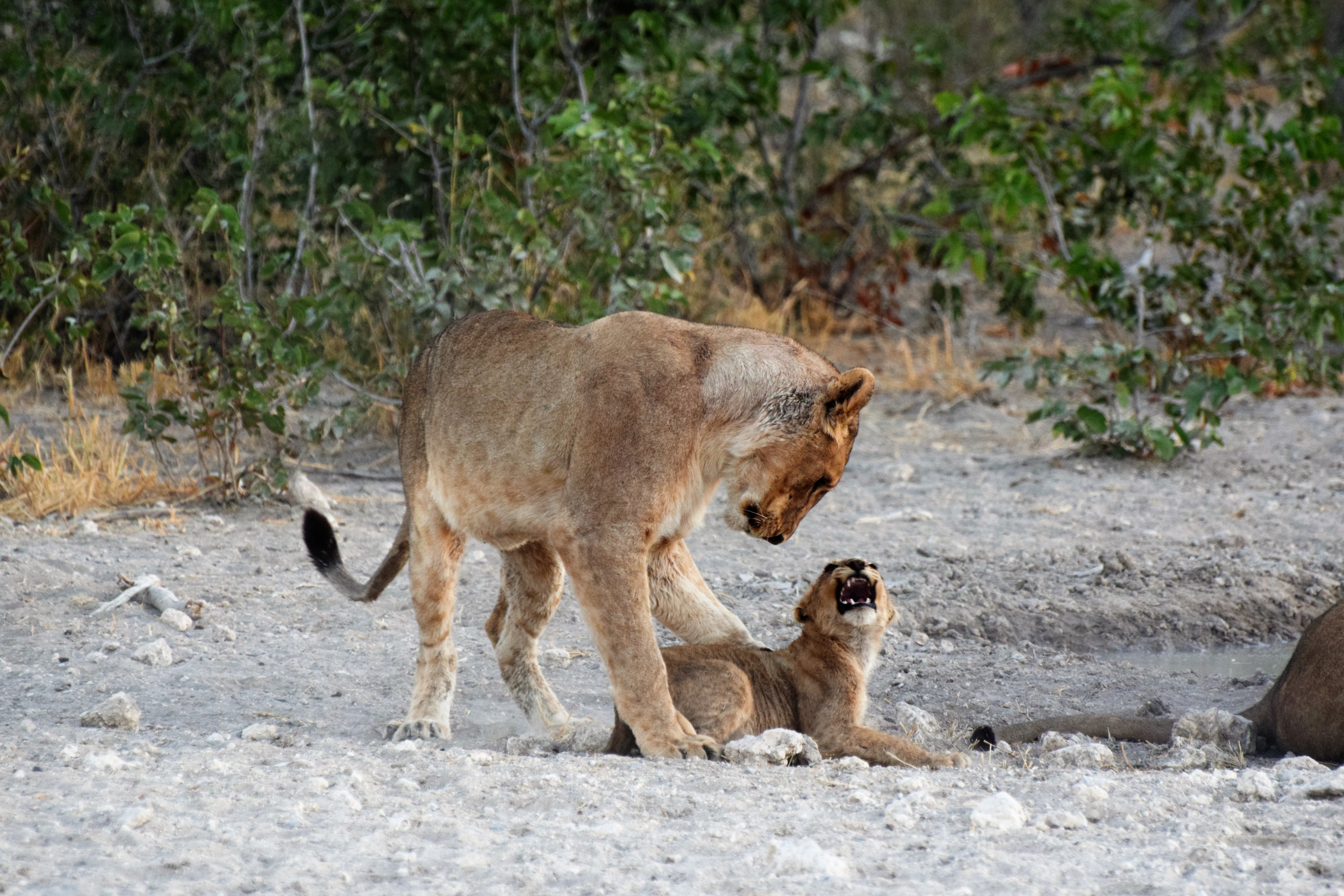
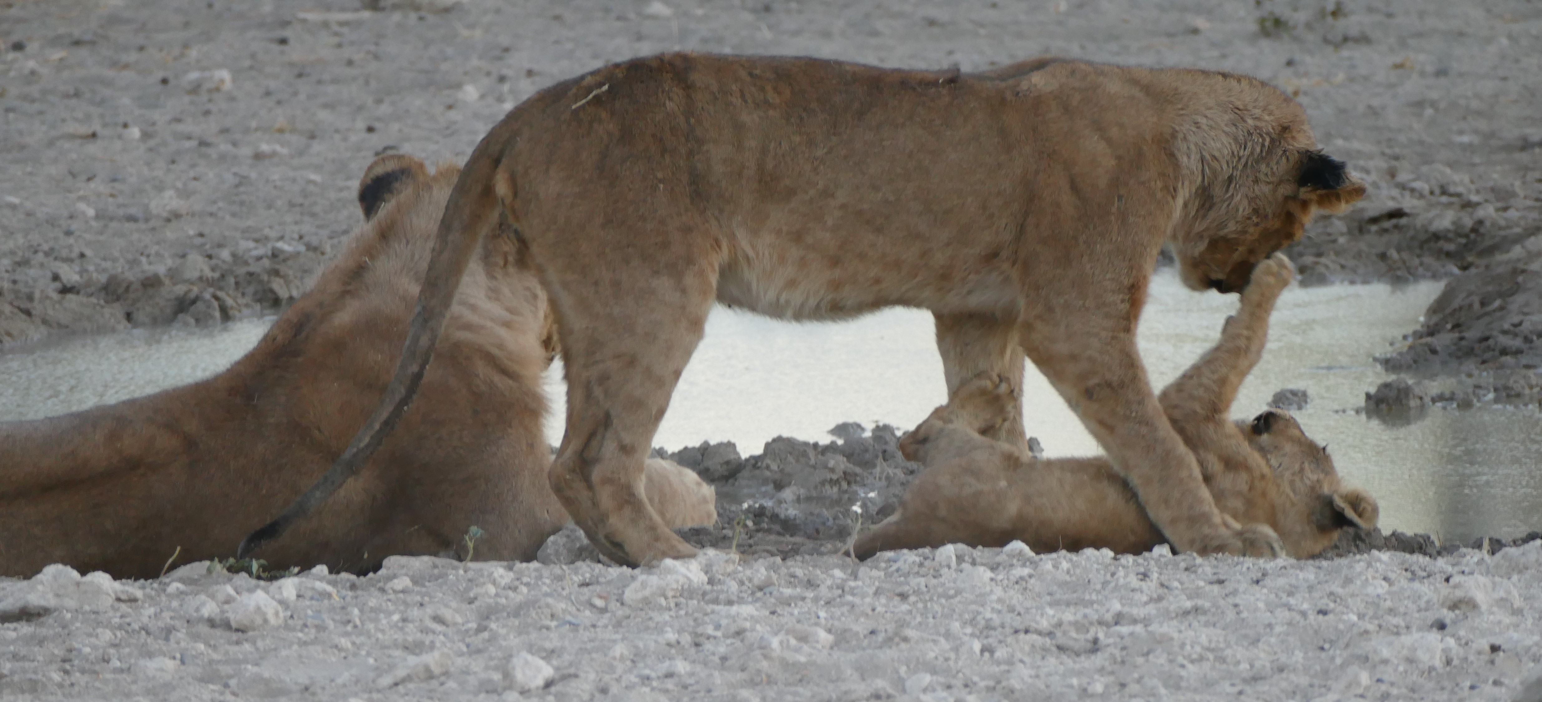
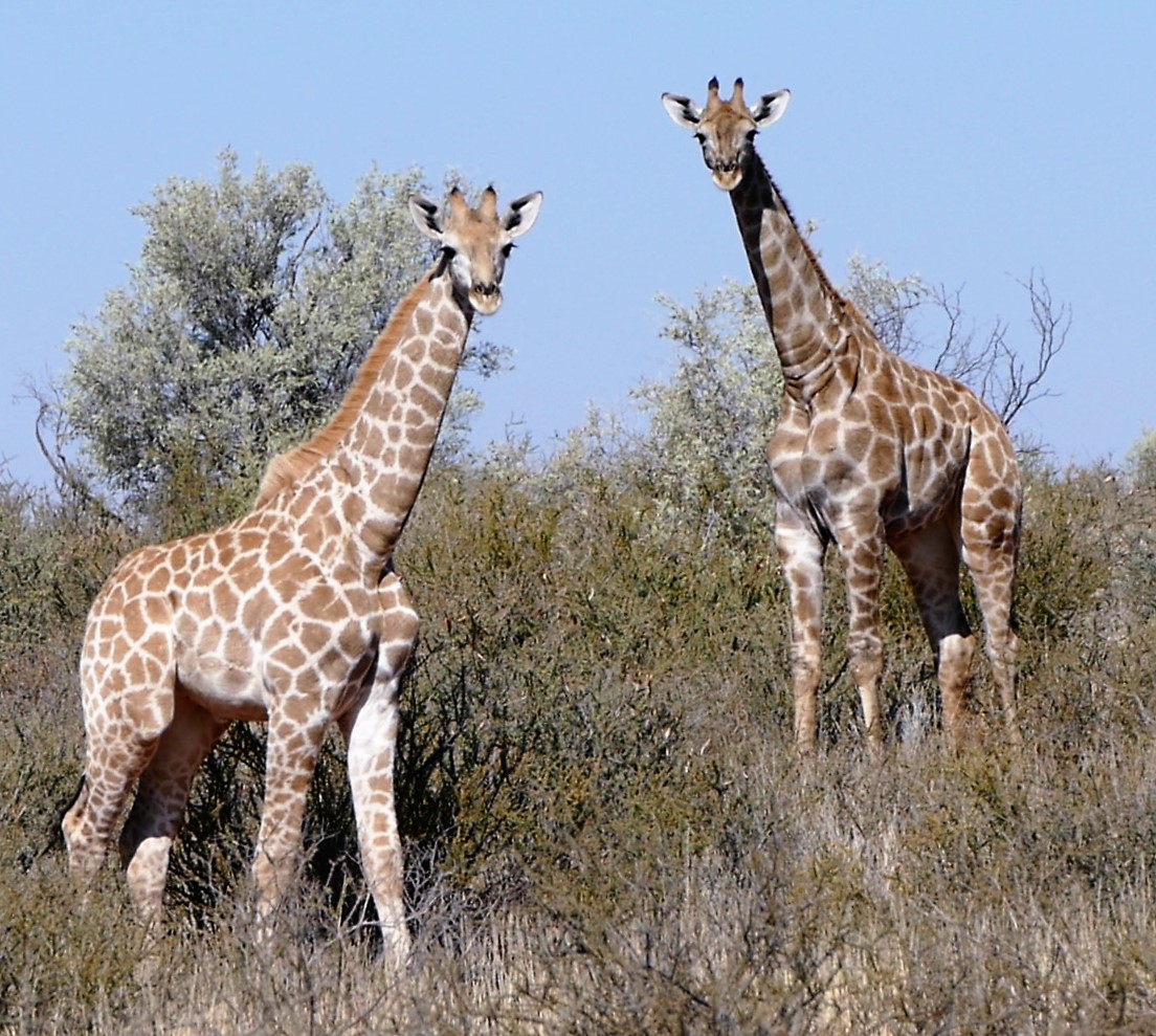
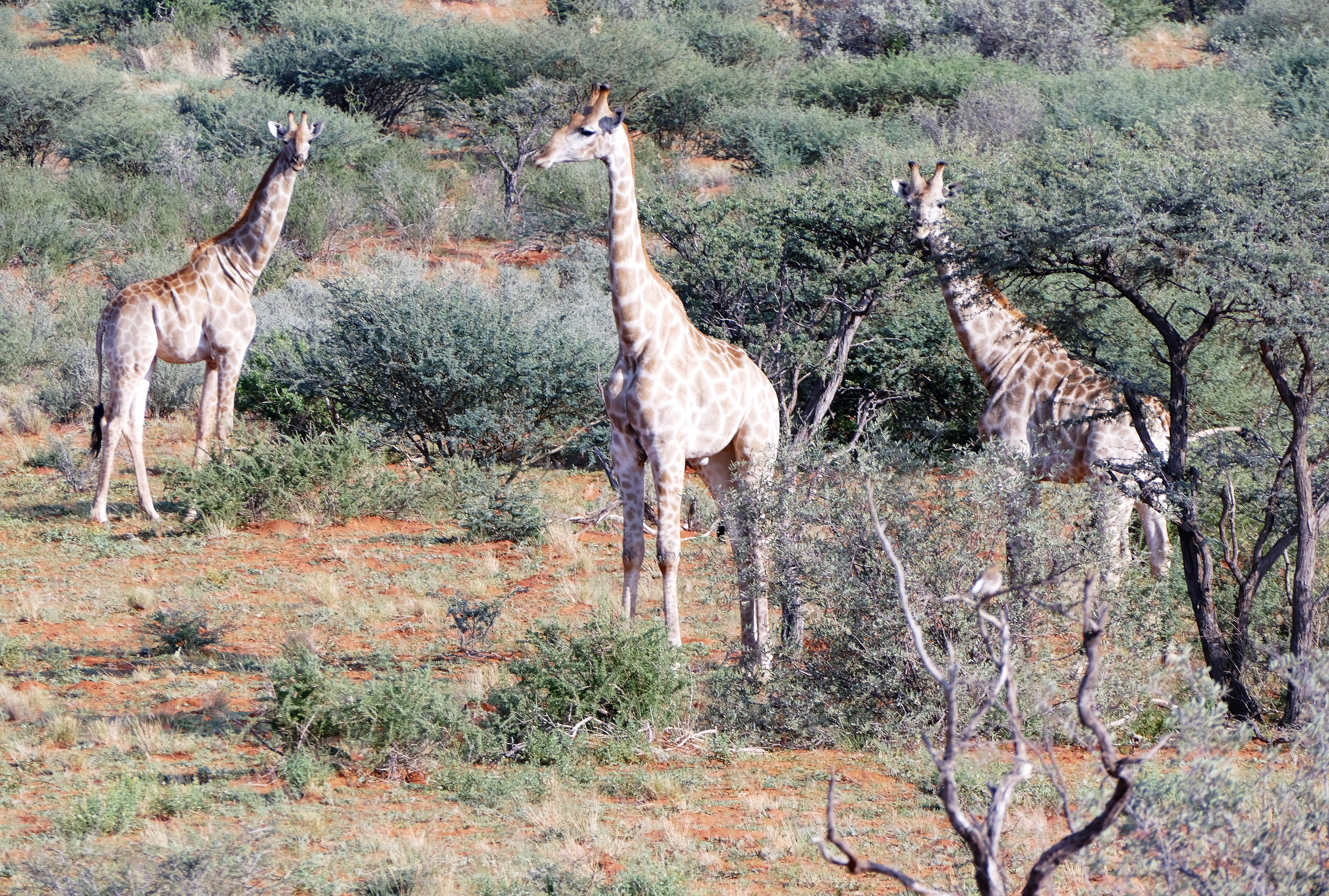
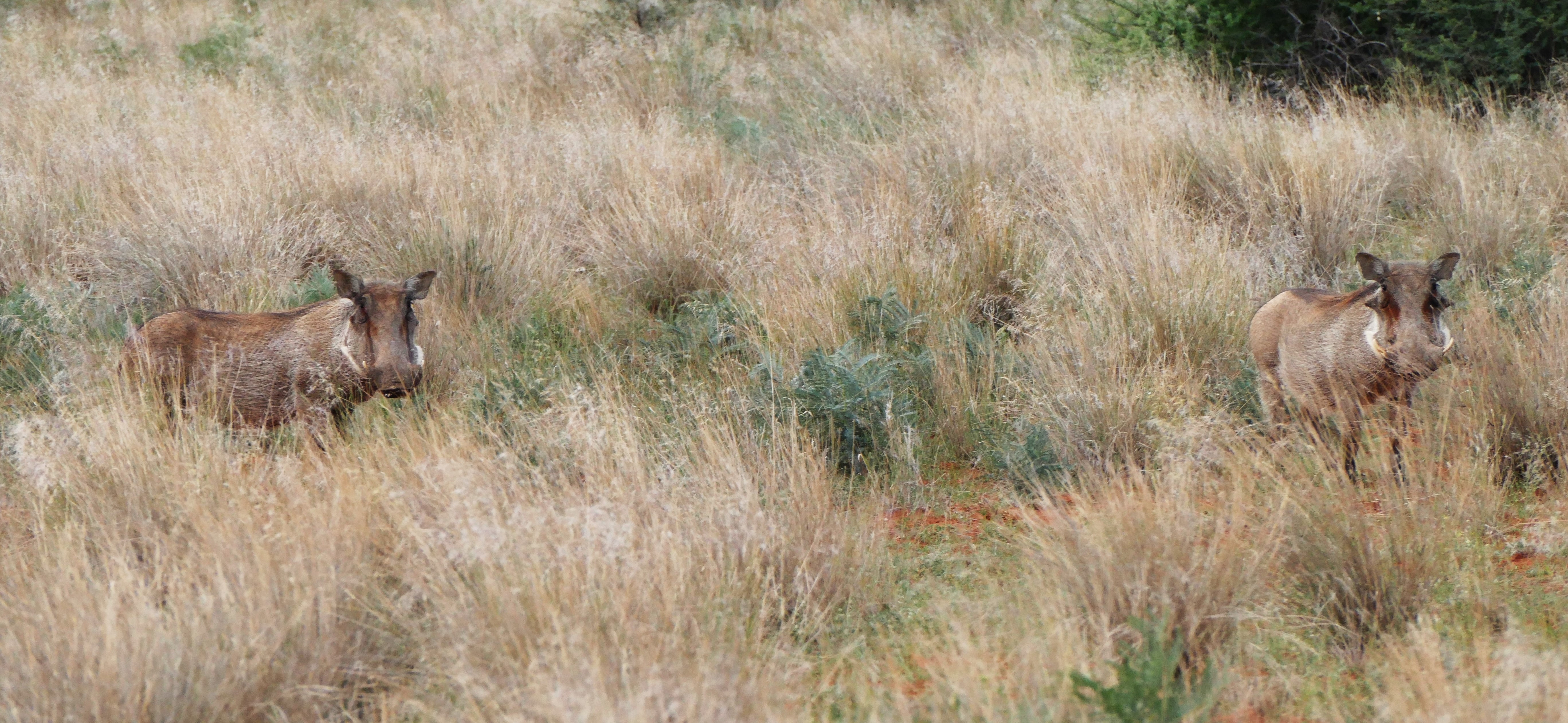
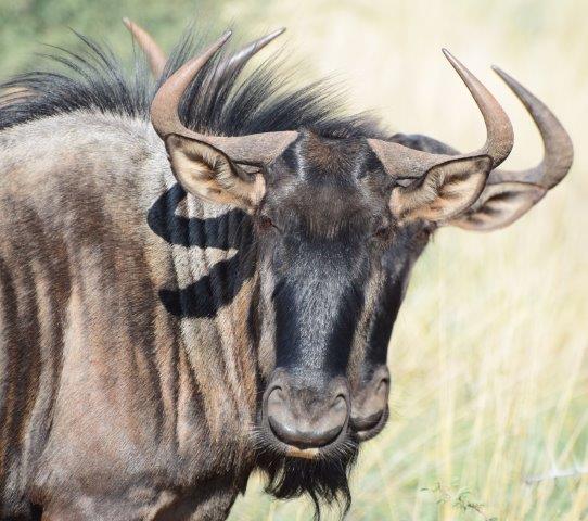
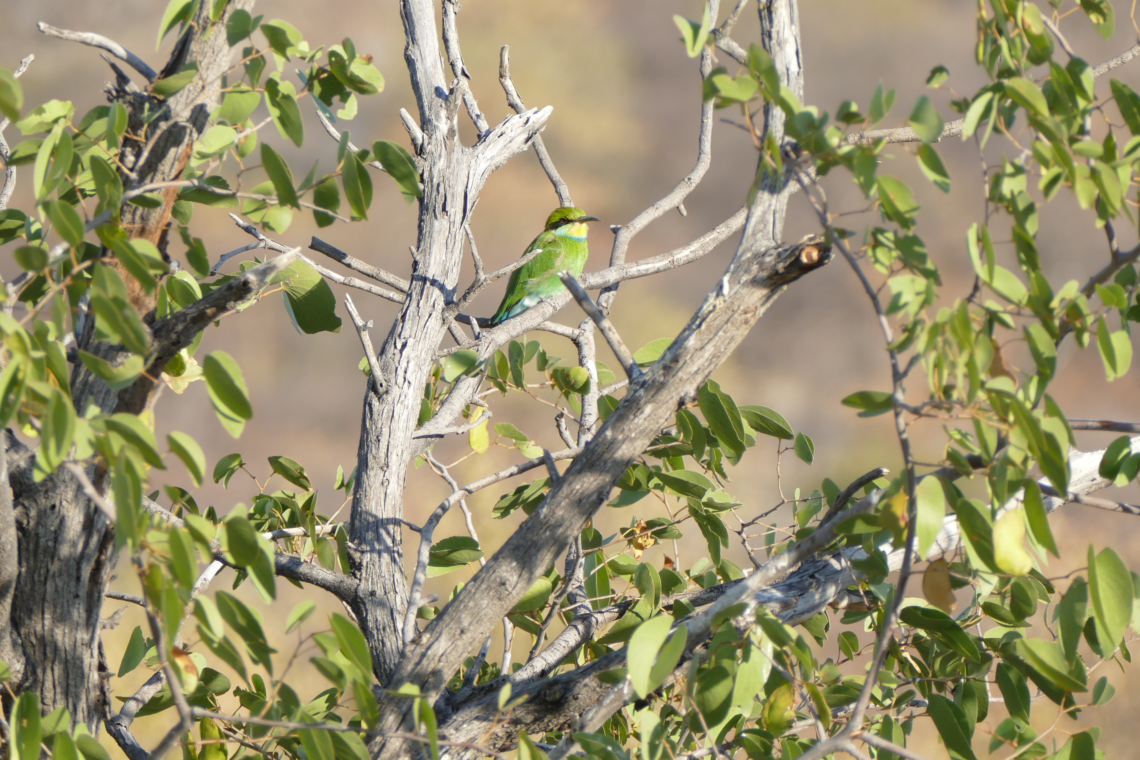
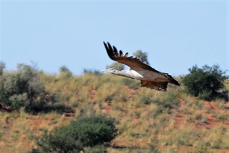
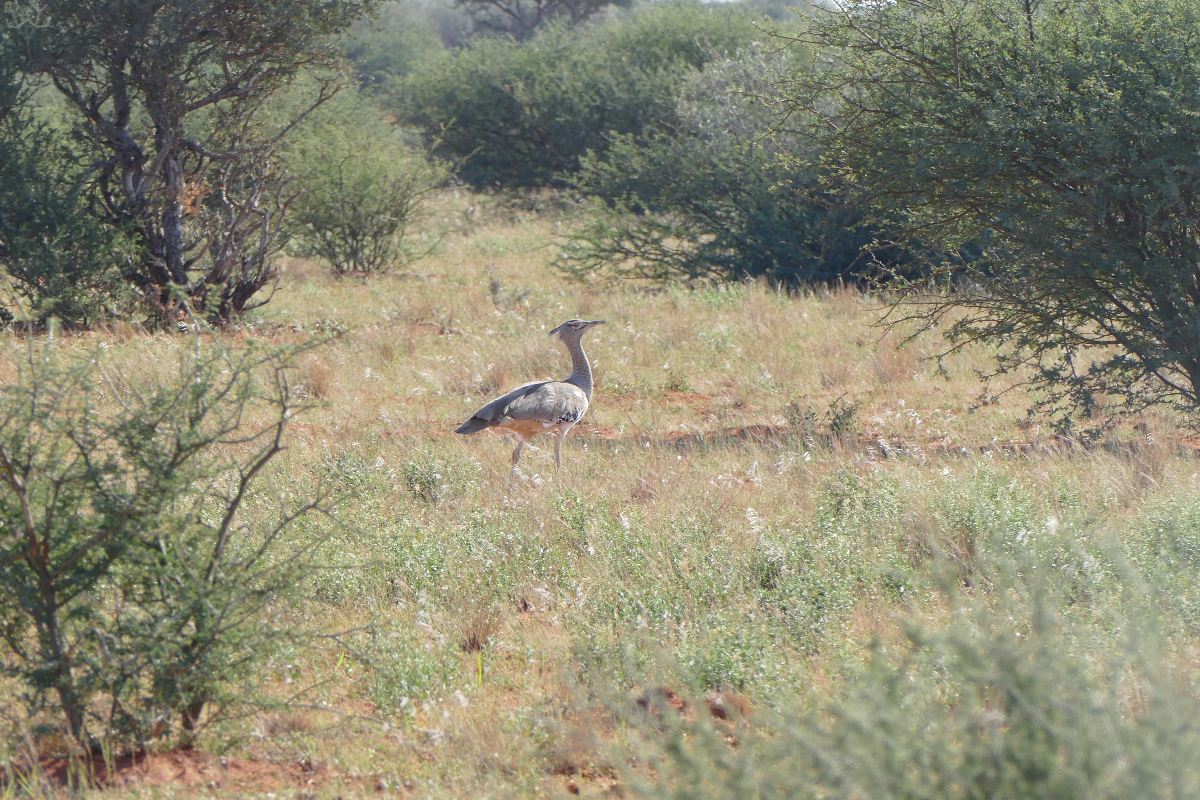
We were wakened at 530 AM, and were told it would be safe to walk outside at 600 AM. Breakfast eaten, we were ready to go at 630 AM. Leon, our guide, drove us out of the Ongava Game Reserve and turned left to the entrance of Etosha National Park. He told us that most guides work 6 weeks and then have 2 weeks off. Louis had been looking at the instructions of my new Panasonic Lumix FX-1000 camera, which he had pointed me to months before the trip. An expert photographer himself, Louis showed me how to use aperture priority and point focus. Doing this, my zoom photos were much better focused. We saw giraffe, warthog, rock dassie, wildebeest, impala, bee eater swallowtail bird (many others), kudu, and lion. We found 9 lion cubs playing together. The smallest was 5-6 months old. The rest were 1 ½ years old. They would stay together till full grown, around 3 or 4 years.
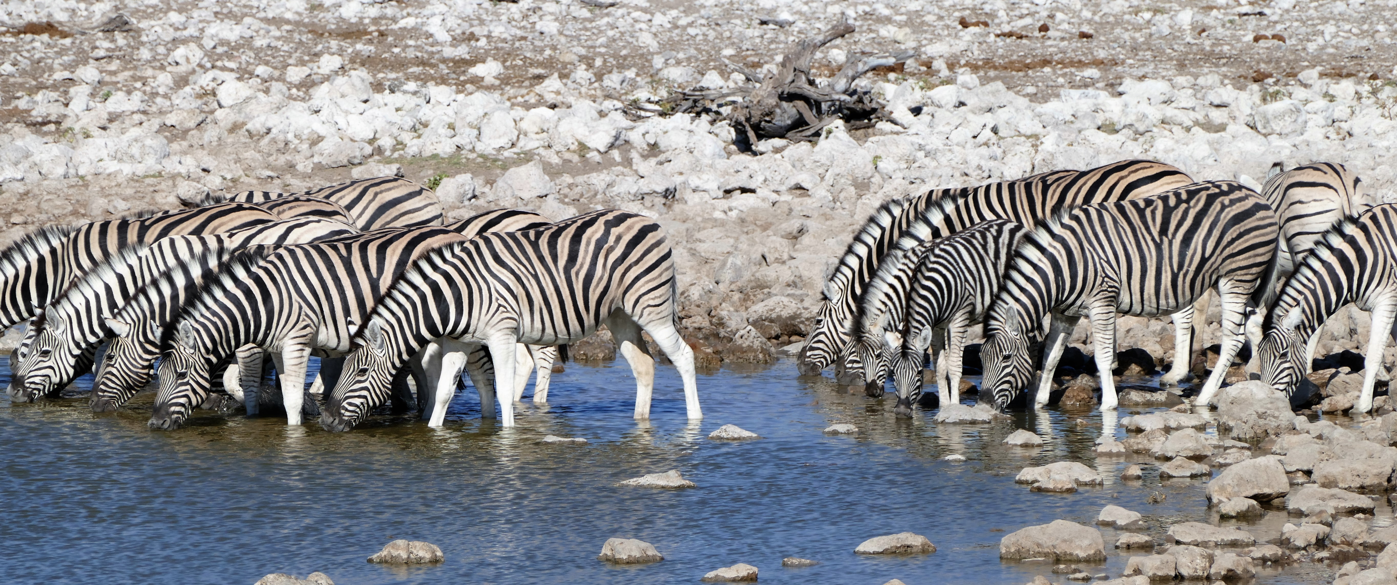
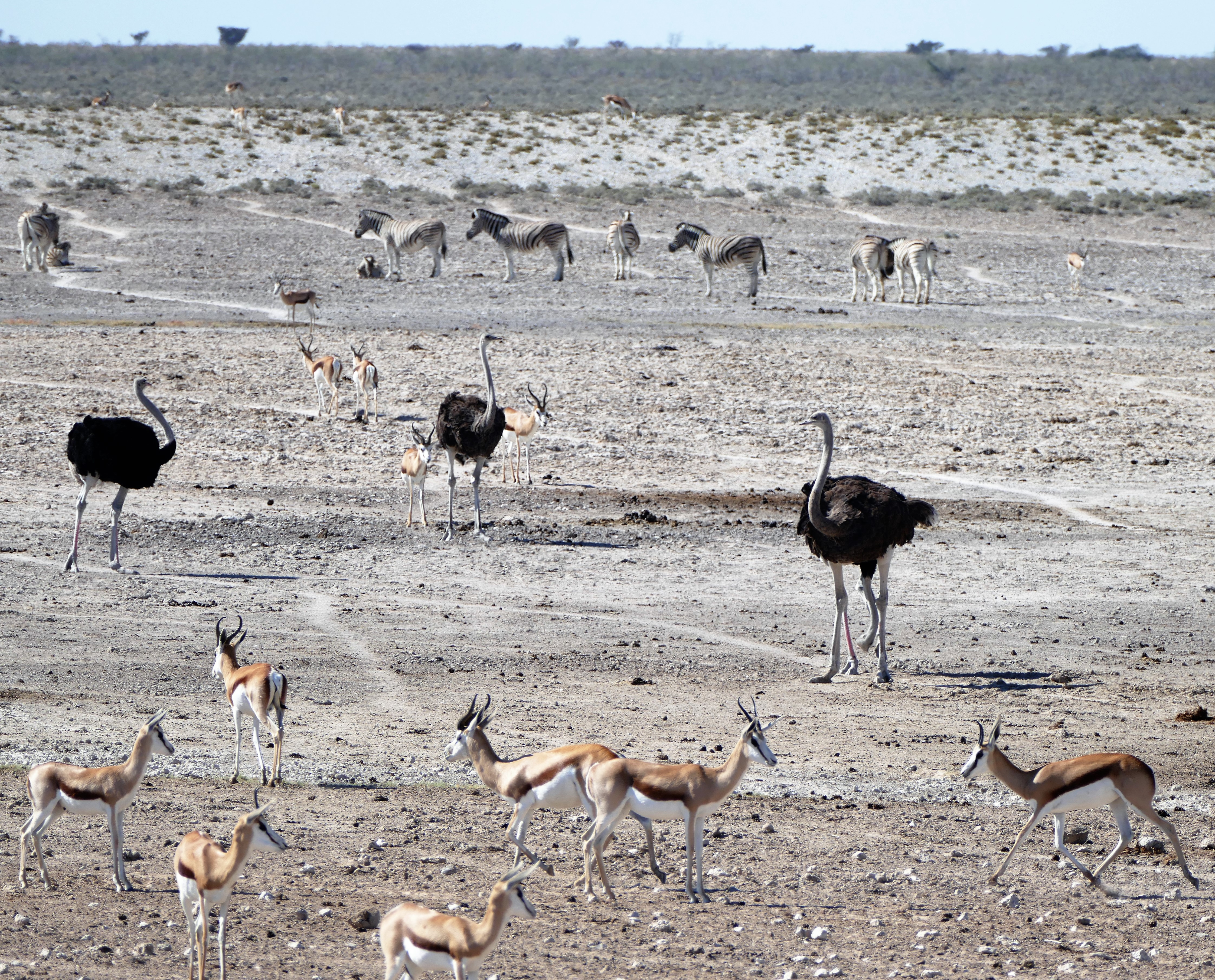
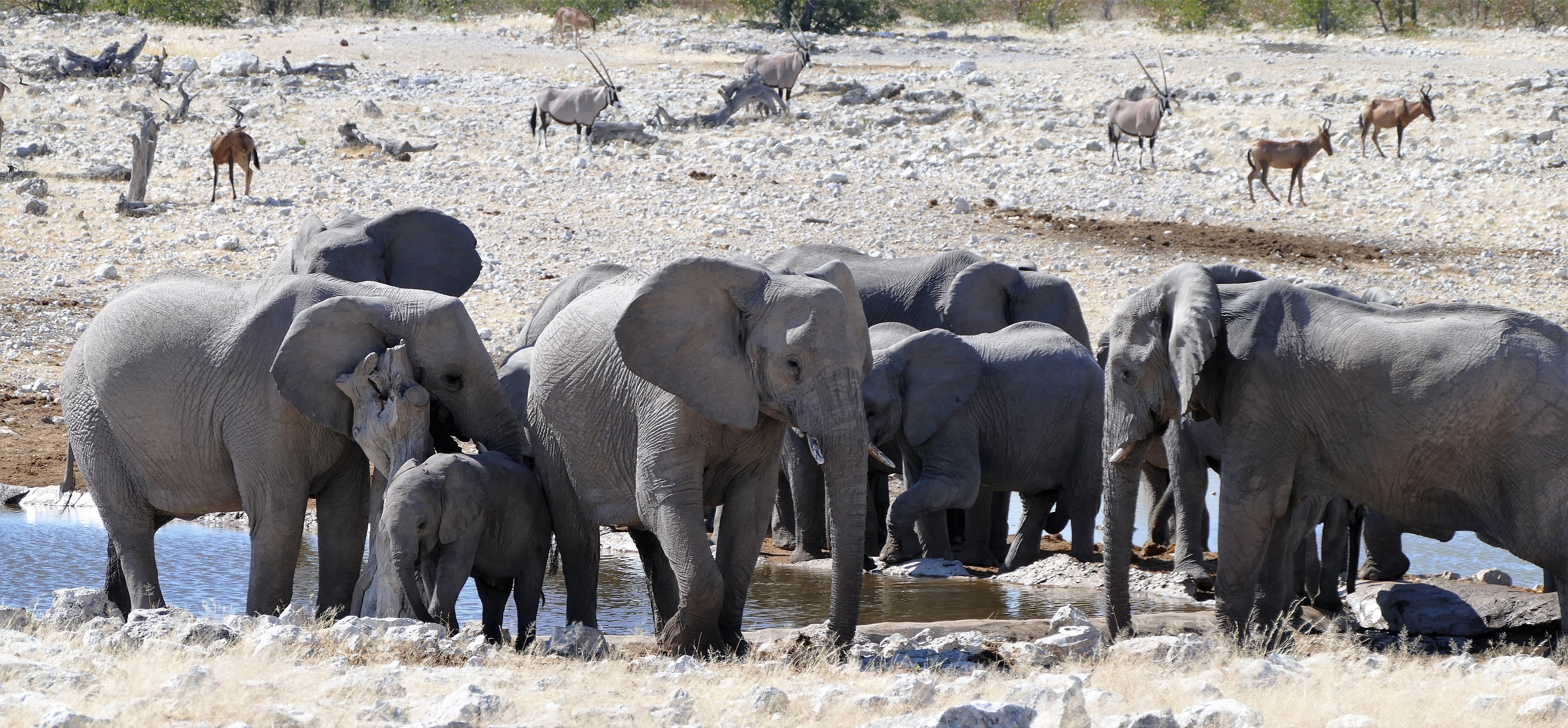
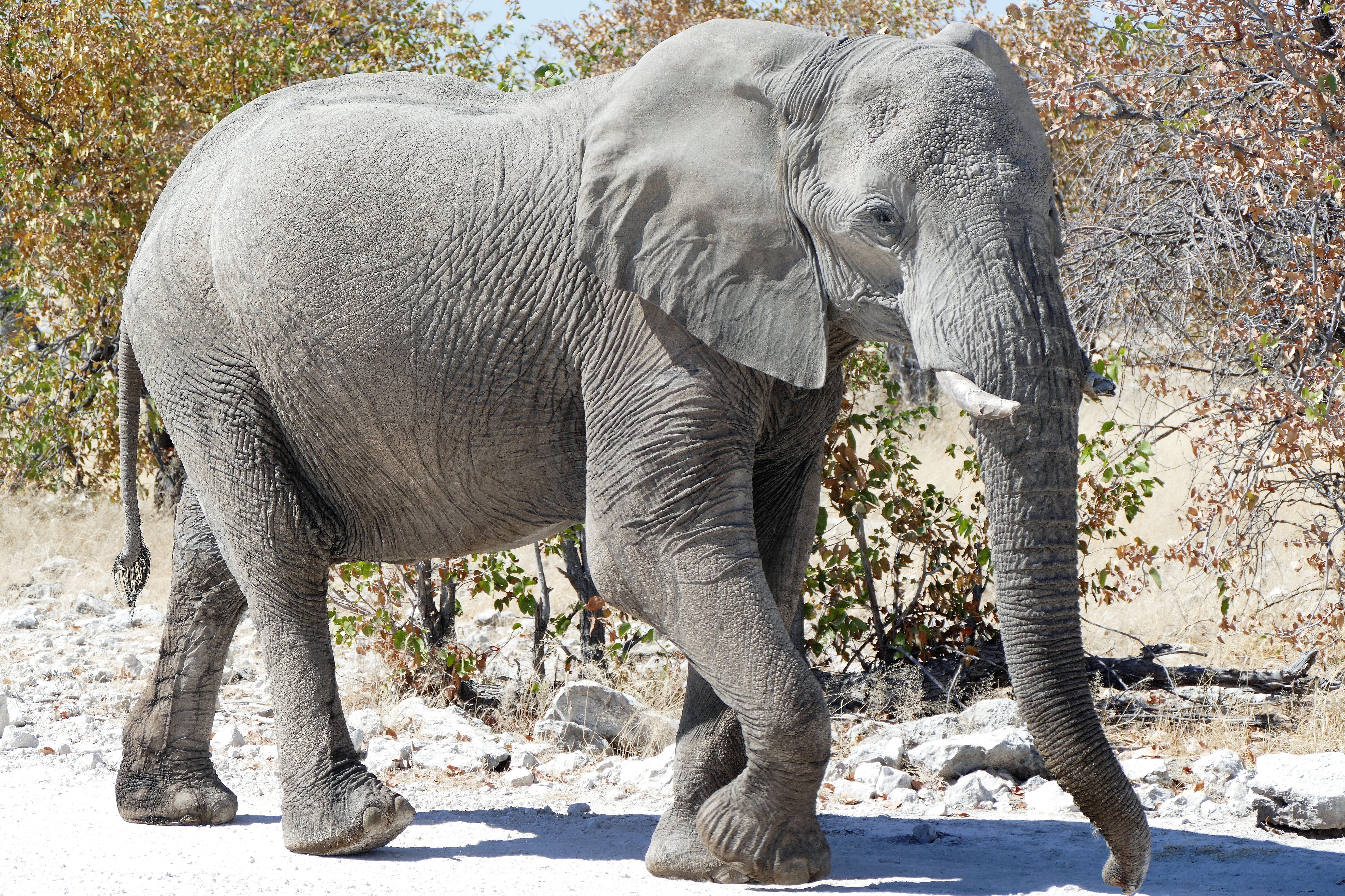
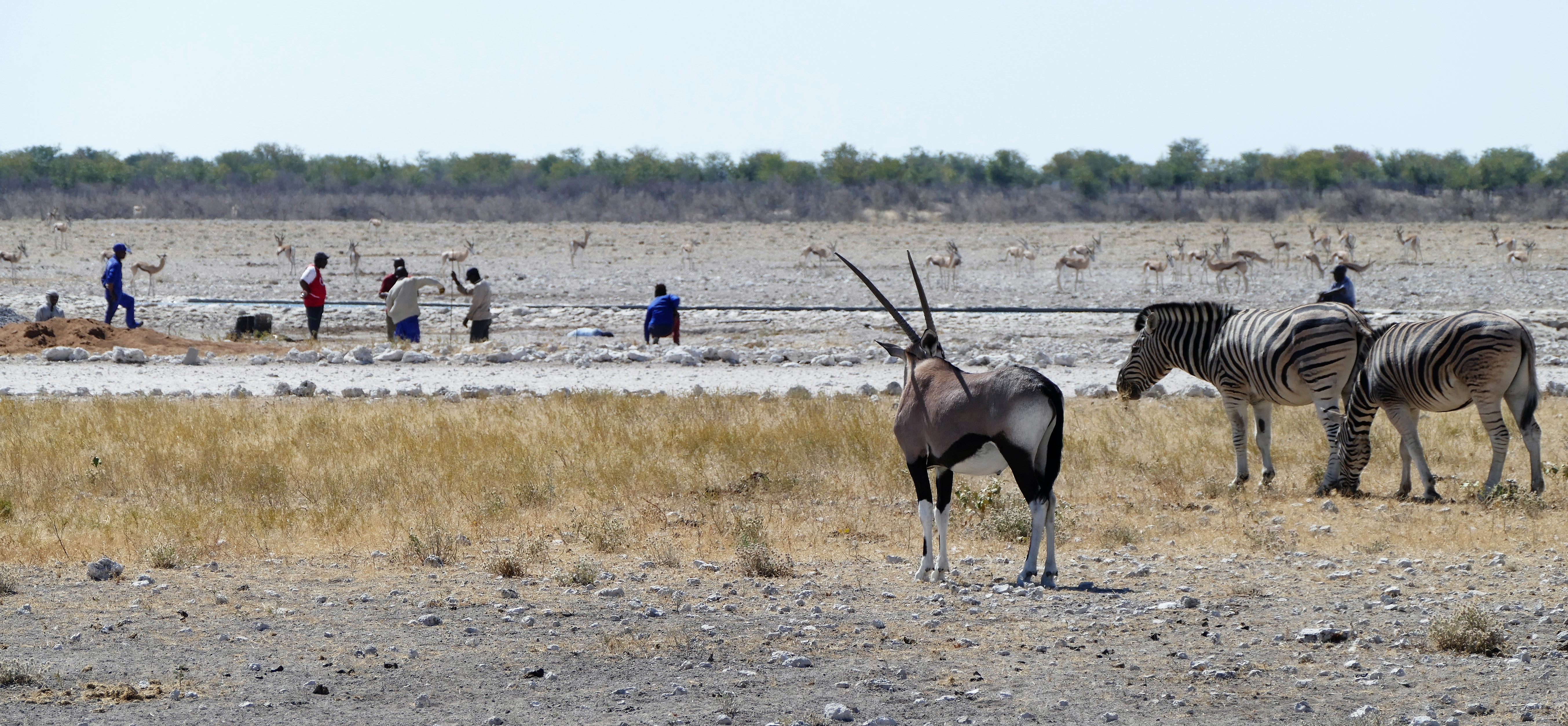
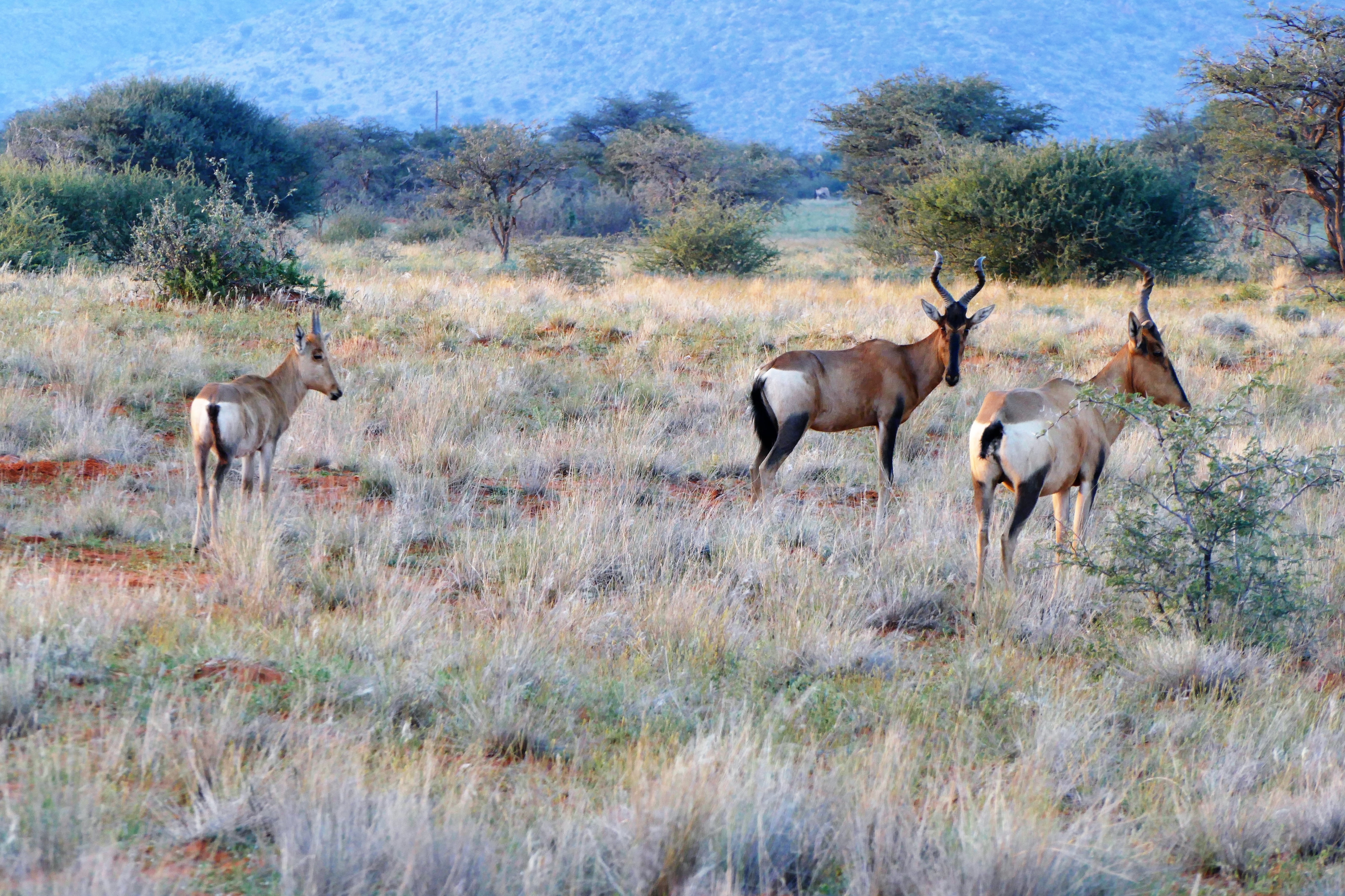
We drove to 4 different water holes. The first had various animals, arriving in groups to the water hole. There were groups of springbok, impala, zebra, and ostridge. We noticed that the animals were orderly in their waterhole activity. One group would come in together and leave as the next arrived. The second water hole had second many zebra. The third water hole was being repaired by a group of men. The water holes were kept filled by man-made pipes. There were over two hundred animals circled around that water hold waiting patiently for the men to make the water full it again. The fourth water hole had elephants. One elephant apparently had had enough of tourists and picked a medium sized rock with his trunk and tossed it towards our range rover. The lead elephant stared us down. There were around 2000 elephants in the park. We learned that the males leave mothers sooner than the females. They flap their ears to cool themselves and sleep standing up. They may live 60-65 years. When leaving, the park staff sprayed the wheels with disinfectant for hoof and mouth disease.
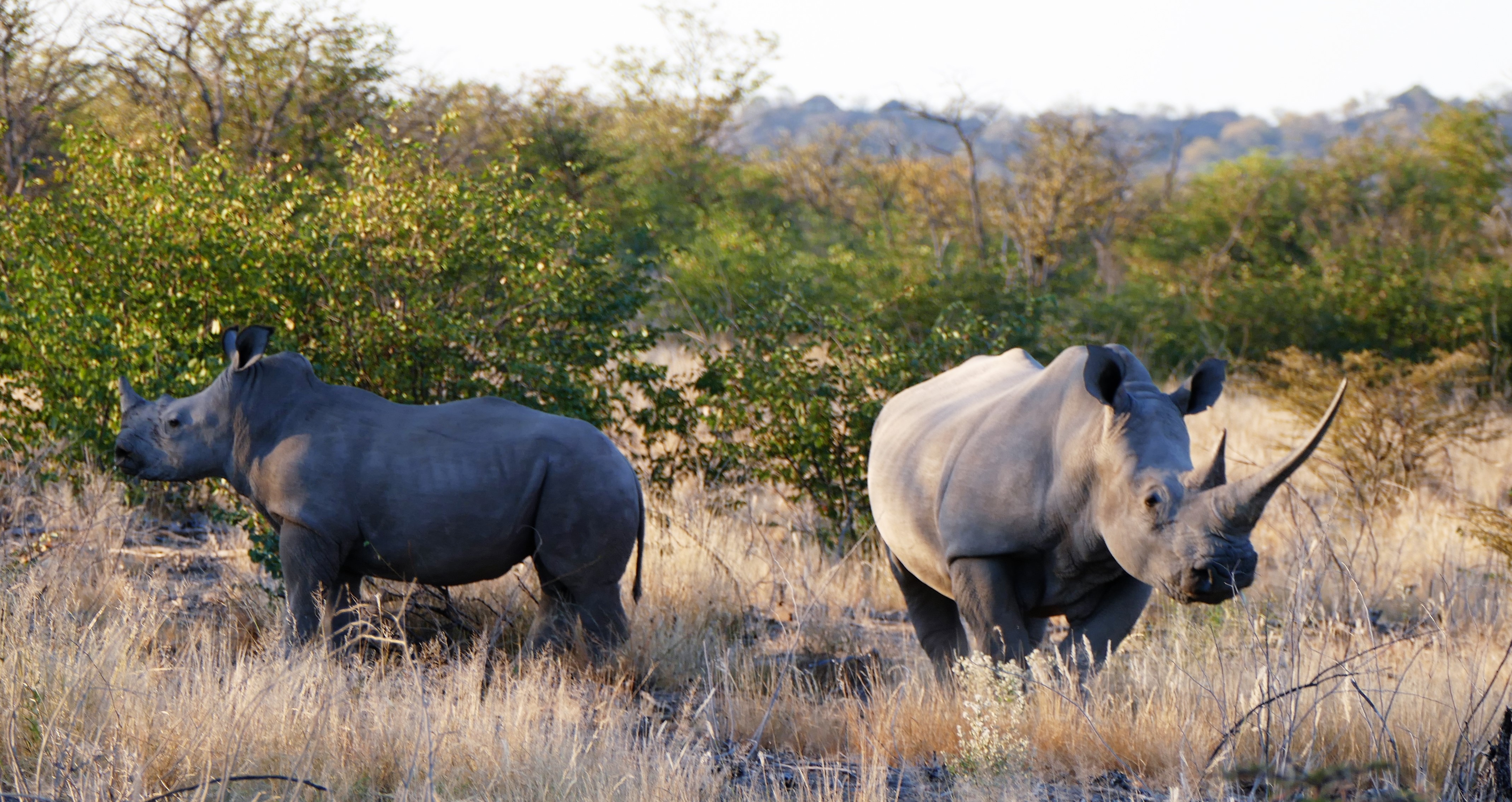
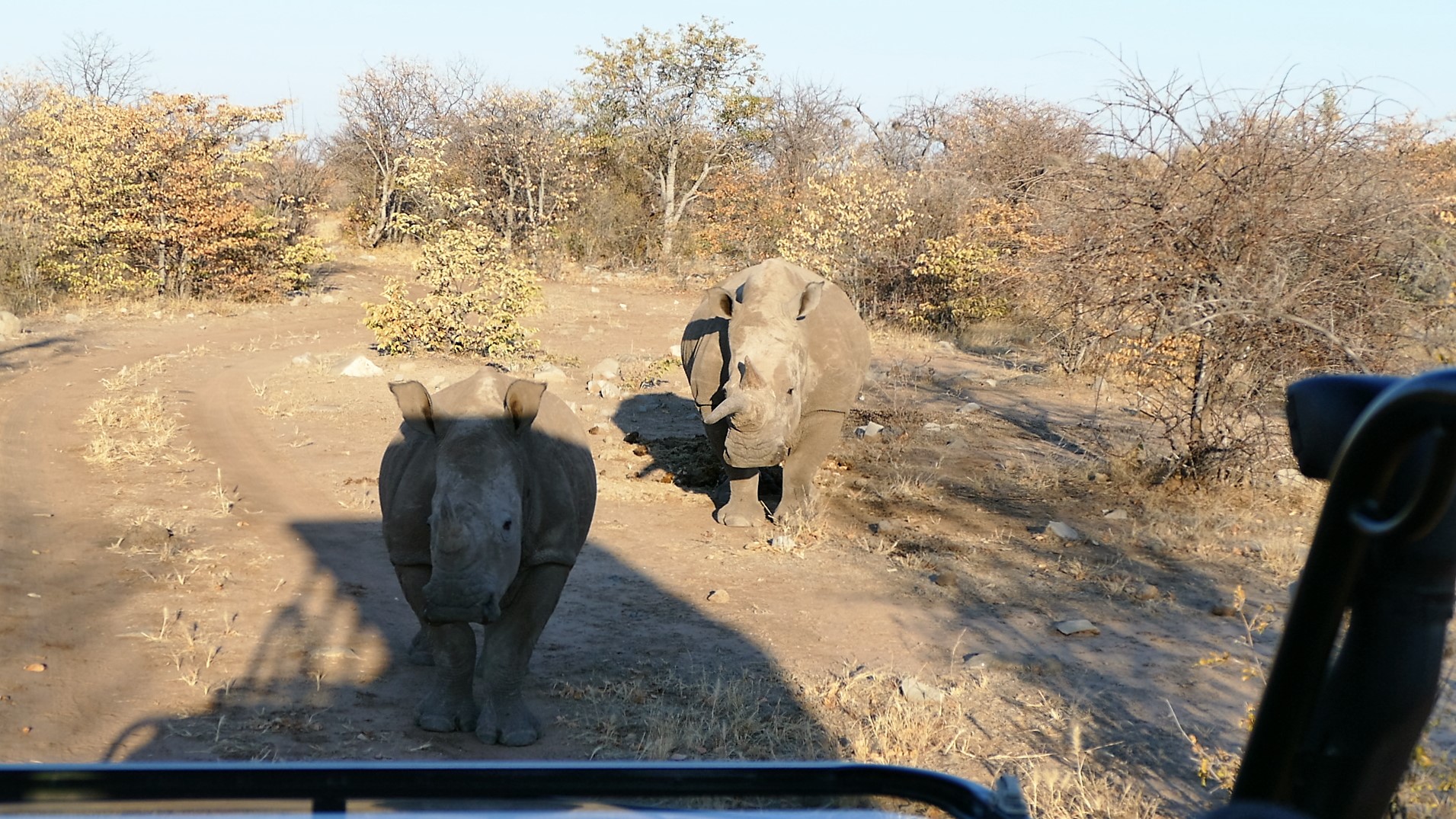
While at lunch back at the camp, there were several water bucks at the watering hole. One male appeared to be focused on getting “tail” from a female, although the female repeatedly turned around refusing his advances. During a sunset drive in the game reserve, we found a mother and daughter rhino walking on the road up to our truck to get a better look at the vehicle and us. White rhinos have 3 humps and stay in front of their babies while black rhinos have smooth backs and stay behind their babies. To discourage poaching, the population of rhinos in the park is not released to the public. The poachers are more interested in the black rhino. It was dark after we returned, and because we could not walk out of our tent unattended, we just had to wait for an escort. The escort was late retrieving us and we wondered what we would do to get to dinner if he forgot. We figured that eventually someone would miss us at dinner. The escort finally came and dinner was fine.

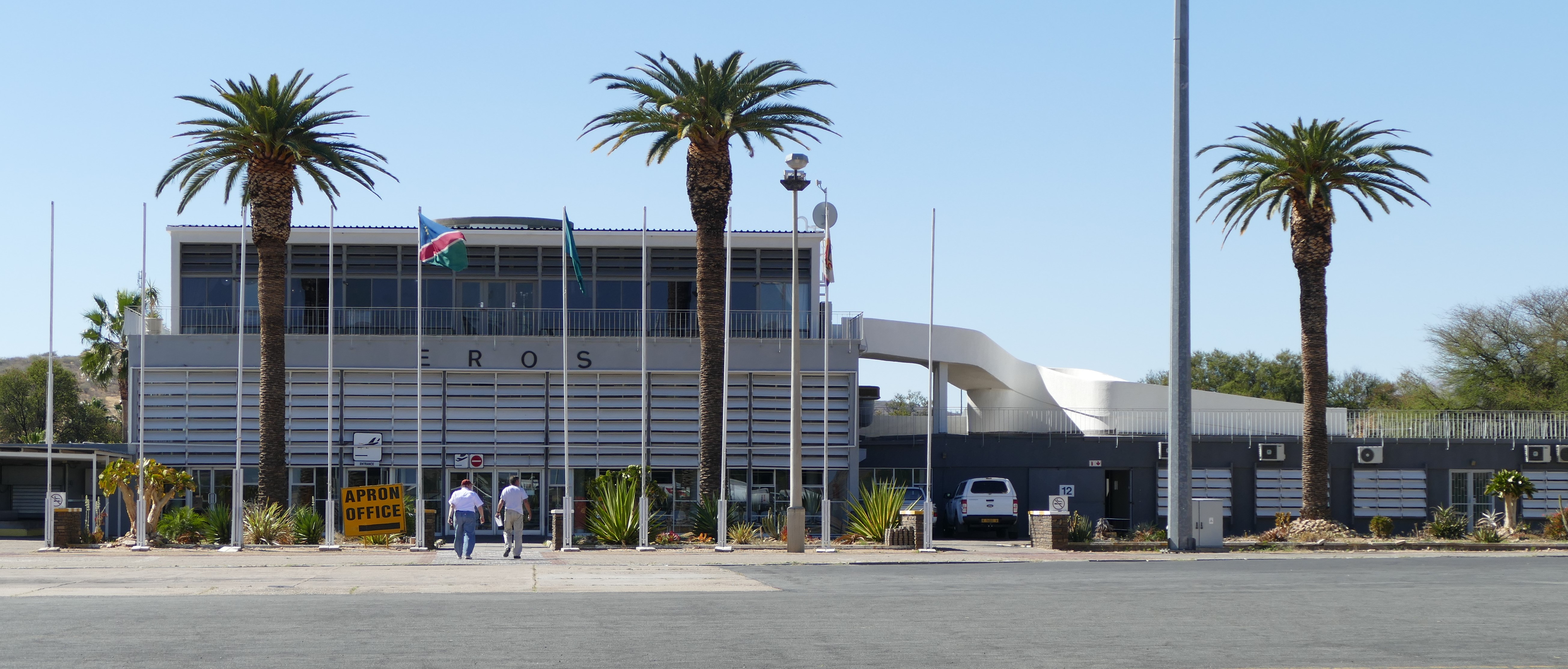
Leg 10 - Ongava (FYNG) to Windhoek Eros (FYWE)
Leg 11 - Windhoek Eros (FYWE to
Kalahari Game Reserve (FYKE)

5/20/16: Windhoek
The flight for leg #10 from Ongava to Windhoek Eros Airport required more preparation because Windhoek was a complicated airspace with several frequency changes needed. Flight uniforms were worn because Eros was a busy, well secured airport. I was the first in the air and I opened the flight plans for all 3 airplanes with Windhoek Area North. We had clear skies and unlimited visibility for the 1 hour 45 minute flight. Approach involved position reporting in FYD-130, the Windhoek Flying Training Area, and contacting Windhoek Approach. Eros was a busy tower controlled airport. The Windhoek-Eros aerodrome diagram is available by searching for “FYWE airport aerodrome.. After landing, fuel trucks topped off our tanks and the fuel uptake was recorded in the flight folio. We ate lunch at the Skyview Restaurant in the airport terminal, a nice break. I asked for a sandwich and the waitress told me they only served them for breakfast. I settled on a salad.
The flight for leg #11 from Eros to Kalahari Game Reserve required a rapid climb to get over the U-shaped mountains that surrounded Windhoek to the east, south, and west. Weather continued to be clear with unlimited visibility on the 2 hour 20 minute flight. The landing was landing because the gravel, sand and grass landing strip at the Kalahari Game Reserve only was only 40 feet wide. It was the most bushy of all the bush air strips, requiring a high altitude, soft field and precision short field landing techniques. No one had landed at this strip for the previous 6 months.


5/21/16: Kalahari
After breakfast, our guide David drove us for 5 hours into the Kalahari Game
Lodge Lion Reserve. Four of the male lions were tagged, so their approximate
location was known at 630 AM from satellite. While on the drive, a directional
antenna was used to track their actual location. We came upon two male and one
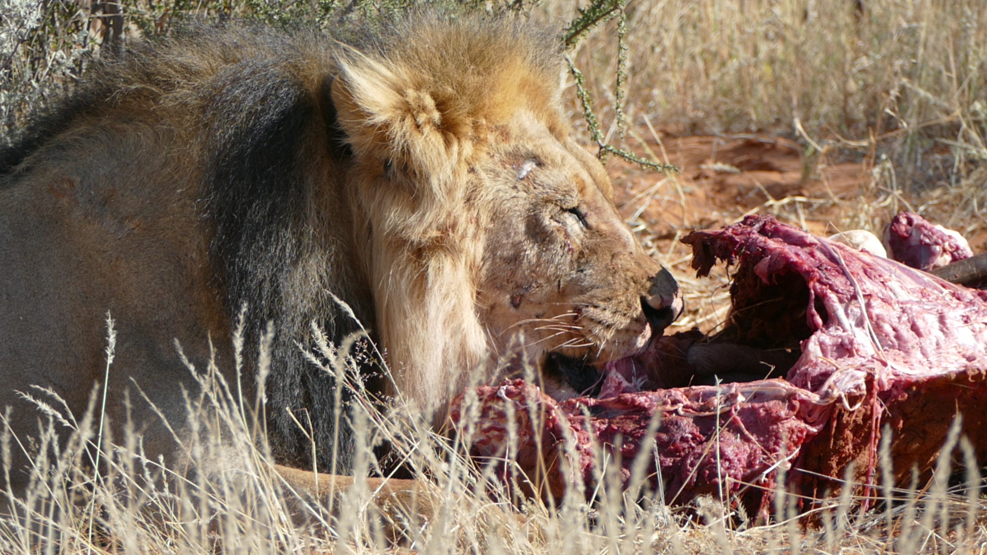
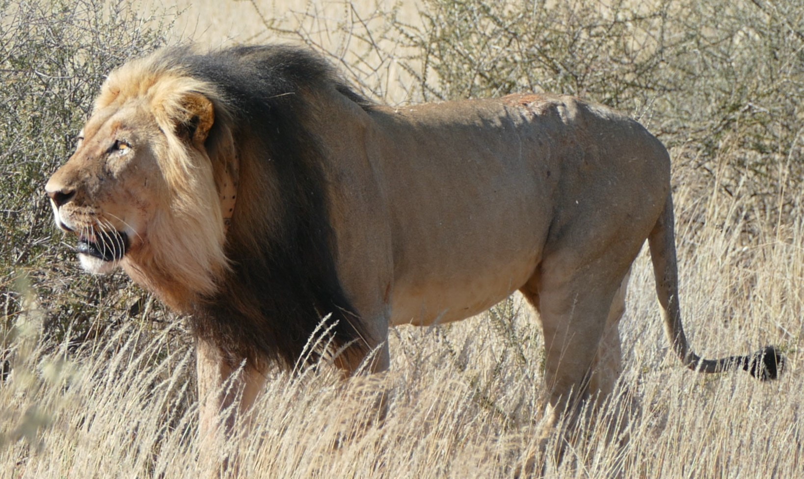
female lion lying by a partially eaten onyx. The older lion walked over and
helped himself to the leftovers. At another location, we found one young male
and some female lions with two cubs, sleeping under the bushes. The young male
lion had a reputation for chasing the trucks, but he did not follow us very far.
We were told that they could not get permits to swap lions with other reserves.
David relayed a story about taking 2 guests out the day before us. One of the
cubs played too rough with his mom and she swiped at him and angrily got up and
walked over to the land rover circling the van. He couldn't back the Land Rover
away quickly because he was pointing downward on a dune. The other lions
started to follow her and there were a few panicky moments for everyone.
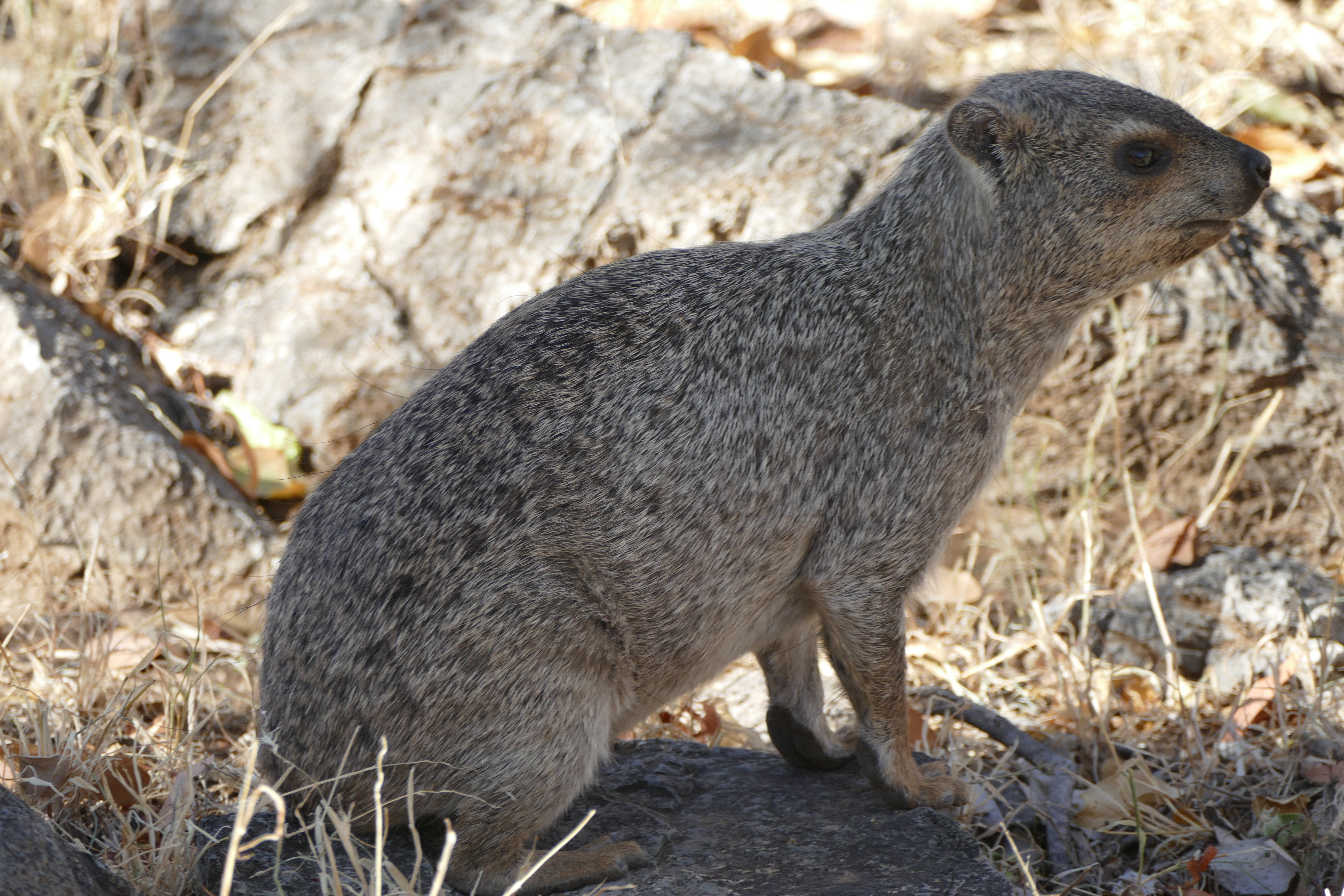
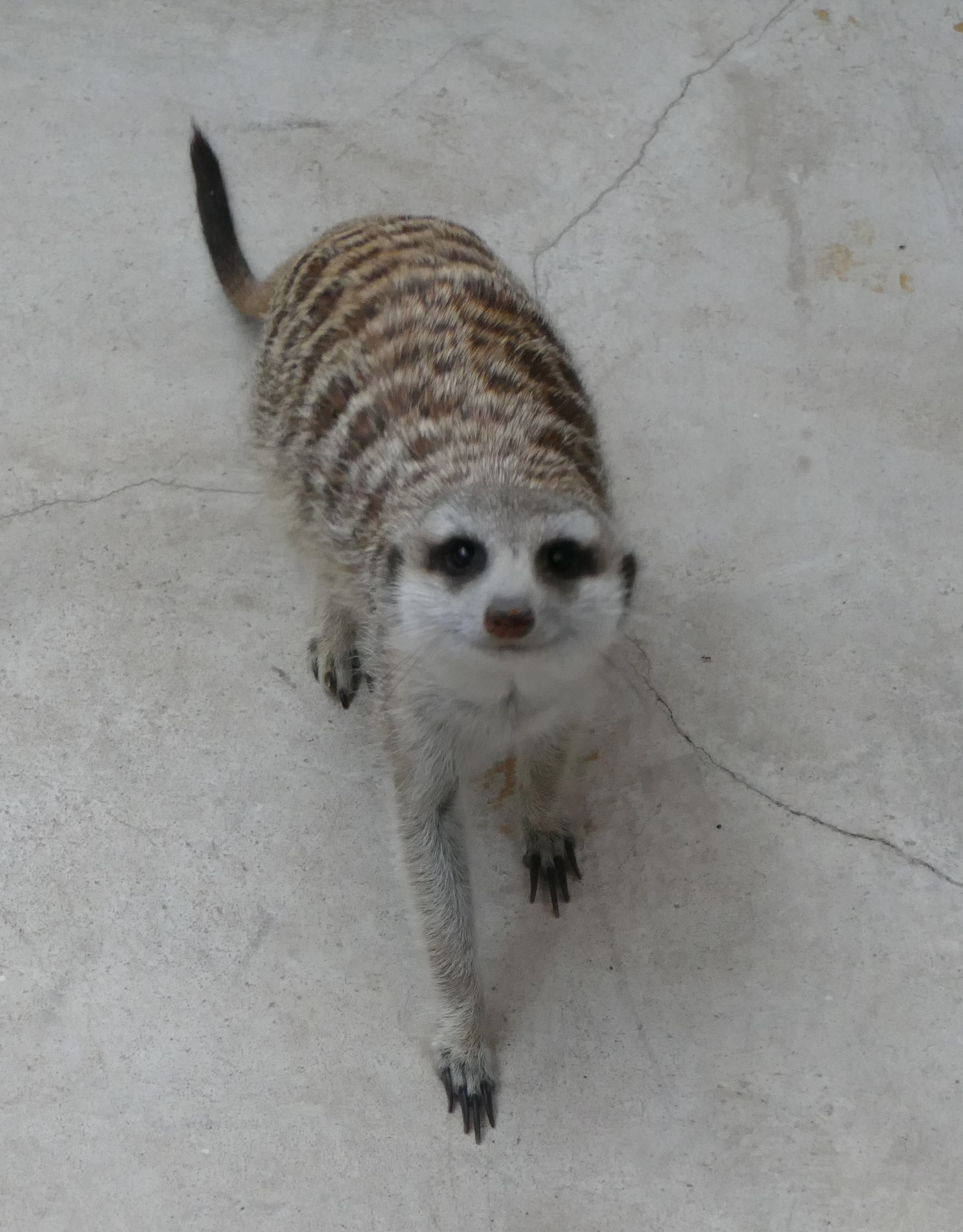
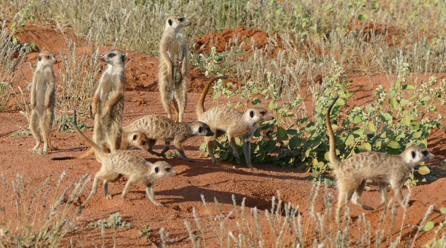
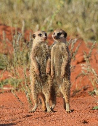
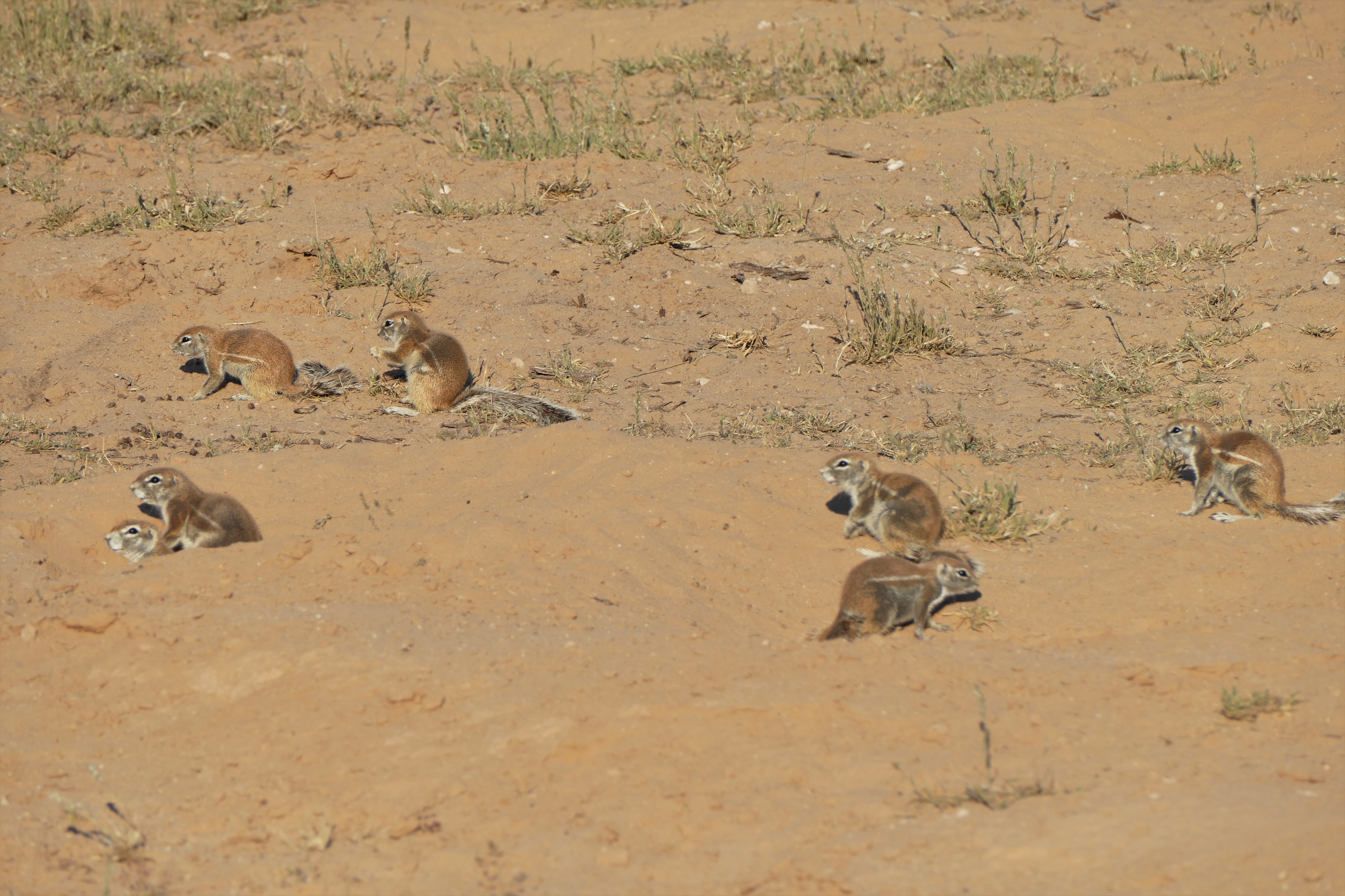
I was told that there was a meerkat family on the lodge grounds. I found the holes of their nest a short walk from our chalet. I was told that they would be out around 430 PM, when it was no longer hot. I found and photographed 3 large squirrels, that I later learned from our Tswalu guide were ground squirrels, but were called in Afrikaans what translated to fan tailed meerkats. Liz and I walked to the top of a sand dune hill were there was a lookout platform where I photographed the sunset and moonrise. I later asked David about the meerkats and he said they go out to hunt as sunrise.
Leg 12 - Kalahari Game Lodge (FYKE) to Keetmanshoop (FYKT)
Leg 13 - Keetmanshoop (FYKT) to Upington (FAUP)
Leg 14 - Upington (FAUP) to Tswalu (FATW)

5/22/16: Border Crossing to South Africa
David then told me that the meerkats came out after the sun hit the holes that were the entrance of their burrows. By 730 AM, only the ground squirrels were outside their nests. Our Tswalu guide said that ground squirrels could live with meerkats together in their burrows because they ate different things. The squirrels were skittish, and then went back underground when I came closer than 15 feet.
This was another flight uniform day with landings at 2 international airports.
Louis rechecked my oil for me. It was important to keep the airplane level as
possible when checking oil, and we added another quart. We used the oil valve
that I brought with me from the States. Louis liked it and I gave it to him.
Even thought this was a day with 3 flights with at least 1 hour stops at 2
international airports, we had to leave a lot later than we would have liked.
We were told not to arrive in Keetmanshoop Airport before 11 am because everyone
in Keetmanshoop goes to church on Sunday morning. Well, it's Africa! Things are
not always as expected, resources may not be available. Patience is required,
good humor is helpful, and being prepared for anything is a necessity. It's
Africa!
We departed from the Kalahari Game Lodge on leg #12 and flew 1 hour under clear skies to Keetmanshoop. During the flight, I photographed Louis’s Cessna 220 as he passed me. Again, this international airport had no tower controller. After landing, we met with customs for an exit stamp for our passport out of Namibia. I was asked, "What are you taking out of Namibia?" I told the customs agent some carvings and little baskets. She seemed satisfied. After a little wait, we got extra fuel hand pumped in from a barrel.
We then flew a 1 hour 40 minute hour leg #13 in clear skies over the border to Upington Airport. Before we could exit the airplane they sprayed the interior with disinfectant. We had to check with customs and get another tourist visa stamped into our passports for entry back into South Africa. We were then permitted to top off our tanks with fuel.
A third 40 minute leg #14, again in clear skies, was flown to Tswalu which featured a paved, asphalt runway. We arrived at 4:00 pm, about an hour before sunset.
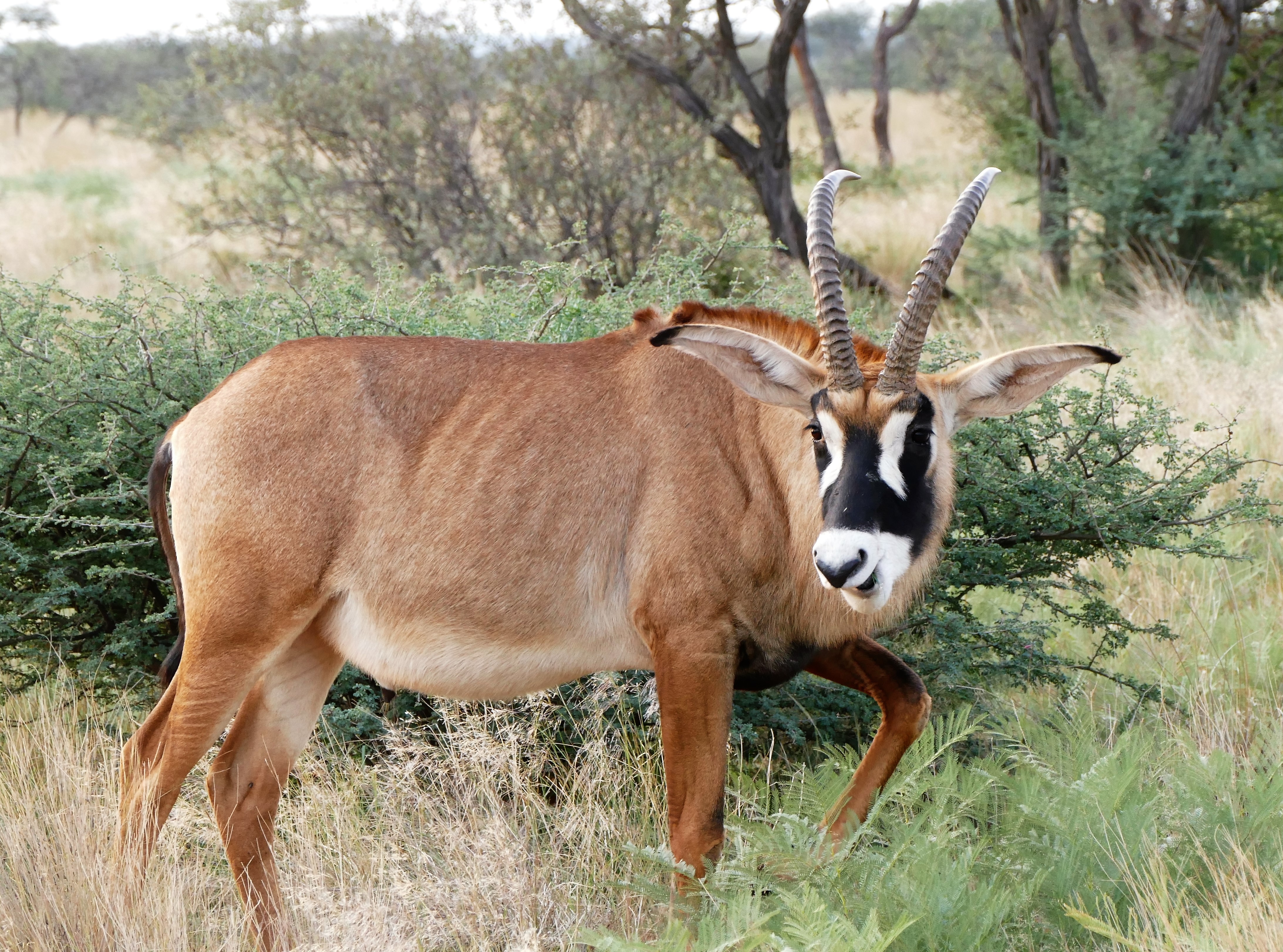
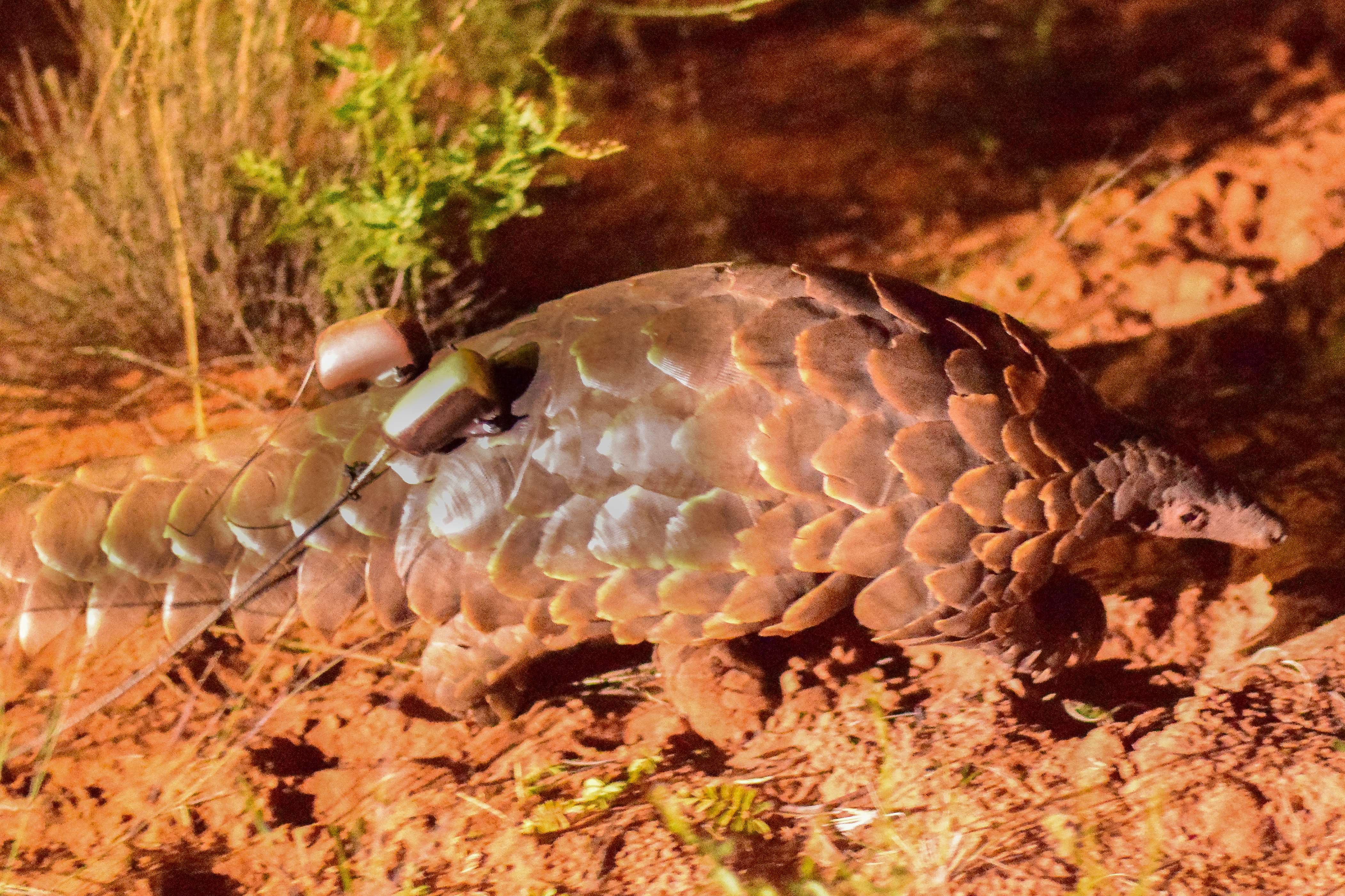
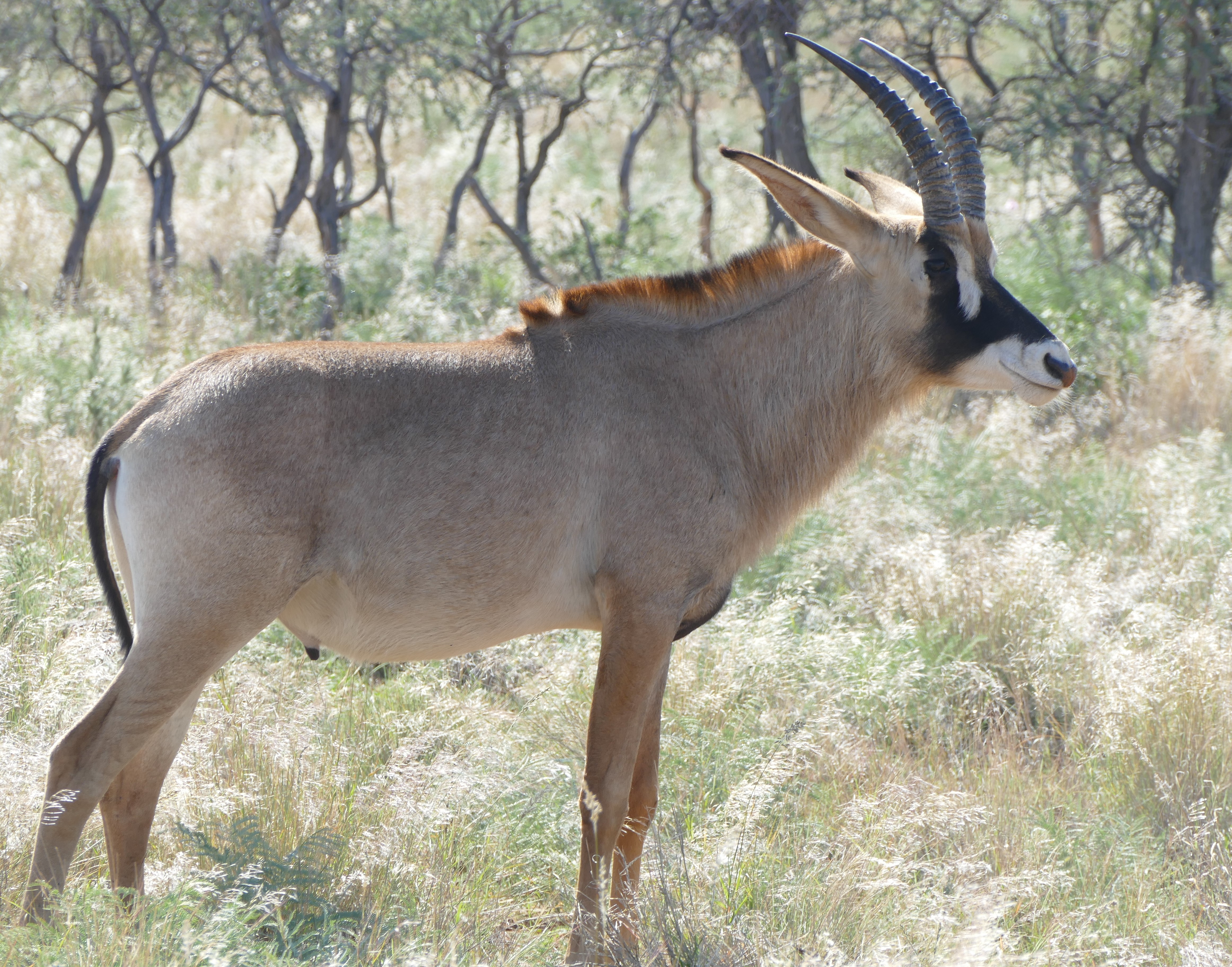
At Tswalu, we were met by Marielis, our guide, and James, our tracker. We did a slow drive back to the lodge, looking for animals. Our guide got a radio call about a pangolin sighting, and we drove to it as the sun set. The pangolin is an unusual mammal, with external scales that look like a reptile. It was dark, so lights were shined on it so we could take photographs. The pangolin apparently did not like the attention, and scooted away in a hurry. We also saw a roan antelope, which is slightly larger than an oryx. White markings on the face reflect the sun while the black markings help with panting and cooling down. It's called a correlated reset system.
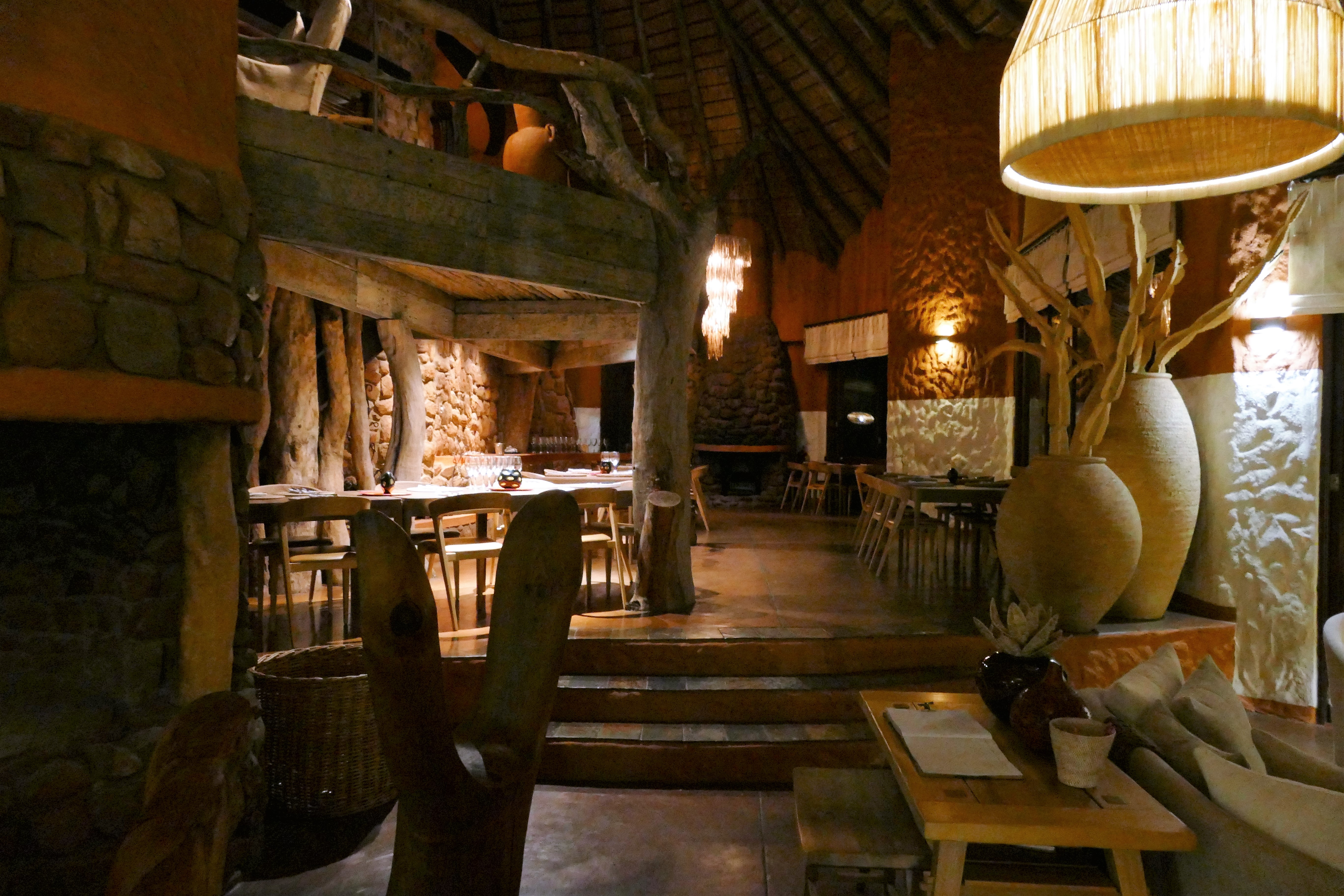
We arrived at the Motse Lodge to find it was a 5 star hotel, which can accommodate up to 24 guests. Our lagaes (suite) was elegant and expensively appointed. Dinner was served outside, our meal was barely illuminated by gas lanterns. It was spicy and tasty. We ate under the African night sky.


5/23/16: Meerkats & tracking cheetah
Our guide gave us a wakeup call at 600 AM, then breakfast at 630 AM, for a game drive at 715 AM. We looked for cheetah tracks. Cheetah tracks show their nails but lion and leopard do not. After finding tracks, the tracker left on foot. We stopped to look at meerkats who were habituated to humans. We could walk as close as 3 meters and they were not bothered. The meerkats were frantically running around, stopping frequently to stand up and look around. Our guide said it was a meerkat war. They were trying to scare off a meerkat from another colony who entered their territory. They eventually scampered off to forage for food. We found our tracker, who said the cheetahs were circling, which made the tracks confusing. We drove to an a building on a hill and were served brunch with a view.
Tracker sits in chair on the Land Rover's hood
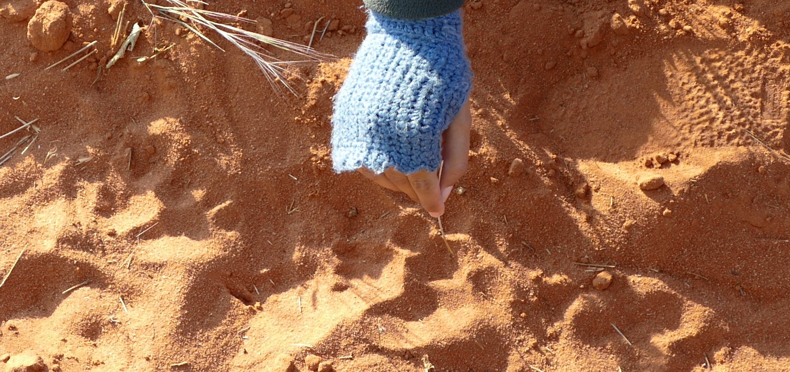
Cheetah tracks, you can tell by the claws
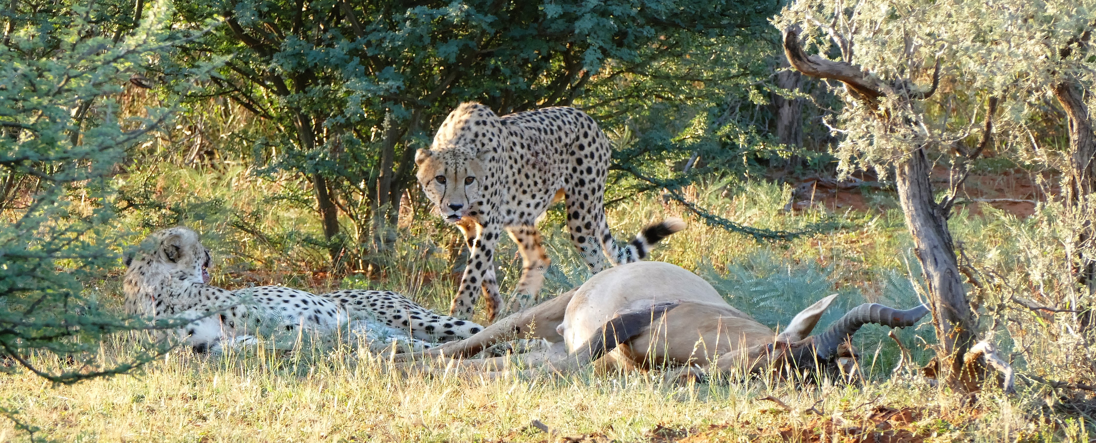
Cheetah's enjoying their kill

At Tswalu, there is an early afternoon break because the animals sleep then. It could be dangerous to startle a sleeping animal. After high tea at 330 PM, we resumed our search for the cheetah. Our tracker found its tracks in the sand of the road, and found where the cheetah turned into the block, an area in the bush bounded by roads. Our guide asked if we wanted to continue the tracking on foot, and we enthusiastically agreed. Our guide armed herself with a rifle and gave us instructions to follow single file. After walking about 10 minutes, our tracker noticed that there was more space between the cheetah tracks indicating that they were running. There were also tracks of a hartebeest also running. Our tracker thought that the cheetahs were chasing the hartebeest for a kill. After another 5 minutes of walking, we saw one of the cheetahs in front of a bush, with the dead hartebeest. After taking some photos, our tracker picked us up with the Land Rover so we could get a closer look. The cheetah's brother joined in their dinner. The cheetah rest 20 minutes after the kill to cool down before they start to eat. They drag their kill into a tree to ward off hyenas and jackals, who want to finish what the cheetah doesn't eat. Vultures arrive in the afternoon when they smell the dead animal and can catch the thermals.
We tried to find leopard but they are elusive - bigger than the cheetah and the cheetah are afraid of them. There was a wild dog pack that recently died off because of canine distemper. Otherwise we saw eland, fox, sable, mongoose and many new birds.
5/24/16: Tswalu
The morning game drive started with tracking for lion, but we heard that the lion went over the mountain. We then looked for various birds, first at a water hole, then while driving. Before lunch, an oryx walked between our lagaes and the next, and got stuck by a wall on the main path. A staff member reassured us that it happens all the time and they only intervene when it's a more critical situation.
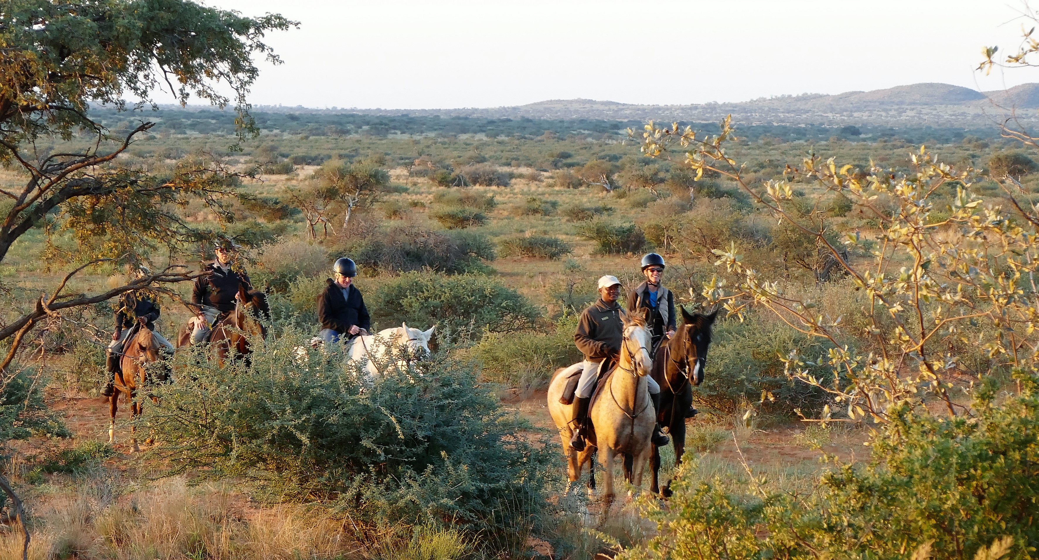
During the afternoon, I was able to ride a horse. Their weight limit was 100 kg,
but our guide was able to arrange with the stable manager a horse appropriate
for my size. At the stables, chaps were put over my legs, and I was given a
riding hat. Horses were led out, and my horse, Lex, was significantly larger
than the others. Lex was of the Shire breed. The horses walked a slow and
leisurely pace, up a gradual slope for an hour, then circling back. On the way,
we were met by our guide and the rest of the flight crews for a sunset drink.
Dinner that evening was barbecued game meat.
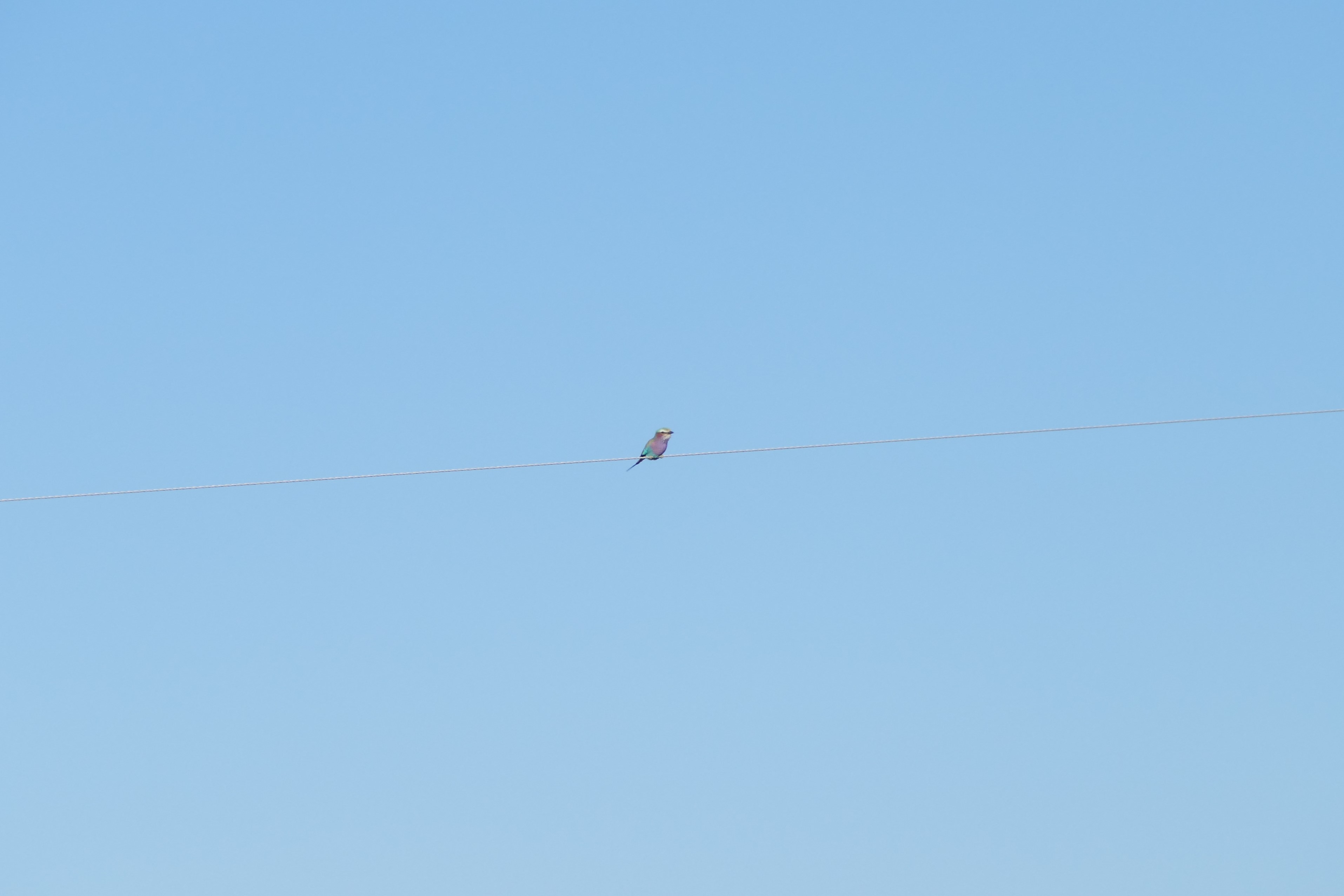

5/19 to 5/24/16: Birding
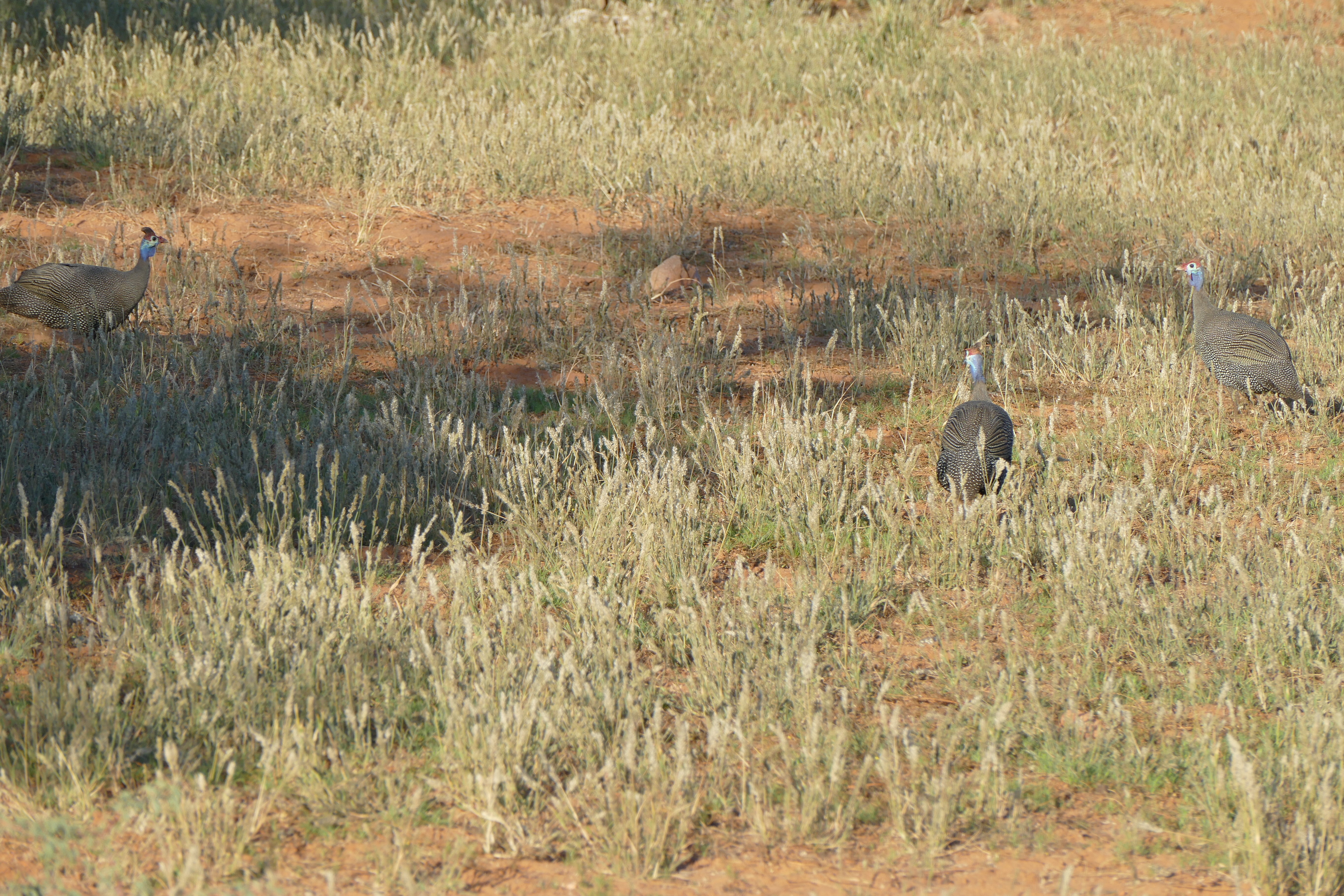
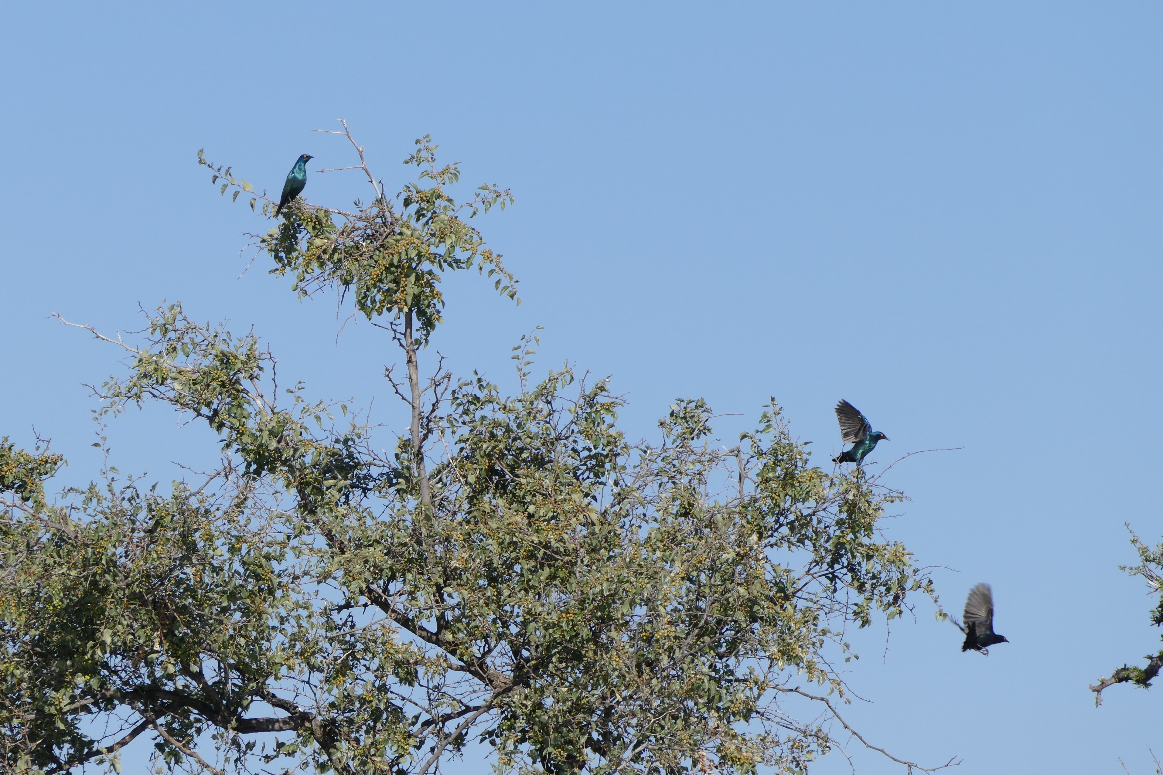
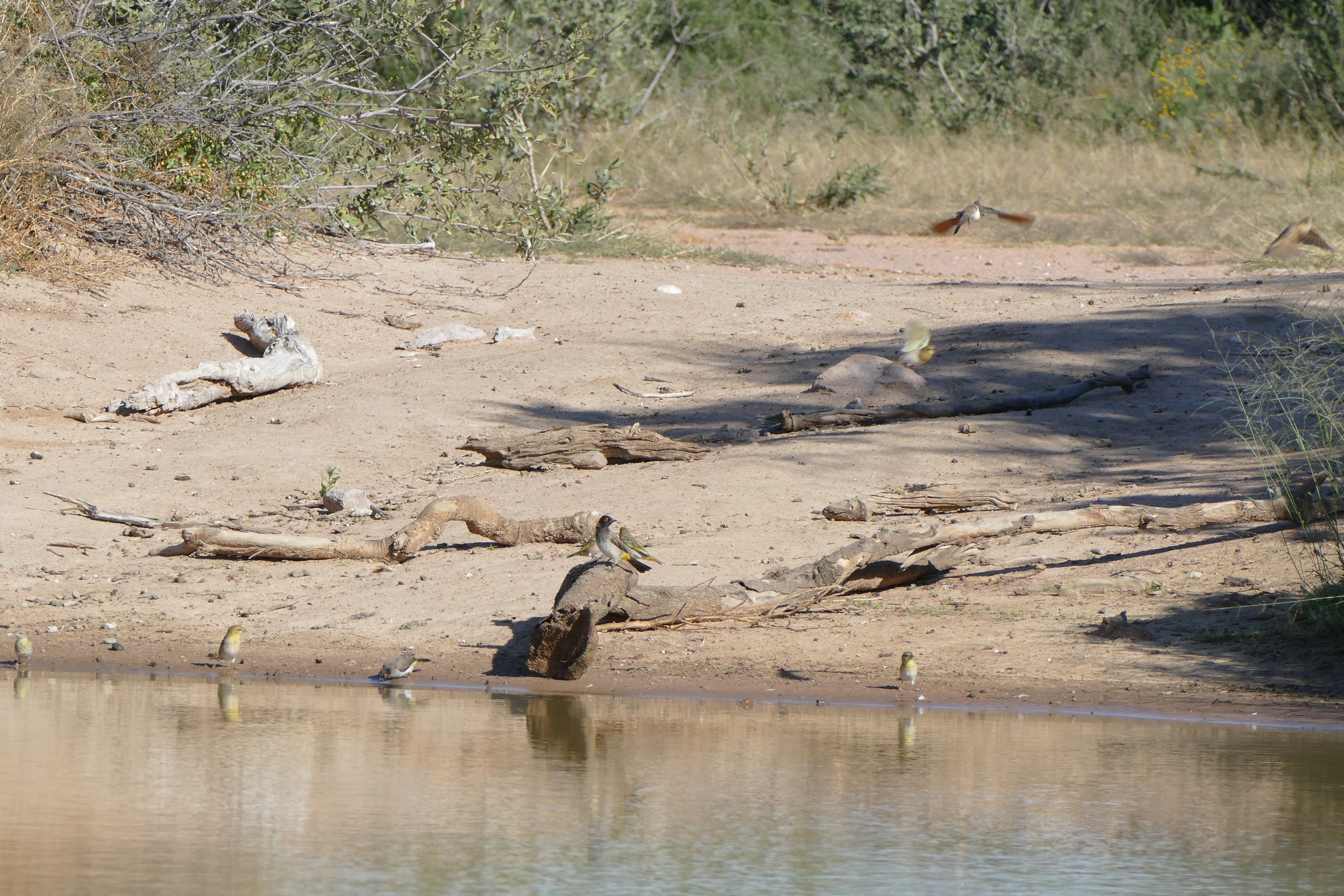
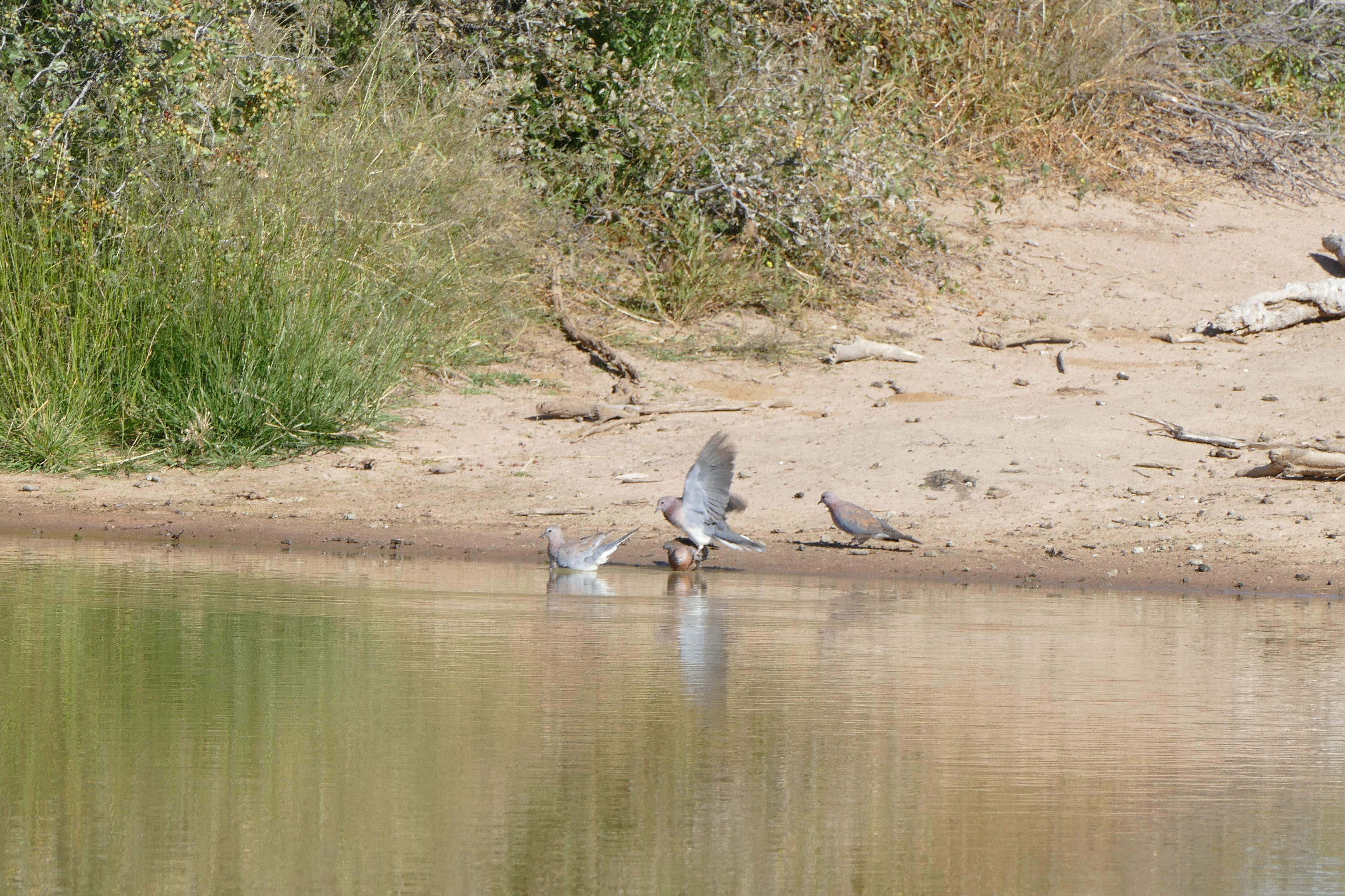
Karie had a great love of bird, and we often stopped on game drives to see various birds that were barely visible on trees some distance from the road. After I learned to use the spot focus on my camera, I was able to zoom in and photograph some off the birds. I eventually used the burst mode to try to catch some birds in flight.
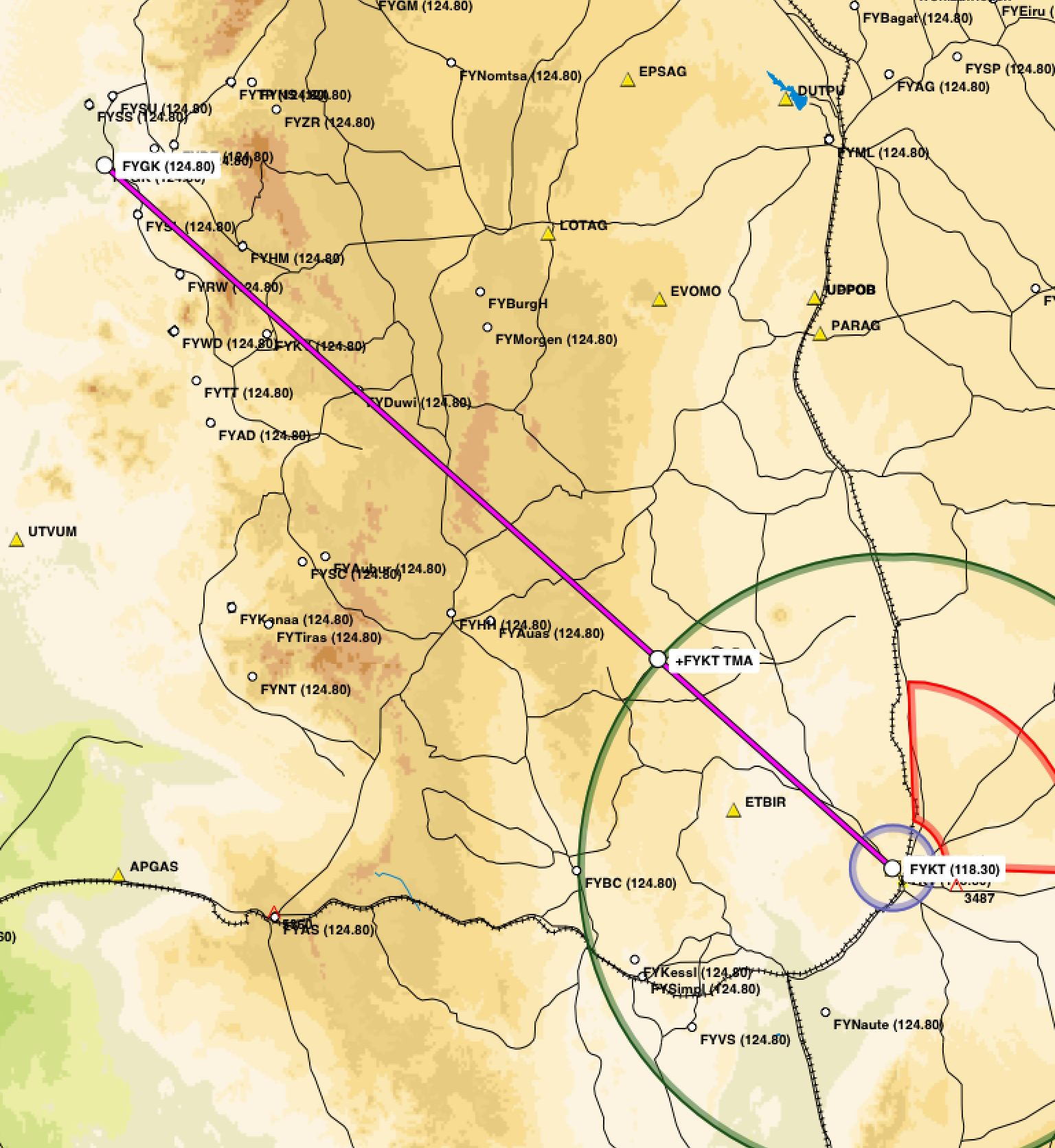
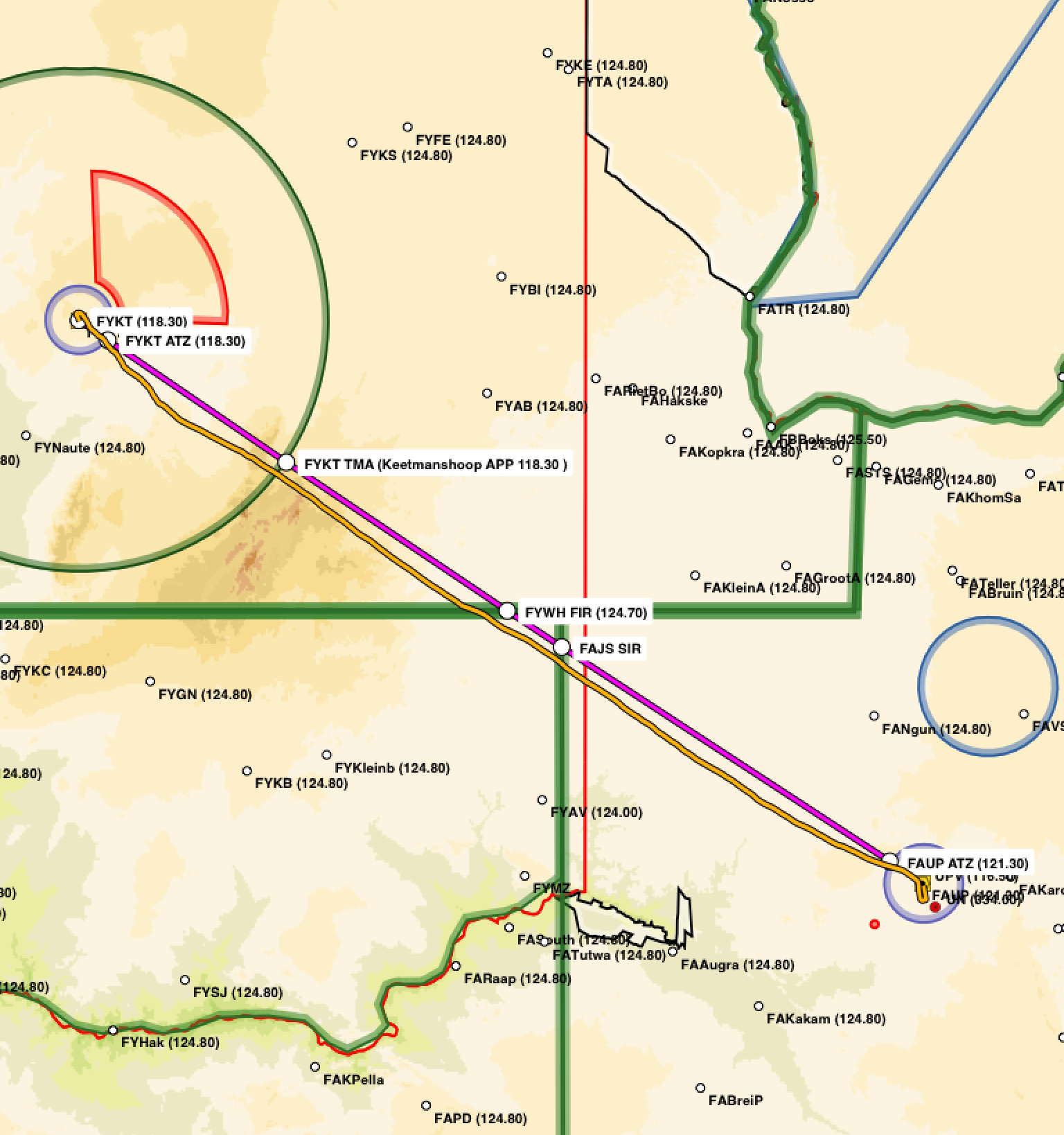
Leg 15 - FAUP to FALA flight plan and path
Tswalu guilde and tracker with flight crews
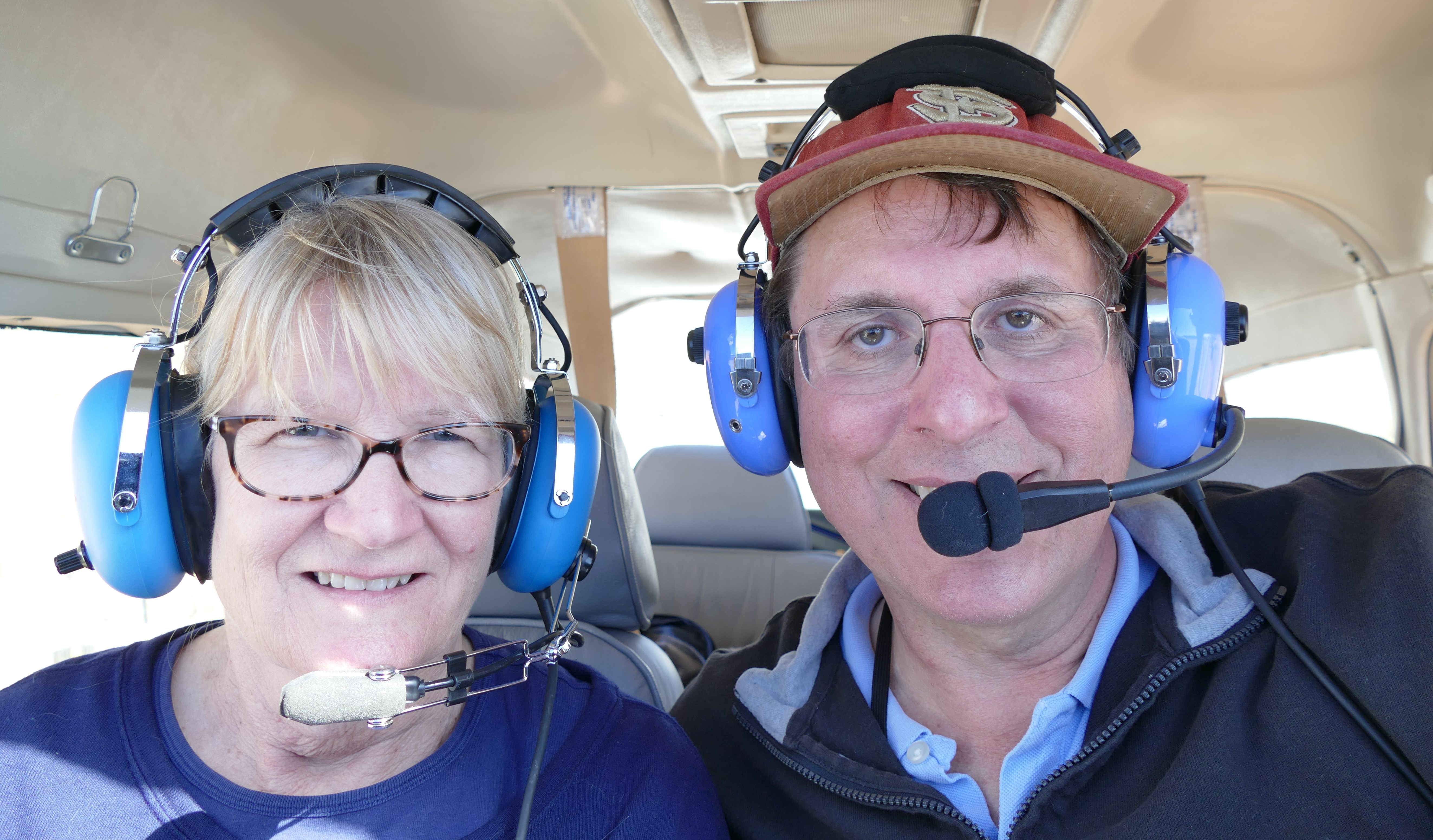
Liz ("the crew") & Harry ("the pilot")
5/25/16: Return to Lanseria
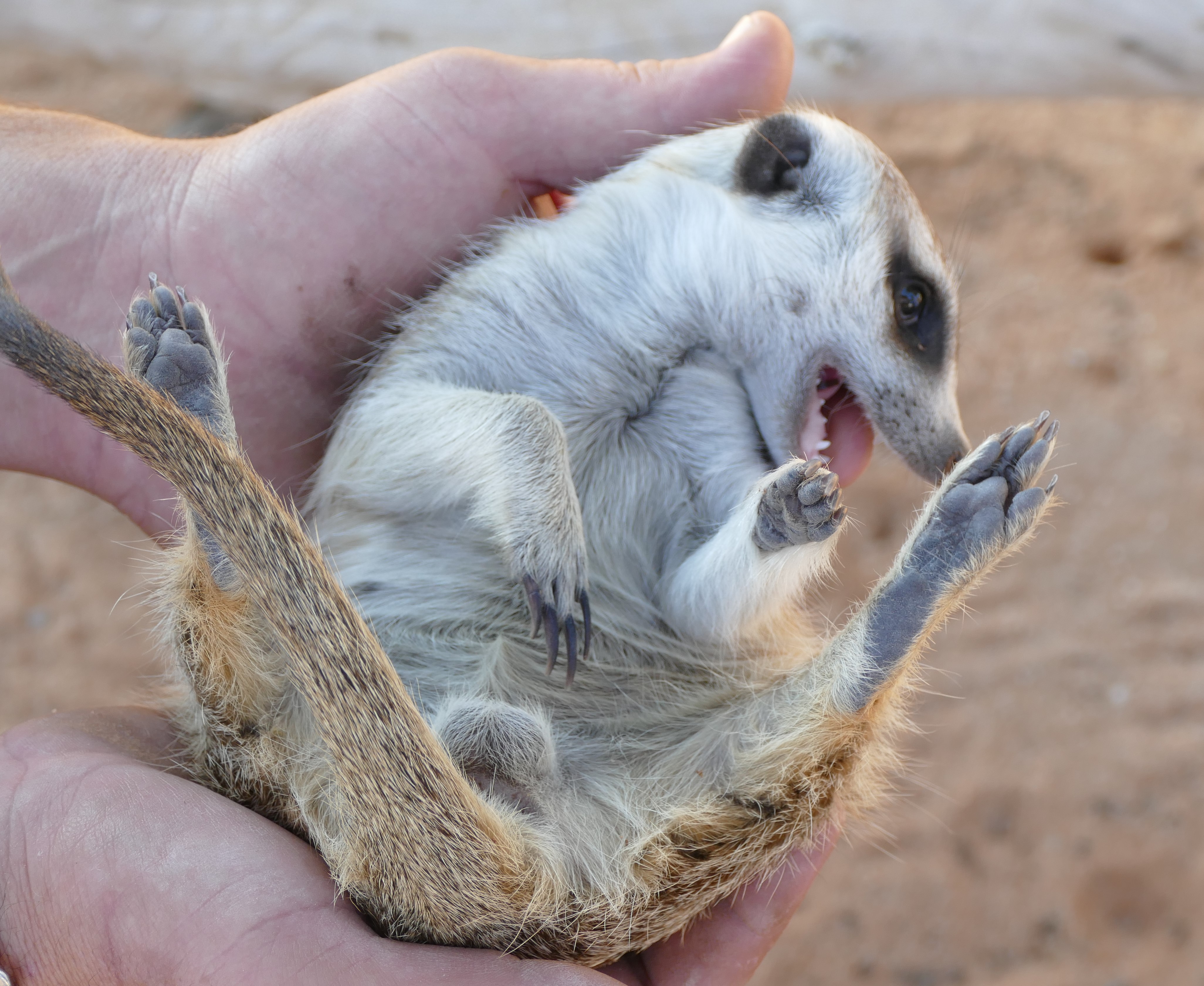
Karie stayed behind at the lodge for a massage, while the rest of us set out on a game drive. I wanted to see the meerkats again, and we found them digging for insects, their food. Our guide was able to get a picture of myself with a meerkat, a female that our guide knew personally as calm around people. The meerkat actually ignored me, even though I was trying to make sounds to get her to stand. We then found the cheetahs we saw yesterday, and drove into the lion area but learned that the lions were too far away to make it there and to the air strip in time for our planned departure. We spent time by a lake watching the birds, then on to the air strip.
We are given tasty bagged lunches and take pictures of ourselves before we
"saddle up" for our last flight in Africa.
Leg #15 back
to Lanseria was a 2 hour 50 minute under large scattered closed at flight level
090. The flight was bumpy, but otherwise uneventful. I felt good about my radio
work with Johannesburg Information. After announcing my position on Johannesburg
West Special Rules, I contacted Lanseria tower and reported the tracking
station, requesting joining and landing. Lanseria tower told me to not enter the
control zone, so I used the VFR approach procedure into Lanseria that Silke had
briefed me on. This involved a left turn after the tracking station toward the
Pelindaba nuclear power station until called. Tower called me to join the
circuit on a left downwind for runway 07, then cleared us for landing. . Nick and
Chris Hanks were waiting at the fueling bay and the airplanes were refueled. The
last entries were made in the flight folio and the reliable Cessna 182 that we
had flown for the past 30 hours was put back in the hanger.
We were put into the Southern Sun Montecasino in Fourways, where we had dinner and a final debrief discussion of the trip with the Hank's and other flight crews. Altogether, we had spent 15 days in the bush, flying through 2 countries to 6 destinations. We made 15 flights totally over 2,900 nautical miles and 30.6 Hobbs hours.
5/26/16: Soweto
Gookie picked us up around 930 for a tour of Johannesburg, the Apartheid Museum,
and the Kliptown area of Soweto. He gave us an inside look at the corruption in
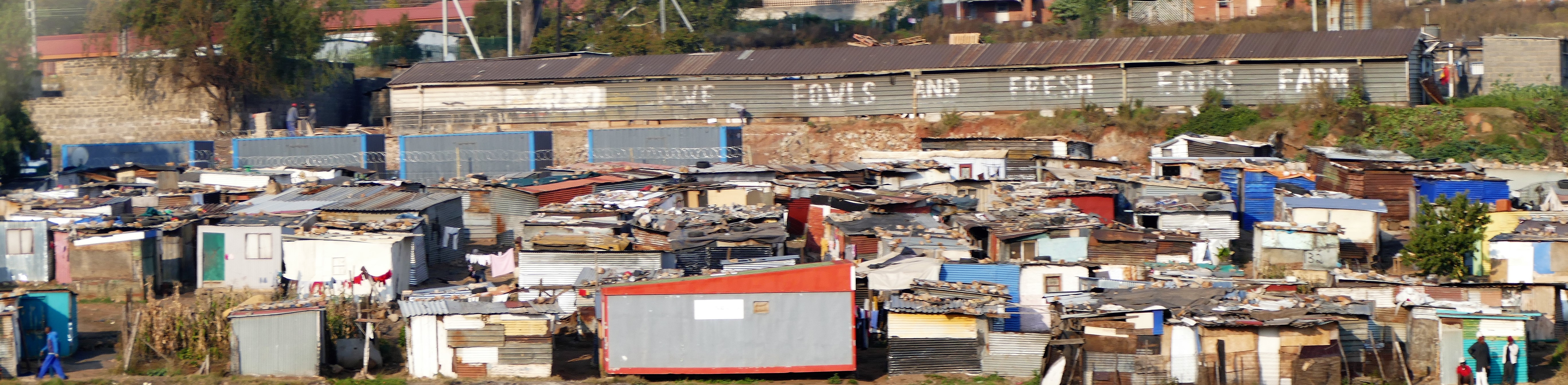
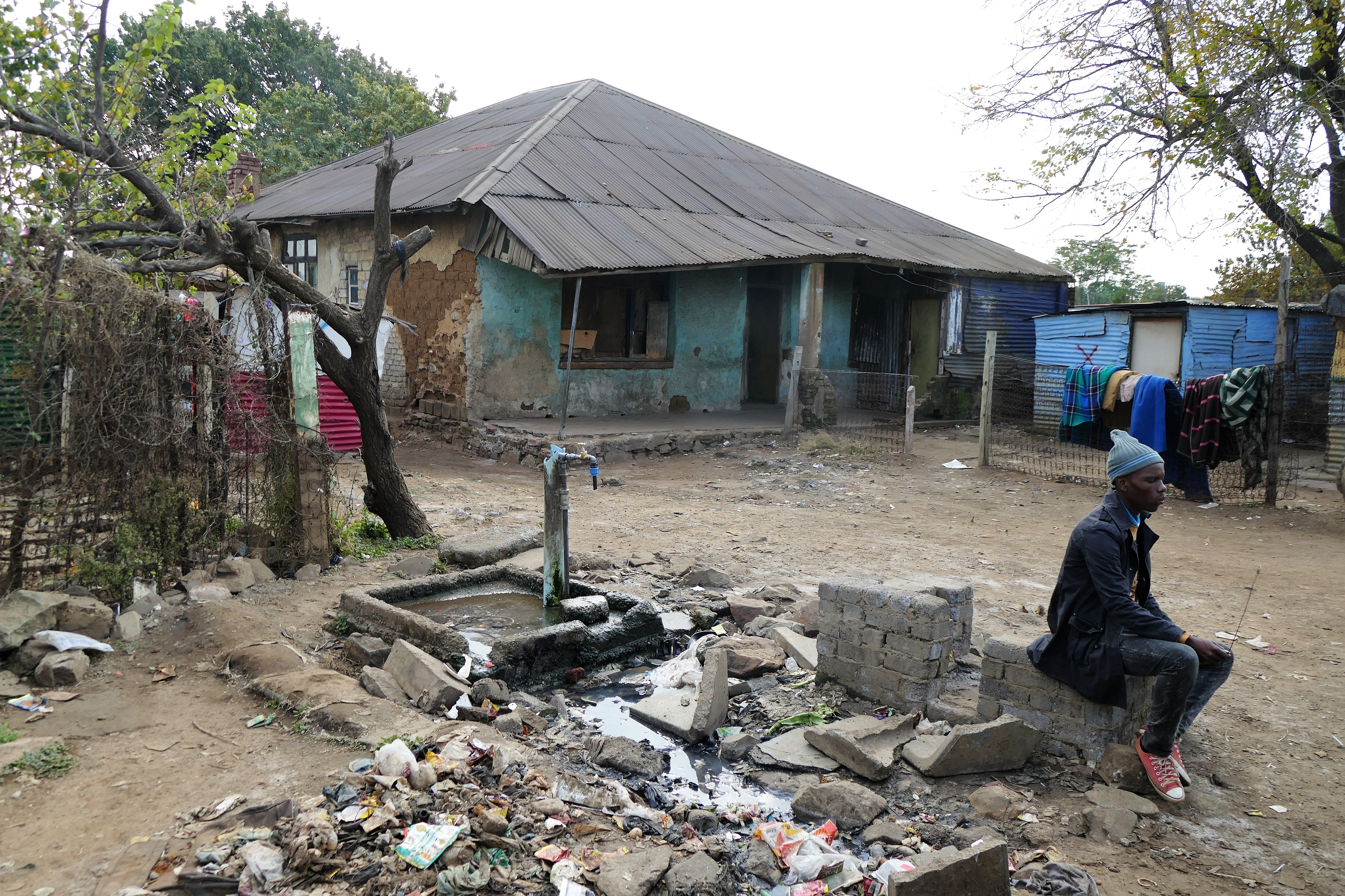
the country from taxis to general services to the government parties. Garbage on
the side of road is prevalent and very noticeable in Soweto. The unionized
sanitation workers go on strike without notice. Electrical outages aren't
uncommon either as confirmed by crew we travelled with from South Africa. Gookie
talked about the settlement of the Dutch as the first arrivals. The British
arrived later. Cape Town evolved from a refueling stop for ships but
Johannesberg began to grow with the discovery of gold at Kimberly. No rivers run
through Johannesburg and yet it is the largest city in South Africa, maybe 6
million if all the squatting residents could be counted. Active and inactive
mines surround the area as well as being inside Jo’burg proper. Illegal mining
occurs with people getting into the inactive mines looking for gold. They say
the streets of Jo’burg are lined with gold due to the gold dust mixed in with
the dirt removed from the mines and used in road beds. There are miles of
tunnels that exist below the surface from mines, even standing on the grounds of
the apartheid museum.
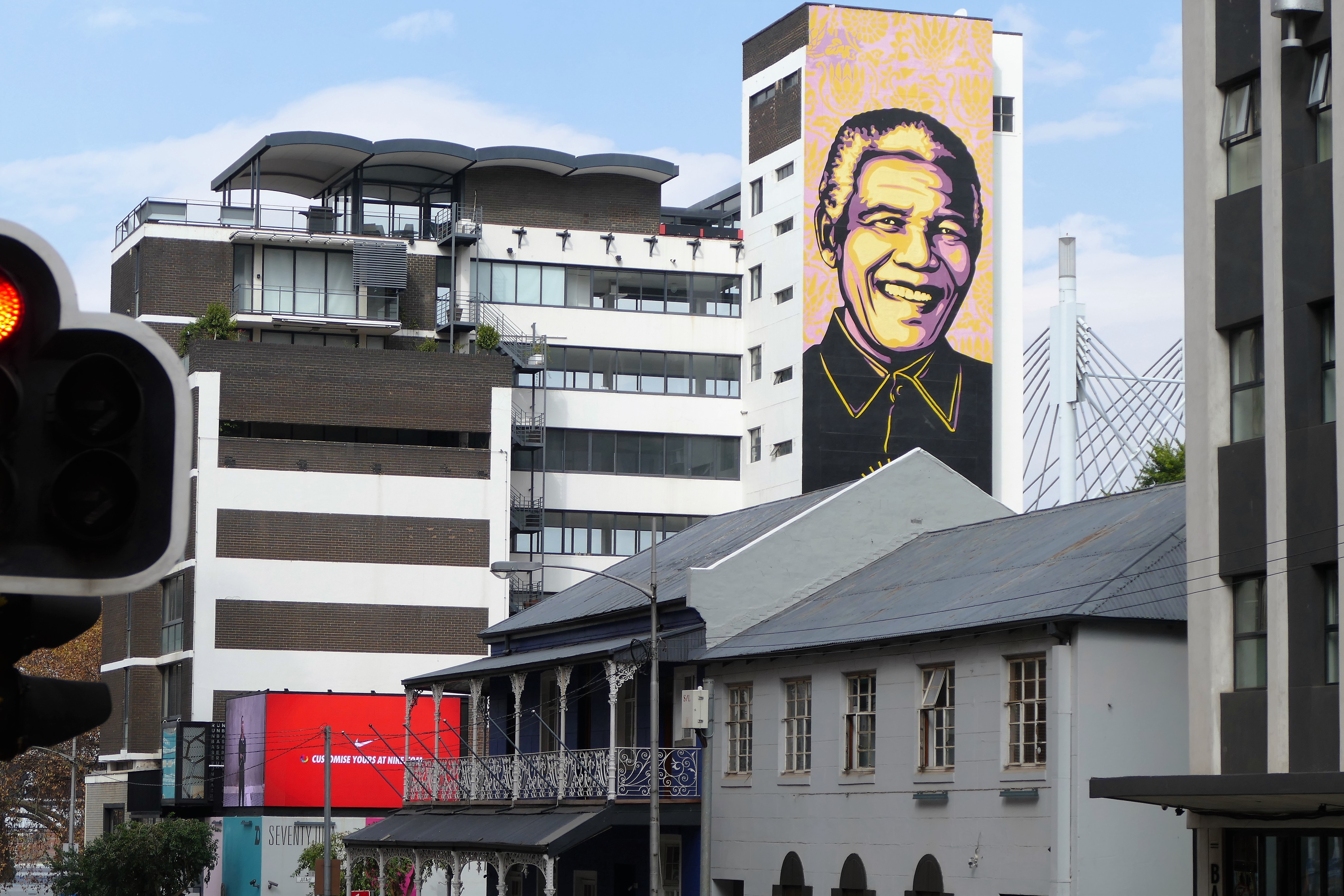
We stopped by the Mandela family home in a wealthy area of Jo’burg. All homes are enclosed with walls with barbed wire over top and security cameras. The security business became huge in the city and remains that way as conflicts continue between white, colored, black, and Afrikaners. The country eliminated apartheid 20 years ago but difficulties exist with the blacks and their ruling influence and the affinity for corruption to remain in charge. Their bill of rights clearly states everyone has a right to adequate housing, education, healthcare, and nutrition.
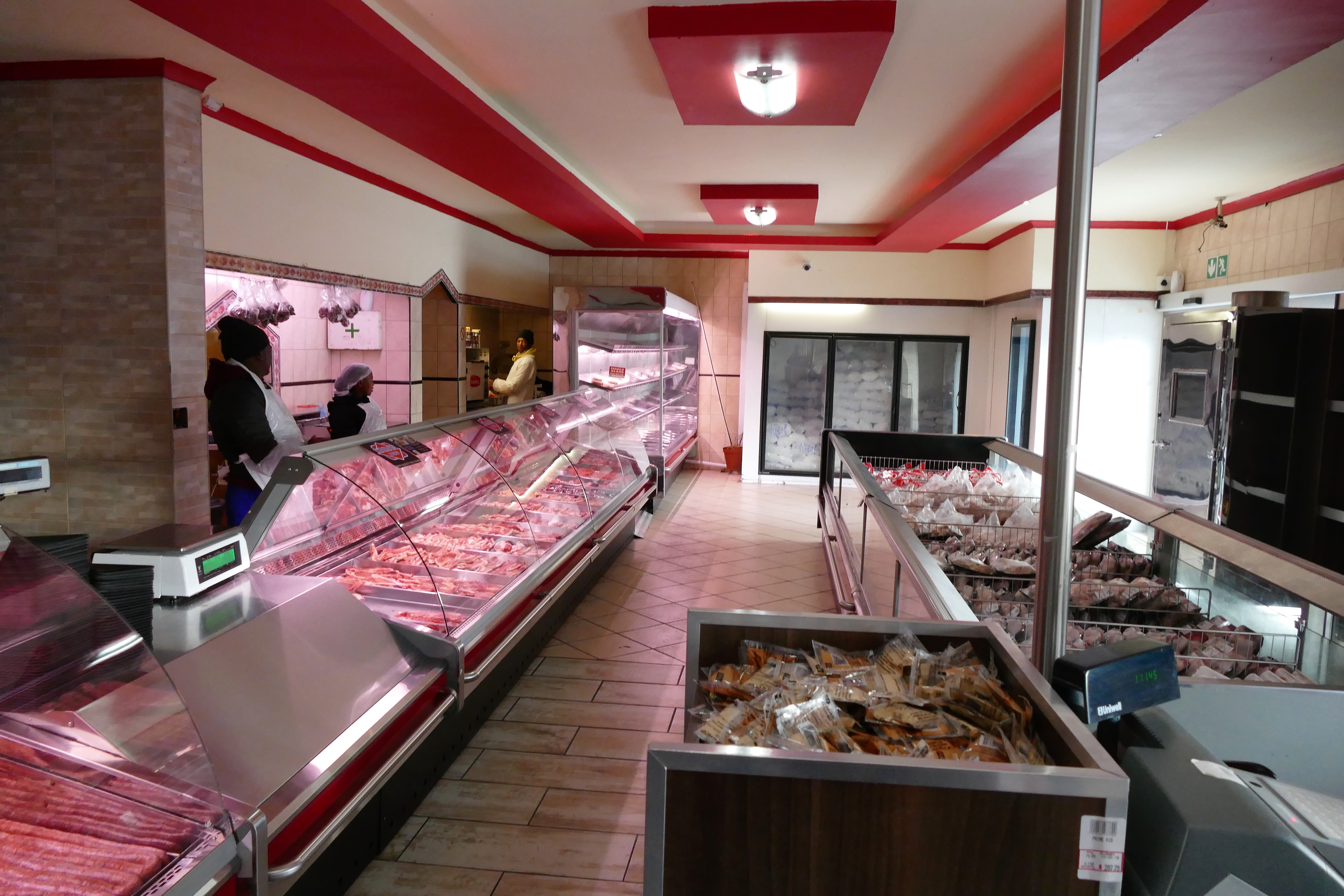
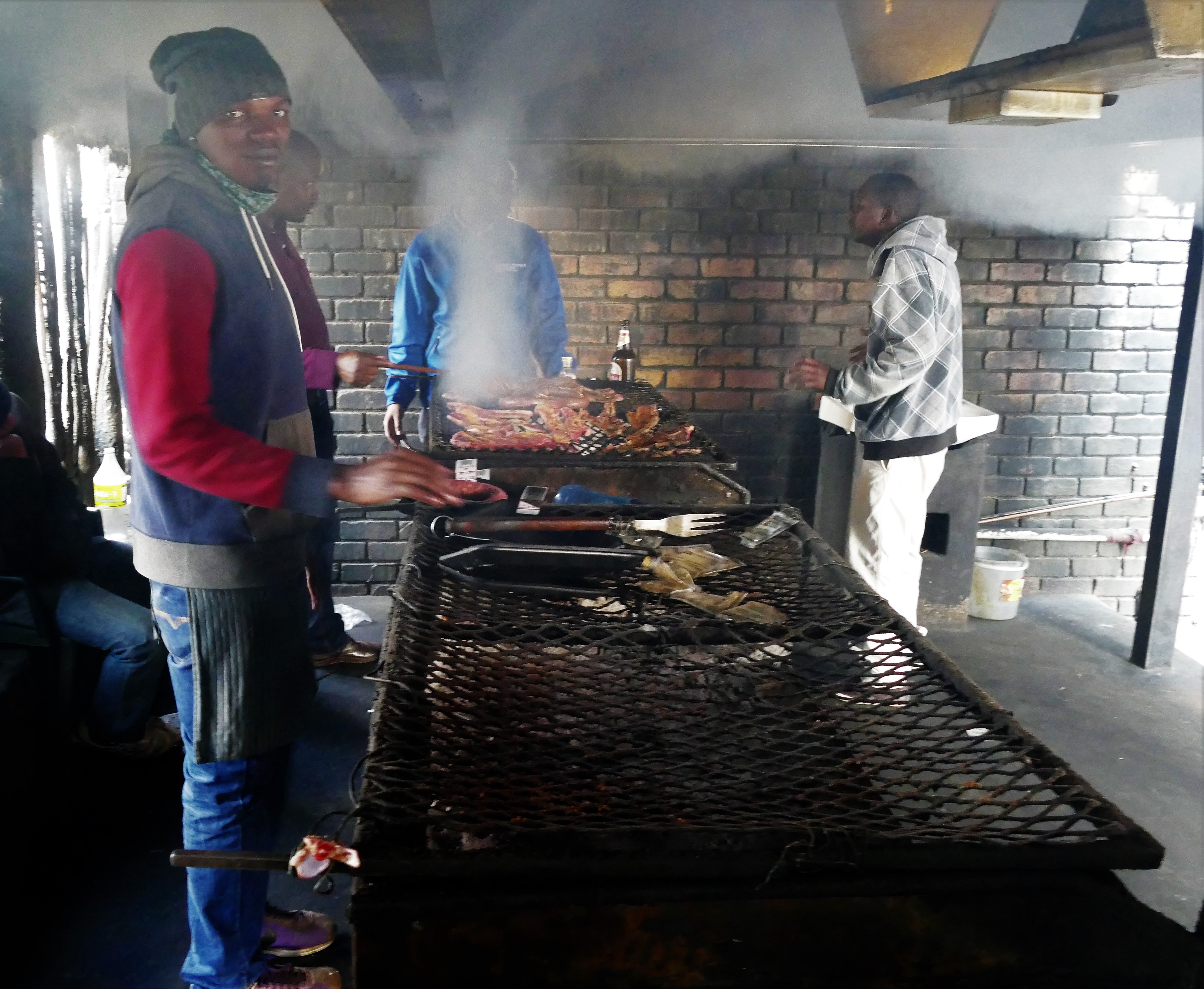
Gookie asked if we wanted to try an authentic lunch, and we agreed. He took us
to Tintie’s Family Butchery on the border of Soweto. Gookie said it was the best
barbeque or braai around. Tintie’s Family Butchery was on the same block as
Tintie’s Restaurant, as Tintie owns the block. The experience started out sort
of seedy and became amazing. Gookie told us we had to “hunt" for our meat in the
butcher shop. We bought blade steak, lamb chops and sausage. Gookie also picked
out spice packs for purchase. We then went next door to the open barbeque pit to
have it cooked. Along with barbeque, we had salsa and polenta. After a little
piece to try at first, we were surprised at the wonderful tastes. Everyone ate
with fingers, there were no utensils. Before leaving, we grabbed more spice
packets to take home to try to duplicate what we ate. The meat was very fresh
and the butcher shop was very clean. Most of the locals hanging around the
barbeque were high or had been drinking. Gookie pointed out one guy who broke
out into a Zulu dance..
Gookie pointed
out the yellow numbers on the houses in Kliptown as reference to when the
resident would be able to receive their own home from the government. Even after
moving into free government housing, many Soweto keep their own shacks to rent
out to others as landlords. Some yards in Kliptown had port-o-pots while others
used chemical sanitation. Many seemed to have satellite dish and cell phone
access. Cattle and goats roam close by as is part of their funeral custom to
kill a cow and feast on it during the sendoff gathering, which usually takes
place on Saturdays.
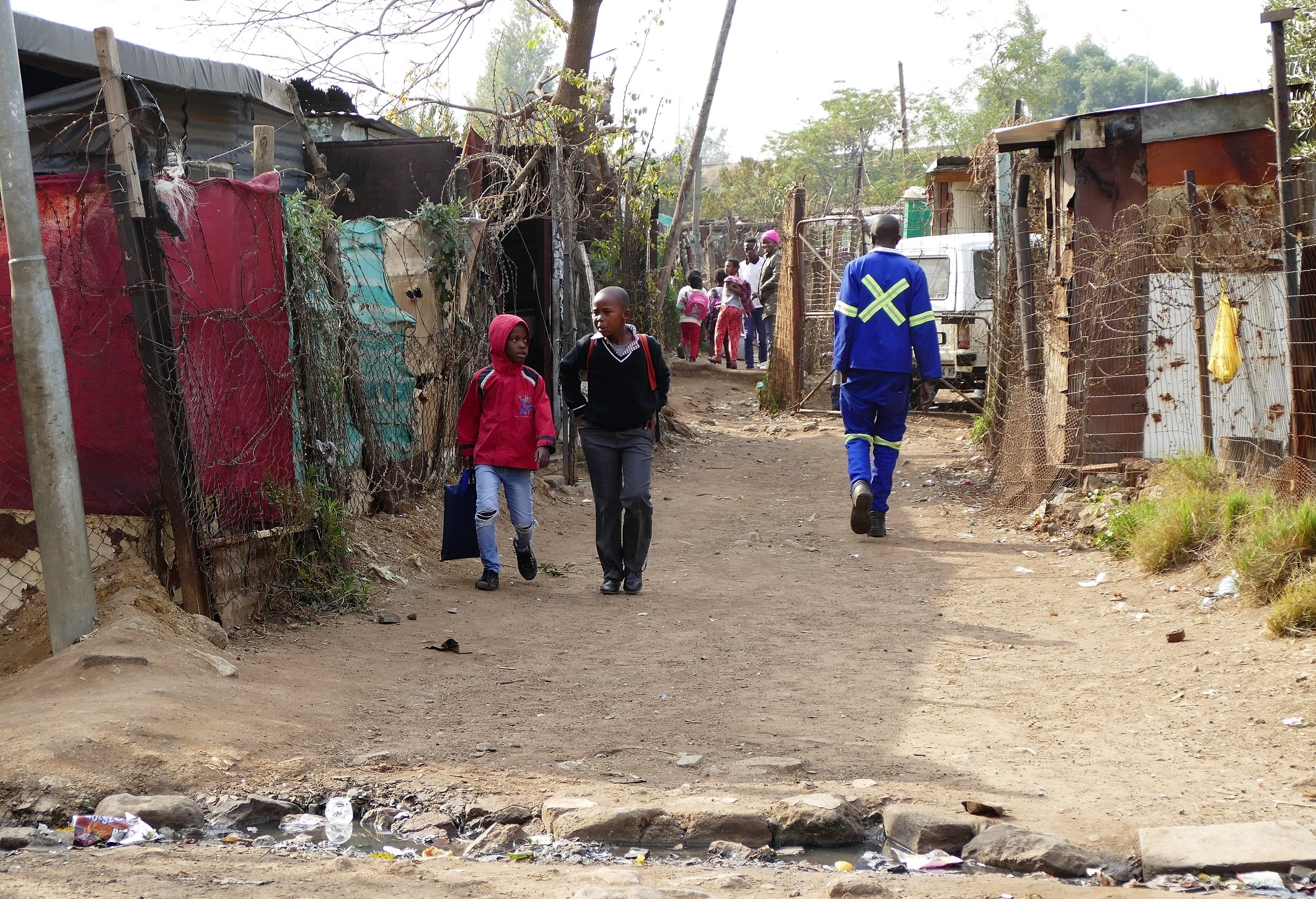
A volunteer at the Kliptown Youth Center gave us a tour of the facilities,
computers, kitchen, and general purpose room. The program centers around
providing meals and extra curricular activities to help the children who live in
the area grow healthy. School Age children are eligible to participate.
Scholarships from donations help some get to college. Donations run the
facility and often help fit the school age kids with uniforms as they can't go
to school without them. The Kip founder has been featured as a CNN hero.
Gookie took us to the site of the Soweto Uprising and to the home of Nelson
Mandela during the time he was in prison. Gookie helped start the museum that is
now in Mandela’s home. We were taken to O. R. Tambo Airport for the flight home.
 5/17/16: Return

We flew Delta 201 for a 15 ½ hour night flight back to Atlanta. Stamping our passports, the United States customs agent smiled and said, “Welcome home!”